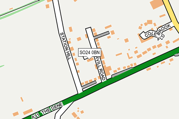
SO24 0BN lies on Dene Close in Ropley, Alresford. SO24 0BN is located in the Ropley, Hawkley & Hangers electoral ward, within the local authority district of East Hampshire and the English Parliamentary constituency of East Hampshire. The Sub Integrated Care Board (ICB) Location is NHS Hampshire and Isle of Wight ICB - D9Y0V and the police force is Hampshire. This postcode has been in use since January 1980.


GetTheData
Source: OS OpenMap – Local (Ordnance Survey)
Source: OS VectorMap District (Ordnance Survey)
Licence: Open Government Licence (requires attribution)
| Easting | 463029 |
| Northing | 132156 |
| Latitude | 51.085267 |
| Longitude | -1.101507 |
GetTheData
Source: Open Postcode Geo
Licence: Open Government Licence
| Street | Dene Close |
| Locality | Ropley |
| Town/City | Alresford |
| Country | England |
| Postcode District | SO24 |
➜ See where SO24 is on a map ➜ Where is Ropley Dean? | |
GetTheData
Source: Land Registry Price Paid Data
Licence: Open Government Licence
Elevation or altitude of SO24 0BN as distance above sea level:
| Metres | Feet | |
|---|---|---|
| Elevation | 100m | 328ft |
Elevation is measured from the approximate centre of the postcode, to the nearest point on an OS contour line from OS Terrain 50, which has contour spacing of ten vertical metres.
➜ How high above sea level am I? Find the elevation of your current position using your device's GPS.
GetTheData
Source: Open Postcode Elevation
Licence: Open Government Licence
| Ward | Ropley, Hawkley & Hangers |
| Constituency | East Hampshire |
GetTheData
Source: ONS Postcode Database
Licence: Open Government Licence
| Darvill Road (The Dene) | Ropley Dean | 93m |
| Darvill Road (The Dene) | Ropley Dean | 100m |
| Petersfield Road (The Dene) | Ropley Dean | 412m |
| Petersfield Road (The Dene) | Ropley Dean | 515m |
| Gascoigne Lane (Winchester Road) | Ropley Dean | 608m |
| Ropley (Mid-hants Railway) | Ropley Dean | 263m |
GetTheData
Source: NaPTAN
Licence: Open Government Licence
| Percentage of properties with Next Generation Access | 83.3% |
| Percentage of properties with Superfast Broadband | 83.3% |
| Percentage of properties with Ultrafast Broadband | 0.0% |
| Percentage of properties with Full Fibre Broadband | 0.0% |
Superfast Broadband is between 30Mbps and 300Mbps
Ultrafast Broadband is > 300Mbps
| Percentage of properties unable to receive 2Mbps | 0.0% |
| Percentage of properties unable to receive 5Mbps | 0.0% |
| Percentage of properties unable to receive 10Mbps | 16.7% |
| Percentage of properties unable to receive 30Mbps | 16.7% |
GetTheData
Source: Ofcom
Licence: Ofcom Terms of Use (requires attribution)
GetTheData
Source: ONS Postcode Database
Licence: Open Government Licence


➜ Get more ratings from the Food Standards Agency
GetTheData
Source: Food Standards Agency
Licence: FSA terms & conditions
| Last Collection | |||
|---|---|---|---|
| Location | Mon-Fri | Sat | Distance |
| The Dene | 16:45 | 10:00 | 74m |
| The Chequers | 16:00 | 09:30 | 689m |
| Petersfield Road | 16:45 | 09:30 | 995m |
GetTheData
Source: Dracos
Licence: Creative Commons Attribution-ShareAlike
The below table lists the International Territorial Level (ITL) codes (formerly Nomenclature of Territorial Units for Statistics (NUTS) codes) and Local Administrative Units (LAU) codes for SO24 0BN:
| ITL 1 Code | Name |
|---|---|
| TLJ | South East (England) |
| ITL 2 Code | Name |
| TLJ3 | Hampshire and Isle of Wight |
| ITL 3 Code | Name |
| TLJ36 | Central Hampshire |
| LAU 1 Code | Name |
| E07000085 | East Hampshire |
GetTheData
Source: ONS Postcode Directory
Licence: Open Government Licence
The below table lists the Census Output Area (OA), Lower Layer Super Output Area (LSOA), and Middle Layer Super Output Area (MSOA) for SO24 0BN:
| Code | Name | |
|---|---|---|
| OA | E00115039 | |
| LSOA | E01022627 | East Hampshire 007F |
| MSOA | E02004703 | East Hampshire 007 |
GetTheData
Source: ONS Postcode Directory
Licence: Open Government Licence
| SO24 0BW | Darvill Road | 55m |
| SO24 0BL | Station Road | 90m |
| SO24 0BH | The Dene | 118m |
| SO24 0BJ | Dene Cottages | 206m |
| SO24 0ED | Hook Lane | 289m |
| SO24 0EE | Petersfield Road | 360m |
| SO24 0BG | The Dene | 389m |
| SO24 9SQ | Bighton Hill | 553m |
| SO24 0EG | Petersfield Road | 632m |
| SO24 0EF | Petersfield Road | 634m |
GetTheData
Source: Open Postcode Geo; Land Registry Price Paid Data
Licence: Open Government Licence