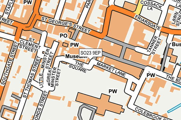
SO23 9EP is located in the St Michael electoral ward, within the local authority district of Winchester and the English Parliamentary constituency of Winchester. The Sub Integrated Care Board (ICB) Location is NHS Hampshire and Isle of Wight ICB - D9Y0V and the police force is Hampshire. This postcode has been in use since January 1980.


GetTheData
Source: OS OpenMap – Local (Ordnance Survey)
Source: OS VectorMap District (Ordnance Survey)
Licence: Open Government Licence (requires attribution)
| Easting | 448192 |
| Northing | 129412 |
| Latitude | 51.062030 |
| Longitude | -1.313682 |
GetTheData
Source: Open Postcode Geo
Licence: Open Government Licence
| Country | England |
| Postcode District | SO23 |
➜ See where SO23 is on a map ➜ Where is Winchester? | |
GetTheData
Source: Land Registry Price Paid Data
Licence: Open Government Licence
Elevation or altitude of SO23 9EP as distance above sea level:
| Metres | Feet | |
|---|---|---|
| Elevation | 40m | 131ft |
Elevation is measured from the approximate centre of the postcode, to the nearest point on an OS contour line from OS Terrain 50, which has contour spacing of ten vertical metres.
➜ How high above sea level am I? Find the elevation of your current position using your device's GPS.
GetTheData
Source: Open Postcode Elevation
Licence: Open Government Licence
| Ward | St Michael |
| Constituency | Winchester |
GetTheData
Source: ONS Postcode Database
Licence: Open Government Licence
| Upper Brook Street (St George's Street) | Winchester | 86m |
| Marks & Spencer (Middle Brook Street) | Winchester | 109m |
| Jewry Street | Winchester | 229m |
| Broadway Guildhall (The Broadway) | Winchester | 280m |
| Jewry Street | Winchester | 280m |
| Winchester Station | 0.7km |
| Shawford Station | 4.5km |
GetTheData
Source: NaPTAN
Licence: Open Government Licence
GetTheData
Source: ONS Postcode Database
Licence: Open Government Licence


➜ Get more ratings from the Food Standards Agency
GetTheData
Source: Food Standards Agency
Licence: FSA terms & conditions
| Last Collection | |||
|---|---|---|---|
| Location | Mon-Fri | Sat | Distance |
| City Cross | 17:30 | 11:30 | 130m |
| Winchester Post Office | 18:30 | 12:30 | 151m |
| The Guidhall | 17:45 | 11:15 | 239m |
GetTheData
Source: Dracos
Licence: Creative Commons Attribution-ShareAlike
The below table lists the International Territorial Level (ITL) codes (formerly Nomenclature of Territorial Units for Statistics (NUTS) codes) and Local Administrative Units (LAU) codes for SO23 9EP:
| ITL 1 Code | Name |
|---|---|
| TLJ | South East (England) |
| ITL 2 Code | Name |
| TLJ3 | Hampshire and Isle of Wight |
| ITL 3 Code | Name |
| TLJ36 | Central Hampshire |
| LAU 1 Code | Name |
| E07000094 | Winchester |
GetTheData
Source: ONS Postcode Directory
Licence: Open Government Licence
The below table lists the Census Output Area (OA), Lower Layer Super Output Area (LSOA), and Middle Layer Super Output Area (MSOA) for SO23 9EP:
| Code | Name | |
|---|---|---|
| OA | E00118197 | |
| LSOA | E01023264 | Winchester 007D |
| MSOA | E02004835 | Winchester 007 |
GetTheData
Source: ONS Postcode Directory
Licence: Open Government Licence
| SO23 9AJ | Market Street | 23m |
| SO23 9AL | Market Lane | 28m |
| SO23 9EX | The Square | 56m |
| SO23 9BL | High Street | 59m |
| SO23 9AS | High Street | 62m |
| SO23 9ES | The Square | 88m |
| SO23 8AH | St Georges Street | 106m |
| SO23 8AL | Upper Brook Street | 112m |
| SO23 9JX | High Street | 131m |
| SO23 9HA | Great Minster Street | 132m |
GetTheData
Source: Open Postcode Geo; Land Registry Price Paid Data
Licence: Open Government Licence