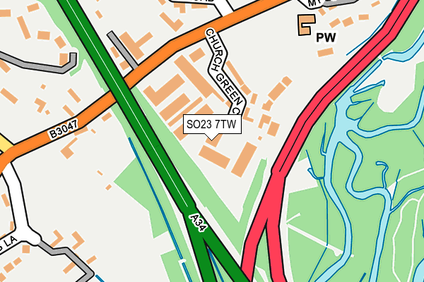
SO23 7TW is located in the The Worthys electoral ward, within the local authority district of Winchester and the English Parliamentary constituency of Winchester. The Sub Integrated Care Board (ICB) Location is NHS Hampshire and Isle of Wight ICB - D9Y0V and the police force is Hampshire. This postcode has been in use since August 2006.


GetTheData
Source: OS OpenMap – Local (Ordnance Survey)
Source: OS VectorMap District (Ordnance Survey)
Licence: Open Government Licence (requires attribution)
| Easting | 449157 |
| Northing | 132166 |
| Latitude | 51.086711 |
| Longitude | -1.299540 |
GetTheData
Source: Open Postcode Geo
Licence: Open Government Licence
| Country | England |
| Postcode District | SO23 |
➜ See where SO23 is on a map ➜ Where is Kings Worthy? | |
GetTheData
Source: Land Registry Price Paid Data
Licence: Open Government Licence
Elevation or altitude of SO23 7TW as distance above sea level:
| Metres | Feet | |
|---|---|---|
| Elevation | 50m | 164ft |
Elevation is measured from the approximate centre of the postcode, to the nearest point on an OS contour line from OS Terrain 50, which has contour spacing of ten vertical metres.
➜ How high above sea level am I? Find the elevation of your current position using your device's GPS.
GetTheData
Source: Open Postcode Elevation
Licence: Open Government Licence
| Ward | The Worthys |
| Constituency | Winchester |
GetTheData
Source: ONS Postcode Database
Licence: Open Government Licence
| St Mary's Church (London Road) | Kings Worthy | 182m |
| St Mary's Church (London Road) | Kings Worthy | 196m |
| Taylors Corner (London Road A3090) | Headbourne Worthy | 227m |
| Taylors Corner (London Road A3090) | Headbourne Worthy | 246m |
| Cart And Horses (London Road) | Kings Worthy | 403m |
| Winchester Station | 2.6km |
GetTheData
Source: NaPTAN
Licence: Open Government Licence
GetTheData
Source: ONS Postcode Database
Licence: Open Government Licence


➜ Get more ratings from the Food Standards Agency
GetTheData
Source: Food Standards Agency
Licence: FSA terms & conditions
| Last Collection | |||
|---|---|---|---|
| Location | Mon-Fri | Sat | Distance |
| Headbourne Worthy | 16:30 | 07:45 | 291m |
| Kings Worthy Post Office | 17:30 | 10:00 | 409m |
| Courtney Road | 17:30 | 11:15 | 1,510m |
GetTheData
Source: Dracos
Licence: Creative Commons Attribution-ShareAlike
The below table lists the International Territorial Level (ITL) codes (formerly Nomenclature of Territorial Units for Statistics (NUTS) codes) and Local Administrative Units (LAU) codes for SO23 7TW:
| ITL 1 Code | Name |
|---|---|
| TLJ | South East (England) |
| ITL 2 Code | Name |
| TLJ3 | Hampshire and Isle of Wight |
| ITL 3 Code | Name |
| TLJ36 | Central Hampshire |
| LAU 1 Code | Name |
| E07000094 | Winchester |
GetTheData
Source: ONS Postcode Directory
Licence: Open Government Licence
The below table lists the Census Output Area (OA), Lower Layer Super Output Area (LSOA), and Middle Layer Super Output Area (MSOA) for SO23 7TW:
| Code | Name | |
|---|---|---|
| OA | E00118246 | |
| LSOA | E01023274 | Winchester 003E |
| MSOA | E02004831 | Winchester 003 |
GetTheData
Source: ONS Postcode Directory
Licence: Open Government Licence
| SO23 7TT | Church Green Close | 88m |
| SO23 7TU | Church Green Close | 93m |
| SO23 7QA | London Road | 117m |
| SO23 7JJ | London Road | 190m |
| SO23 7HX | Edwards Close | 191m |
| SO23 7QJ | Court Road | 243m |
| SO23 7QL | London Road | 253m |
| SO23 7QN | London Road | 268m |
| SO23 7JN | Pudding Lane | 305m |
| SO23 7JH | Taylors Corner | 320m |
GetTheData
Source: Open Postcode Geo; Land Registry Price Paid Data
Licence: Open Government Licence