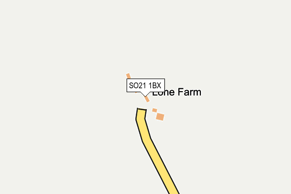
SO21 1BX is located in the Alresford and Itchen Valley electoral ward, within the local authority district of Winchester and the English Parliamentary constituency of Winchester. The Sub Integrated Care Board (ICB) Location is NHS Hampshire and Isle of Wight ICB - D9Y0V and the police force is Hampshire. This postcode has been in use since January 1980.


GetTheData
Source: OS OpenMap – Local (Ordnance Survey)
Source: OS VectorMap District (Ordnance Survey)
Licence: Open Government Licence (requires attribution)
| Easting | 453359 |
| Northing | 134132 |
| Latitude | 51.104008 |
| Longitude | -1.239246 |
GetTheData
Source: Open Postcode Geo
Licence: Open Government Licence
| Country | England |
| Postcode District | SO21 |
➜ See where SO21 is on a map | |
GetTheData
Source: Land Registry Price Paid Data
Licence: Open Government Licence
Elevation or altitude of SO21 1BX as distance above sea level:
| Metres | Feet | |
|---|---|---|
| Elevation | 80m | 262ft |
Elevation is measured from the approximate centre of the postcode, to the nearest point on an OS contour line from OS Terrain 50, which has contour spacing of ten vertical metres.
➜ How high above sea level am I? Find the elevation of your current position using your device's GPS.
GetTheData
Source: Open Postcode Elevation
Licence: Open Government Licence
| Ward | Alresford And Itchen Valley |
| Constituency | Winchester |
GetTheData
Source: ONS Postcode Database
Licence: Open Government Licence
| Village Hall (Station Hill) | Itchen Abbas | 1,217m |
| Old Station Road (Station Hill) | Itchen Abbas | 1,220m |
| Old Station Road (Station Hill) | Itchen Abbas | 1,222m |
| Village Hall (Station Hill) | Itchen Abbas | 1,246m |
| Rectory Lane (B3047) | Itchen Abbas | 1,412m |
GetTheData
Source: NaPTAN
Licence: Open Government Licence
| Percentage of properties with Next Generation Access | 100.0% |
| Percentage of properties with Superfast Broadband | 0.0% |
| Percentage of properties with Ultrafast Broadband | 0.0% |
| Percentage of properties with Full Fibre Broadband | 0.0% |
Superfast Broadband is between 30Mbps and 300Mbps
Ultrafast Broadband is > 300Mbps
| Percentage of properties unable to receive 2Mbps | 0.0% |
| Percentage of properties unable to receive 5Mbps | 0.0% |
| Percentage of properties unable to receive 10Mbps | 0.0% |
| Percentage of properties unable to receive 30Mbps | 100.0% |
GetTheData
Source: Ofcom
Licence: Ofcom Terms of Use (requires attribution)
GetTheData
Source: ONS Postcode Database
Licence: Open Government Licence


➜ Get more ratings from the Food Standards Agency
GetTheData
Source: Food Standards Agency
Licence: FSA terms & conditions
| Last Collection | |||
|---|---|---|---|
| Location | Mon-Fri | Sat | Distance |
| Chilland | 16:00 | 07:00 | 1,561m |
| Avington | 16:00 | 09:00 | 1,963m |
| Martyr Worthy | 16:00 | 07:00 | 2,142m |
GetTheData
Source: Dracos
Licence: Creative Commons Attribution-ShareAlike
The below table lists the International Territorial Level (ITL) codes (formerly Nomenclature of Territorial Units for Statistics (NUTS) codes) and Local Administrative Units (LAU) codes for SO21 1BX:
| ITL 1 Code | Name |
|---|---|
| TLJ | South East (England) |
| ITL 2 Code | Name |
| TLJ3 | Hampshire and Isle of Wight |
| ITL 3 Code | Name |
| TLJ36 | Central Hampshire |
| LAU 1 Code | Name |
| E07000094 | Winchester |
GetTheData
Source: ONS Postcode Directory
Licence: Open Government Licence
The below table lists the Census Output Area (OA), Lower Layer Super Output Area (LSOA), and Middle Layer Super Output Area (MSOA) for SO21 1BX:
| Code | Name | |
|---|---|---|
| OA | E00118066 | |
| LSOA | E01023236 | Winchester 002A |
| MSOA | E02004830 | Winchester 002 |
GetTheData
Source: ONS Postcode Directory
Licence: Open Government Licence
| SO21 1BA | Old Station Road | 1065m |
| SO21 1XA | Little Hayes Lane | 1107m |
| SO21 1AY | Station Close | 1125m |
| SO21 1AZ | Old Station Road | 1127m |
| SO21 1BE | School Lane | 1128m |
| SO21 1FJ | The Paddock | 1130m |
| SO21 1BS | Itchen Down | 1162m |
| SO21 1BB | Station Hill | 1170m |
| SO21 1BP | Rectory Lane | 1194m |
| SO21 1BW | Rectory Lane | 1198m |
GetTheData
Source: Open Postcode Geo; Land Registry Price Paid Data
Licence: Open Government Licence