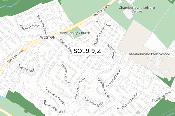
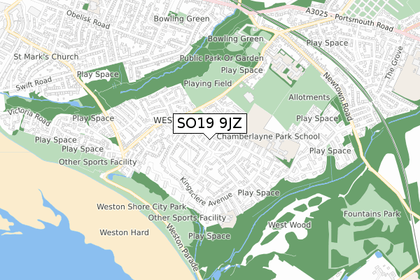
SO19 9JZ lies on Wallace Road in Southampton. SO19 9JZ is located in the Woolston electoral ward, within the unitary authority of Southampton and the English Parliamentary constituency of Southampton, Itchen. The Sub Integrated Care Board (ICB) Location is NHS Hampshire and Isle of Wight ICB - D9Y0V and the police force is Hampshire. This postcode has been in use since December 1994.


GetTheData
Source: OS Open Zoomstack (Ordnance Survey)
Licence: Open Government Licence (requires attribution)
Attribution: Contains OS data © Crown copyright and database right 2025
Source: Open Postcode Geo
Licence: Open Government Licence (requires attribution)
Attribution: Contains OS data © Crown copyright and database right 2025; Contains Royal Mail data © Royal Mail copyright and database right 2025; Source: Office for National Statistics licensed under the Open Government Licence v.3.0
| Easting | 444783 |
| Northing | 110072 |
| Latitude | 50.888406 |
| Longitude | -1.364701 |
GetTheData
Source: Open Postcode Geo
Licence: Open Government Licence
| Street | Wallace Road |
| Town/City | Southampton |
| Country | England |
| Postcode District | SO19 |
➜ See where SO19 is on a map ➜ Where is Southampton? | |
GetTheData
Source: Land Registry Price Paid Data
Licence: Open Government Licence
Elevation or altitude of SO19 9JZ as distance above sea level:
| Metres | Feet | |
|---|---|---|
| Elevation | 20m | 66ft |
Elevation is measured from the approximate centre of the postcode, to the nearest point on an OS contour line from OS Terrain 50, which has contour spacing of ten vertical metres.
➜ How high above sea level am I? Find the elevation of your current position using your device's GPS.
GetTheData
Source: Open Postcode Elevation
Licence: Open Government Licence
| Ward | Woolston |
| Constituency | Southampton, Itchen |
GetTheData
Source: ONS Postcode Database
Licence: Open Government Licence
| Kipling Court (Wallace Road) | Weston | 116m |
| Kingsclere Close (Kingsclere Avenue) | Weston | 174m |
| Poulner Close (Kingsclere Avenue) | Weston | 218m |
| Scott Road (Weston Lane) | Weston | 275m |
| Barnfield Road (Weston Lane) | Weston | 280m |
| Sholing Station | 0.9km |
| Woolston Station | 1.5km |
| Netley Station | 2.2km |
GetTheData
Source: NaPTAN
Licence: Open Government Licence
| Percentage of properties with Next Generation Access | 100.0% |
| Percentage of properties with Superfast Broadband | 100.0% |
| Percentage of properties with Ultrafast Broadband | 97.6% |
| Percentage of properties with Full Fibre Broadband | 0.0% |
Superfast Broadband is between 30Mbps and 300Mbps
Ultrafast Broadband is > 300Mbps
| Median download speed | 55.4Mbps |
| Average download speed | 75.9Mbps |
| Maximum download speed | 350.00Mbps |
| Median upload speed | 9.9Mbps |
| Average upload speed | 9.9Mbps |
| Maximum upload speed | 20.00Mbps |
| Percentage of properties unable to receive 2Mbps | 0.0% |
| Percentage of properties unable to receive 5Mbps | 0.0% |
| Percentage of properties unable to receive 10Mbps | 0.0% |
| Percentage of properties unable to receive 30Mbps | 0.0% |
GetTheData
Source: Ofcom
Licence: Ofcom Terms of Use (requires attribution)
Estimated total energy consumption in SO19 9JZ by fuel type, 2015.
| Consumption (kWh) | 274,434 |
|---|---|
| Meter count | 39 |
| Mean (kWh/meter) | 7,037 |
| Median (kWh/meter) | 6,496 |
| Consumption (kWh) | 155,389 |
|---|---|
| Meter count | 40 |
| Mean (kWh/meter) | 3,885 |
| Median (kWh/meter) | 3,212 |
GetTheData
Source: Postcode level gas estimates: 2015 (experimental)
Source: Postcode level electricity estimates: 2015 (experimental)
Licence: Open Government Licence
GetTheData
Source: ONS Postcode Database
Licence: Open Government Licence


➜ Get more ratings from the Food Standards Agency
GetTheData
Source: Food Standards Agency
Licence: FSA terms & conditions
| Last Collection | |||
|---|---|---|---|
| Location | Mon-Fri | Sat | Distance |
| Weston Post Office | 17:30 | 12:30 | 89m |
| Crookham Road (22) | 16:30 | 12:30 | 224m |
| Weston Lane | 17:30 | 12:15 | 501m |
GetTheData
Source: Dracos
Licence: Creative Commons Attribution-ShareAlike
The below table lists the International Territorial Level (ITL) codes (formerly Nomenclature of Territorial Units for Statistics (NUTS) codes) and Local Administrative Units (LAU) codes for SO19 9JZ:
| ITL 1 Code | Name |
|---|---|
| TLJ | South East (England) |
| ITL 2 Code | Name |
| TLJ3 | Hampshire and Isle of Wight |
| ITL 3 Code | Name |
| TLJ32 | Southampton |
| LAU 1 Code | Name |
| E06000045 | Southampton |
GetTheData
Source: ONS Postcode Directory
Licence: Open Government Licence
The below table lists the Census Output Area (OA), Lower Layer Super Output Area (LSOA), and Middle Layer Super Output Area (MSOA) for SO19 9JZ:
| Code | Name | |
|---|---|---|
| OA | E00087277 | |
| LSOA | E01017280 | Southampton 032C |
| MSOA | E02003580 | Southampton 032 |
GetTheData
Source: ONS Postcode Directory
Licence: Open Government Licence
| SO19 9HW | Wallace Road | 82m |
| SO19 9PY | Bower Close | 87m |
| SO19 9NP | Hawkley Green | 107m |
| SO19 9QX | Weston Close | 117m |
| SO19 9PZ | Bacon Close | 117m |
| SO19 9QA | Deeping Close | 129m |
| SO19 9HF | Kingsclere Avenue | 135m |
| SO19 9NL | Burghclere Road | 140m |
| SO19 9NN | Burghclere Road | 141m |
| SO19 9PQ | Maison Belle Vue | 158m |
GetTheData
Source: Open Postcode Geo; Land Registry Price Paid Data
Licence: Open Government Licence