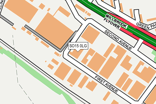
SO15 0LG is located in the Redbridge electoral ward, within the unitary authority of Southampton and the English Parliamentary constituency of Southampton, Test. The Sub Integrated Care Board (ICB) Location is NHS Hampshire and Isle of Wight ICB - D9Y0V and the police force is Hampshire. This postcode has been in use since December 1994.


GetTheData
Source: OS OpenMap – Local (Ordnance Survey)
Source: OS VectorMap District (Ordnance Survey)
Licence: Open Government Licence (requires attribution)
| Easting | 437931 |
| Northing | 113240 |
| Latitude | 50.917382 |
| Longitude | -1.461781 |
GetTheData
Source: Open Postcode Geo
Licence: Open Government Licence
| Country | England |
| Postcode District | SO15 |
➜ See where SO15 is on a map ➜ Where is Southampton? | |
GetTheData
Source: Land Registry Price Paid Data
Licence: Open Government Licence
Elevation or altitude of SO15 0LG as distance above sea level:
| Metres | Feet | |
|---|---|---|
| Elevation | 10m | 33ft |
Elevation is measured from the approximate centre of the postcode, to the nearest point on an OS contour line from OS Terrain 50, which has contour spacing of ten vertical metres.
➜ How high above sea level am I? Find the elevation of your current position using your device's GPS.
GetTheData
Source: Open Postcode Elevation
Licence: Open Government Licence
| Ward | Redbridge |
| Constituency | Southampton, Test |
GetTheData
Source: ONS Postcode Database
Licence: Open Government Licence
| Millbrook Roundabout (A33) | Millbrook | 219m |
| Parkside Avenue (Redbridge Road) | Redbridge | 229m |
| Parkside Avenue (Redbridge Road) | Redbridge | 235m |
| Millbrook Roundabout | Millbrook | 313m |
| Green Park (Wimpson Lane) | Millbrook | 406m |
| Redbridge (Hants) Station | 0.7km |
| Totton Station | 1.5km |
| Millbrook (Hants) Station | 2.1km |
GetTheData
Source: NaPTAN
Licence: Open Government Licence
GetTheData
Source: ONS Postcode Database
Licence: Open Government Licence


➜ Get more ratings from the Food Standards Agency
GetTheData
Source: Food Standards Agency
Licence: FSA terms & conditions
| Last Collection | |||
|---|---|---|---|
| Location | Mon-Fri | Sat | Distance |
| Millbrook Roundabout | 18:30 | 12:00 | 249m |
| Brookwood Road | 16:00 | 12:30 | 269m |
| Redbridge Road | 17:15 | 12:00 | 427m |
GetTheData
Source: Dracos
Licence: Creative Commons Attribution-ShareAlike
The below table lists the International Territorial Level (ITL) codes (formerly Nomenclature of Territorial Units for Statistics (NUTS) codes) and Local Administrative Units (LAU) codes for SO15 0LG:
| ITL 1 Code | Name |
|---|---|
| TLJ | South East (England) |
| ITL 2 Code | Name |
| TLJ3 | Hampshire and Isle of Wight |
| ITL 3 Code | Name |
| TLJ32 | Southampton |
| LAU 1 Code | Name |
| E06000045 | Southampton |
GetTheData
Source: ONS Postcode Directory
Licence: Open Government Licence
The below table lists the Census Output Area (OA), Lower Layer Super Output Area (LSOA), and Middle Layer Super Output Area (MSOA) for SO15 0LG:
| Code | Name | |
|---|---|---|
| OA | E00087093 | |
| LSOA | E01017239 | Southampton 012C |
| MSOA | E02003560 | Southampton 012 |
GetTheData
Source: ONS Postcode Directory
Licence: Open Government Licence
| SO15 0LP | Second Avenue | 132m |
| SO15 0LT | Redbridge Road | 162m |
| SO16 9AE | Green Park Road | 241m |
| SO16 9AD | Green Park Road | 258m |
| SO15 0LU | Redbridge Road | 275m |
| SO16 9AB | Green Park Road | 292m |
| SO16 9AA | Green Park Road | 357m |
| SO16 9AJ | Brookwood Road | 358m |
| SO16 9AF | Parkside Avenue | 363m |
| SO16 9AH | Brookwood Road | 367m |
GetTheData
Source: Open Postcode Geo; Land Registry Price Paid Data
Licence: Open Government Licence