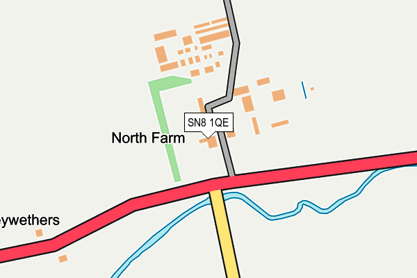
SN8 1QE is in West Overton, Marlborough. SN8 1QE is located in the Marlborough West electoral ward, within the unitary authority of Wiltshire and the English Parliamentary constituency of Devizes. The Sub Integrated Care Board (ICB) Location is NHS Bath and North East Somerset, Swindon and Wiltshire ICB - 92 and the police force is Wiltshire. This postcode has been in use since January 1980.


GetTheData
Source: OS OpenMap – Local (Ordnance Survey)
Source: OS VectorMap District (Ordnance Survey)
Licence: Open Government Licence (requires attribution)
| Easting | 413046 |
| Northing | 168384 |
| Latitude | 51.414325 |
| Longitude | -1.813788 |
GetTheData
Source: Open Postcode Geo
Licence: Open Government Licence
| Locality | West Overton |
| Town/City | Marlborough |
| Country | England |
| Postcode District | SN8 |
➜ See where SN8 is on a map | |
GetTheData
Source: Land Registry Price Paid Data
Licence: Open Government Licence
Elevation or altitude of SN8 1QE as distance above sea level:
| Metres | Feet | |
|---|---|---|
| Elevation | 150m | 492ft |
Elevation is measured from the approximate centre of the postcode, to the nearest point on an OS contour line from OS Terrain 50, which has contour spacing of ten vertical metres.
➜ How high above sea level am I? Find the elevation of your current position using your device's GPS.
GetTheData
Source: Open Postcode Elevation
Licence: Open Government Licence
| Ward | Marlborough West |
| Constituency | Devizes |
GetTheData
Source: ONS Postcode Database
Licence: Open Government Licence
| Telephone Box (Main Street) | West Overton | 349m |
| Telephone Box (Main Street) | West Overton | 363m |
| Southfield (Lockeridge Road) | West Overton | 493m |
| Southfield (Lockeridge Road) | West Overton | 493m |
| Kennet Valley Hall (West Overton Road) | Lockeridge | 1,225m |
GetTheData
Source: NaPTAN
Licence: Open Government Licence
| Percentage of properties with Next Generation Access | 100.0% |
| Percentage of properties with Superfast Broadband | 100.0% |
| Percentage of properties with Ultrafast Broadband | 0.0% |
| Percentage of properties with Full Fibre Broadband | 0.0% |
Superfast Broadband is between 30Mbps and 300Mbps
Ultrafast Broadband is > 300Mbps
| Percentage of properties unable to receive 2Mbps | 0.0% |
| Percentage of properties unable to receive 5Mbps | 0.0% |
| Percentage of properties unable to receive 10Mbps | 0.0% |
| Percentage of properties unable to receive 30Mbps | 0.0% |
GetTheData
Source: Ofcom
Licence: Ofcom Terms of Use (requires attribution)
GetTheData
Source: ONS Postcode Database
Licence: Open Government Licence


➜ Get more ratings from the Food Standards Agency
GetTheData
Source: Food Standards Agency
Licence: FSA terms & conditions
| Last Collection | |||
|---|---|---|---|
| Location | Mon-Fri | Sat | Distance |
| West Kennett | 17:00 | 07:30 | 1,765m |
| Avebury Post Office | 17:00 | 10:00 | 3,299m |
| Barton Park | 17:30 | 12:15 | 4,629m |
GetTheData
Source: Dracos
Licence: Creative Commons Attribution-ShareAlike
The below table lists the International Territorial Level (ITL) codes (formerly Nomenclature of Territorial Units for Statistics (NUTS) codes) and Local Administrative Units (LAU) codes for SN8 1QE:
| ITL 1 Code | Name |
|---|---|
| TLK | South West (England) |
| ITL 2 Code | Name |
| TLK1 | Gloucestershire, Wiltshire and Bath/Bristol area |
| ITL 3 Code | Name |
| TLK15 | Wiltshire |
| LAU 1 Code | Name |
| E06000054 | Wiltshire |
GetTheData
Source: ONS Postcode Directory
Licence: Open Government Licence
The below table lists the Census Output Area (OA), Lower Layer Super Output Area (LSOA), and Middle Layer Super Output Area (MSOA) for SN8 1QE:
| Code | Name | |
|---|---|---|
| OA | E00162555 | |
| LSOA | E01031871 | Wiltshire 024D |
| MSOA | E02006636 | Wiltshire 024 |
GetTheData
Source: ONS Postcode Directory
Licence: Open Government Licence
| SN8 1QD | Bath Road | 51m |
| SN8 4ES | Grange Cottages | 345m |
| SN8 4ER | 397m | |
| SN8 4HD | Peacock | 409m |
| SN8 4ET | Forge Lane | 432m |
| SN8 4HE | Southfield | 532m |
| SN8 4EU | Knights Close | 538m |
| SN8 4PG | Forge Close | 548m |
| SN8 4EZ | 1470m | |
| SN8 4EY | 1525m |
GetTheData
Source: Open Postcode Geo; Land Registry Price Paid Data
Licence: Open Government Licence