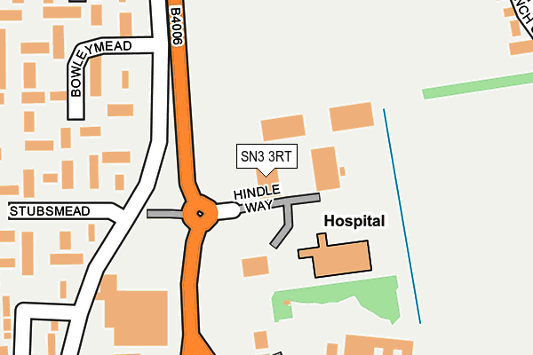
SN3 3RT is located in the Covingham and Dorcan electoral ward, within the unitary authority of Swindon and the English Parliamentary constituency of South Swindon. The Sub Integrated Care Board (ICB) Location is NHS Bath and North East Somerset, Swindon and Wiltshire ICB - 92 and the police force is Wiltshire. This postcode has been in use since April 2004.


GetTheData
Source: OS OpenMap – Local (Ordnance Survey)
Source: OS VectorMap District (Ordnance Survey)
Licence: Open Government Licence (requires attribution)
| Easting | 418737 |
| Northing | 184291 |
| Latitude | 51.557195 |
| Longitude | -1.731115 |
GetTheData
Source: Open Postcode Geo
Licence: Open Government Licence
| Country | England |
| Postcode District | SN3 |
➜ See where SN3 is on a map ➜ Where is Swindon? | |
GetTheData
Source: Land Registry Price Paid Data
Licence: Open Government Licence
Elevation or altitude of SN3 3RT as distance above sea level:
| Metres | Feet | |
|---|---|---|
| Elevation | 100m | 328ft |
Elevation is measured from the approximate centre of the postcode, to the nearest point on an OS contour line from OS Terrain 50, which has contour spacing of ten vertical metres.
➜ How high above sea level am I? Find the elevation of your current position using your device's GPS.
GetTheData
Source: Open Postcode Elevation
Licence: Open Government Licence
| Ward | Covingham And Dorcan |
| Constituency | South Swindon |
GetTheData
Source: ONS Postcode Database
Licence: Open Government Licence
| Stubsmead (Eldene Drive) | Eldene | 127m |
| Stubsmead (Eldene Drive) | Eldene | 138m |
| Eldene Centre (Eldene Drive) | Eldene | 352m |
| Bowleymead (Eldene Drive) | Eldene | 400m |
| Bowleymead (Eldene Drive) | Eldene | 406m |
| Swindon Station | 3.9km |
GetTheData
Source: NaPTAN
Licence: Open Government Licence
GetTheData
Source: ONS Postcode Database
Licence: Open Government Licence


➜ Get more ratings from the Food Standards Agency
GetTheData
Source: Food Standards Agency
Licence: FSA terms & conditions
| Last Collection | |||
|---|---|---|---|
| Location | Mon-Fri | Sat | Distance |
| Eldene Drive | 17:30 | 11:30 | 502m |
| St Pauls Drive | 17:30 | 12:00 | 585m |
| Bryanstone Way | 17:45 | 12:30 | 719m |
GetTheData
Source: Dracos
Licence: Creative Commons Attribution-ShareAlike
The below table lists the International Territorial Level (ITL) codes (formerly Nomenclature of Territorial Units for Statistics (NUTS) codes) and Local Administrative Units (LAU) codes for SN3 3RT:
| ITL 1 Code | Name |
|---|---|
| TLK | South West (England) |
| ITL 2 Code | Name |
| TLK1 | Gloucestershire, Wiltshire and Bath/Bristol area |
| ITL 3 Code | Name |
| TLK14 | Swindon |
| LAU 1 Code | Name |
| E06000030 | Swindon |
GetTheData
Source: ONS Postcode Directory
Licence: Open Government Licence
The below table lists the Census Output Area (OA), Lower Layer Super Output Area (LSOA), and Middle Layer Super Output Area (MSOA) for SN3 3RT:
| Code | Name | |
|---|---|---|
| OA | E00078325 | |
| LSOA | E01015491 | Swindon 023E |
| MSOA | E02003234 | Swindon 023 |
GetTheData
Source: ONS Postcode Directory
Licence: Open Government Licence
| SN3 3RB | Edison Park | 59m |
| SN3 3TZ | Dorcan Way | 221m |
| SN3 3TA | Stubsmead | 239m |
| SN3 3TD | Bowleymead | 242m |
| SN3 3TE | Bowleymead | 287m |
| SN3 3TB | Stubsmead | 315m |
| SN3 3TF | Islandsmead | 363m |
| SN3 3TH | Colingsmead | 381m |
| SN3 3TG | Islandsmead | 383m |
| SN3 5LJ | Bullfinch Close | 383m |
GetTheData
Source: Open Postcode Geo; Land Registry Price Paid Data
Licence: Open Government Licence