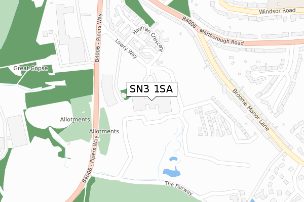
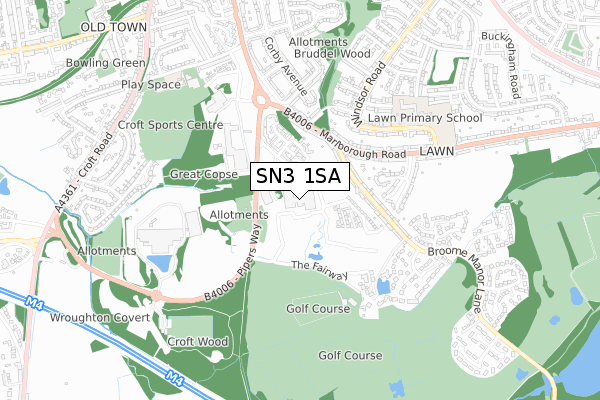
SN3 1SA is located in the Old Town electoral ward, within the unitary authority of Swindon and the English Parliamentary constituency of South Swindon. The Sub Integrated Care Board (ICB) Location is NHS Bath and North East Somerset, Swindon and Wiltshire ICB - 92 and the police force is Wiltshire. This postcode has been in use since May 2019.


GetTheData
Source: OS Open Zoomstack (Ordnance Survey)
Licence: Open Government Licence (requires attribution)
Attribution: Contains OS data © Crown copyright and database right 2025
Source: Open Postcode Geo
Licence: Open Government Licence (requires attribution)
Attribution: Contains OS data © Crown copyright and database right 2025; Contains Royal Mail data © Royal Mail copyright and database right 2025; Source: Office for National Statistics licensed under the Open Government Licence v.3.0
| Easting | 416164 |
| Northing | 182573 |
| Latitude | 51.541827 |
| Longitude | -1.768308 |
GetTheData
Source: Open Postcode Geo
Licence: Open Government Licence
| Country | England |
| Postcode District | SN3 |
➜ See where SN3 is on a map ➜ Where is Swindon? | |
GetTheData
Source: Land Registry Price Paid Data
Licence: Open Government Licence
Elevation or altitude of SN3 1SA as distance above sea level:
| Metres | Feet | |
|---|---|---|
| Elevation | 130m | 427ft |
Elevation is measured from the approximate centre of the postcode, to the nearest point on an OS contour line from OS Terrain 50, which has contour spacing of ten vertical metres.
➜ How high above sea level am I? Find the elevation of your current position using your device's GPS.
GetTheData
Source: Open Postcode Elevation
Licence: Open Government Licence
| Ward | Old Town |
| Constituency | South Swindon |
GetTheData
Source: ONS Postcode Database
Licence: Open Government Licence
| Wakefield House | Old Town | 55m |
| Aspect Park (Pipers Way) | Old Town | 237m |
| Broome Manor Lane (Marlborough Road) | Lawn | 287m |
| Broome Manor Lane (Marlborough Road) | Lawn | 300m |
| Aspect Park (Pipers Way) | Old Town | 344m |
| Swindon Station | 2.9km |
GetTheData
Source: NaPTAN
Licence: Open Government Licence
GetTheData
Source: ONS Postcode Database
Licence: Open Government Licence


➜ Get more ratings from the Food Standards Agency
GetTheData
Source: Food Standards Agency
Licence: FSA terms & conditions
| Last Collection | |||
|---|---|---|---|
| Location | Mon-Fri | Sat | Distance |
| Broome Manor Lane | 17:45 | 11:30 | 288m |
| Marlborough Lane | 17:30 | 11:30 | 618m |
| Corby Avenue | 18:00 | 12:00 | 627m |
GetTheData
Source: Dracos
Licence: Creative Commons Attribution-ShareAlike
The below table lists the International Territorial Level (ITL) codes (formerly Nomenclature of Territorial Units for Statistics (NUTS) codes) and Local Administrative Units (LAU) codes for SN3 1SA:
| ITL 1 Code | Name |
|---|---|
| TLK | South West (England) |
| ITL 2 Code | Name |
| TLK1 | Gloucestershire, Wiltshire and Bath/Bristol area |
| ITL 3 Code | Name |
| TLK14 | Swindon |
| LAU 1 Code | Name |
| E06000030 | Swindon |
GetTheData
Source: ONS Postcode Directory
Licence: Open Government Licence
The below table lists the Census Output Area (OA), Lower Layer Super Output Area (LSOA), and Middle Layer Super Output Area (MSOA) for SN3 1SA:
| Code | Name | |
|---|---|---|
| OA | E00078554 | |
| LSOA | E01015535 | Swindon 024C |
| MSOA | E02003235 | Swindon 024 |
GetTheData
Source: ONS Postcode Directory
Licence: Open Government Licence
| SN3 1FH | Allen Close | 146m |
| SN3 1FR | Orpen Close | 206m |
| SN3 1FN | Hayman Crescent | 231m |
| SN3 1FL | Dearden Walk | 241m |
| SN3 1LX | Broome Manor Lane | 276m |
| SN3 1LU | Marlborough Road | 282m |
| SN3 1FG | Gosse Court | 289m |
| SN3 1FP | Tunnicliffe Close | 314m |
| SN3 1NB | Broome Manor Lane | 320m |
| SN3 1NX | Marlborough Road | 356m |
GetTheData
Source: Open Postcode Geo; Land Registry Price Paid Data
Licence: Open Government Licence