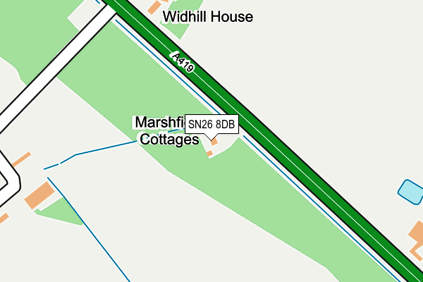
SN26 8DB lies on Marshfield Cottages in Blunsdon, Swindon. SN26 8DB is located in the St Andrews electoral ward, within the unitary authority of Swindon and the English Parliamentary constituency of North Swindon. The Sub Integrated Care Board (ICB) Location is NHS Bath and North East Somerset, Swindon and Wiltshire ICB - 92 and the police force is Wiltshire. This postcode has been in use since June 2000.


GetTheData
Source: OS OpenMap – Local (Ordnance Survey)
Source: OS VectorMap District (Ordnance Survey)
Licence: Open Government Licence (requires attribution)
| Easting | 413152 |
| Northing | 191472 |
| Latitude | 51.621918 |
| Longitude | -1.811419 |
GetTheData
Source: Open Postcode Geo
Licence: Open Government Licence
| Street | Marshfield Cottages |
| Locality | Blunsdon |
| Town/City | Swindon |
| Country | England |
| Postcode District | SN26 |
➜ See where SN26 is on a map | |
GetTheData
Source: Land Registry Price Paid Data
Licence: Open Government Licence
Elevation or altitude of SN26 8DB as distance above sea level:
| Metres | Feet | |
|---|---|---|
| Elevation | 90m | 295ft |
Elevation is measured from the approximate centre of the postcode, to the nearest point on an OS contour line from OS Terrain 50, which has contour spacing of ten vertical metres.
➜ How high above sea level am I? Find the elevation of your current position using your device's GPS.
GetTheData
Source: Open Postcode Elevation
Licence: Open Government Licence
| Ward | St Andrews |
| Constituency | North Swindon |
GetTheData
Source: ONS Postcode Database
Licence: Open Government Licence
| Castle Eaton Turn (A419) | Calcutt | 1,365m |
| Castle Eaton Turn (A419) | Calcutt | 1,369m |
| High Street Top (High Street) | Broad Blunsdon | 1,754m |
| Hillside Way (Ermin Street) | Broad Blunsdon | 1,820m |
| Abbey Stadium (Lady Lane) | Broad Blunsdon | 1,959m |
GetTheData
Source: NaPTAN
Licence: Open Government Licence
| Percentage of properties with Next Generation Access | 0.0% |
| Percentage of properties with Superfast Broadband | 0.0% |
| Percentage of properties with Ultrafast Broadband | 0.0% |
| Percentage of properties with Full Fibre Broadband | 0.0% |
Superfast Broadband is between 30Mbps and 300Mbps
Ultrafast Broadband is > 300Mbps
| Percentage of properties unable to receive 2Mbps | 0.0% |
| Percentage of properties unable to receive 5Mbps | 0.0% |
| Percentage of properties unable to receive 10Mbps | 50.0% |
| Percentage of properties unable to receive 30Mbps | 100.0% |
GetTheData
Source: Ofcom
Licence: Ofcom Terms of Use (requires attribution)
GetTheData
Source: ONS Postcode Database
Licence: Open Government Licence


➜ Get more ratings from the Food Standards Agency
GetTheData
Source: Food Standards Agency
Licence: FSA terms & conditions
| Last Collection | |||
|---|---|---|---|
| Location | Mon-Fri | Sat | Distance |
| Hillside Way | 16:00 | 08:00 | 1,723m |
| Saltzgitter Drive | 17:30 | 12:00 | 1,886m |
| High Street | 16:15 | 07:15 | 2,164m |
GetTheData
Source: Dracos
Licence: Creative Commons Attribution-ShareAlike
The below table lists the International Territorial Level (ITL) codes (formerly Nomenclature of Territorial Units for Statistics (NUTS) codes) and Local Administrative Units (LAU) codes for SN26 8DB:
| ITL 1 Code | Name |
|---|---|
| TLK | South West (England) |
| ITL 2 Code | Name |
| TLK1 | Gloucestershire, Wiltshire and Bath/Bristol area |
| ITL 3 Code | Name |
| TLK14 | Swindon |
| LAU 1 Code | Name |
| E06000030 | Swindon |
GetTheData
Source: ONS Postcode Directory
Licence: Open Government Licence
The below table lists the Census Output Area (OA), Lower Layer Super Output Area (LSOA), and Middle Layer Super Output Area (MSOA) for SN26 8DB:
| Code | Name | |
|---|---|---|
| OA | E00078246 | |
| LSOA | E01015474 | Swindon 008B |
| MSOA | E02003219 | Swindon 008 |
GetTheData
Source: ONS Postcode Directory
Licence: Open Government Licence
| SN26 8DA | 372m | |
| SN26 8BZ | Blunsdon Hill | 853m |
| SN26 8DE | 982m | |
| SN25 2PP | William Morris Way | 1246m |
| SN25 2PT | William Morris Way | 1348m |
| SN26 8BX | Upper Widhill Lane | 1356m |
| SN26 8BU | Hillside Way | 1433m |
| SN25 2PX | Malory Close | 1437m |
| SN6 6JS | Seven Bridges Cottages | 1439m |
| SN25 2PZ | De Morgan Crescent | 1444m |
GetTheData
Source: Open Postcode Geo; Land Registry Price Paid Data
Licence: Open Government Licence