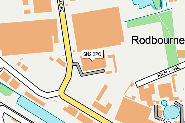
SN2 2PQ is located in the Rodbourne Cheney electoral ward, within the unitary authority of Swindon and the English Parliamentary constituency of North Swindon. The Sub Integrated Care Board (ICB) Location is NHS Bath and North East Somerset, Swindon and Wiltshire ICB - 92 and the police force is Wiltshire. This postcode has been in use since January 1993.


GetTheData
Source: OS OpenMap – Local (Ordnance Survey)
Source: OS VectorMap District (Ordnance Survey)
Licence: Open Government Licence (requires attribution)
| Easting | 413499 |
| Northing | 186086 |
| Latitude | 51.573483 |
| Longitude | -1.806613 |
GetTheData
Source: Open Postcode Geo
Licence: Open Government Licence
| Country | England |
| Postcode District | SN2 |
➜ See where SN2 is on a map ➜ Where is Swindon? | |
GetTheData
Source: Land Registry Price Paid Data
Licence: Open Government Licence
Elevation or altitude of SN2 2PQ as distance above sea level:
| Metres | Feet | |
|---|---|---|
| Elevation | 100m | 328ft |
Elevation is measured from the approximate centre of the postcode, to the nearest point on an OS contour line from OS Terrain 50, which has contour spacing of ten vertical metres.
➜ How high above sea level am I? Find the elevation of your current position using your device's GPS.
GetTheData
Source: Open Postcode Elevation
Licence: Open Government Licence
| Ward | Rodbourne Cheney |
| Constituency | North Swindon |
GetTheData
Source: ONS Postcode Database
Licence: Open Government Licence
| Enterprise House (Darby Close) | Cheney Manor | 125m |
| Enterprise House (Darby Close) | Cheney Manor | 136m |
| Bss House (Cheney Manor Industrial Estate) | Cheney Manor | 274m |
| Bss House (Cheney Manor Industrial Estate) | Cheney Manor | 296m |
| Lynton Road (Darby Close) | Cheney Manor | 347m |
| Swindon Station | 1.7km |
GetTheData
Source: NaPTAN
Licence: Open Government Licence
| Median download speed | 8.5Mbps |
| Average download speed | 8.0Mbps |
| Maximum download speed | 10.39Mbps |
| Median upload speed | 1.1Mbps |
| Average upload speed | 1.0Mbps |
| Maximum upload speed | 1.20Mbps |
GetTheData
Source: Ofcom
Licence: Ofcom Terms of Use (requires attribution)
GetTheData
Source: ONS Postcode Database
Licence: Open Government Licence


➜ Get more ratings from the Food Standards Agency
GetTheData
Source: Food Standards Agency
Licence: FSA terms & conditions
| Last Collection | |||
|---|---|---|---|
| Location | Mon-Fri | Sat | Distance |
| Cheney Manor Industrial Esate | 18:30 | 12:15 | 297m |
| Cheney Manor Industrial Estate | 302m | ||
| Cheney Manor Post Office | 17:30 | 12:15 | 364m |
GetTheData
Source: Dracos
Licence: Creative Commons Attribution-ShareAlike
The below table lists the International Territorial Level (ITL) codes (formerly Nomenclature of Territorial Units for Statistics (NUTS) codes) and Local Administrative Units (LAU) codes for SN2 2PQ:
| ITL 1 Code | Name |
|---|---|
| TLK | South West (England) |
| ITL 2 Code | Name |
| TLK1 | Gloucestershire, Wiltshire and Bath/Bristol area |
| ITL 3 Code | Name |
| TLK14 | Swindon |
| LAU 1 Code | Name |
| E06000030 | Swindon |
GetTheData
Source: ONS Postcode Directory
Licence: Open Government Licence
The below table lists the Census Output Area (OA), Lower Layer Super Output Area (LSOA), and Middle Layer Super Output Area (MSOA) for SN2 2PQ:
| Code | Name | |
|---|---|---|
| OA | E00078791 | |
| LSOA | E01015581 | Swindon 012D |
| MSOA | E02003223 | Swindon 012 |
GetTheData
Source: ONS Postcode Directory
Licence: Open Government Licence
| SN2 2NU | Telford Pool | 264m |
| SN2 2PP | Kiln Lane | 269m |
| SN2 2NT | Cheney Manor Road | 356m |
| SN2 2NX | Cheney Manor Road | 356m |
| SN2 2QP | Ravenseft Park | 359m |
| SN2 2NR | Cheney Manor Road | 383m |
| SN2 2DN | Aubrey Gardens | 393m |
| SN2 2NS | Cheney Manor Road | 398m |
| SN2 2ND | Manor Gardens | 439m |
| SN2 1NE | Somerset Road | 467m |
GetTheData
Source: Open Postcode Geo; Land Registry Price Paid Data
Licence: Open Government Licence