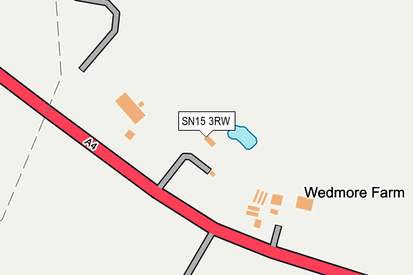
SN15 3RW is in Pewsham, Chippenham. SN15 3RW is located in the Chippenham Pewsham electoral ward, within the unitary authority of Wiltshire and the English Parliamentary constituency of North Wiltshire. The Sub Integrated Care Board (ICB) Location is NHS Bath and North East Somerset, Swindon and Wiltshire ICB - 92 and the police force is Wiltshire. This postcode has been in use since January 1980.


GetTheData
Source: OS OpenMap – Local (Ordnance Survey)
Source: OS VectorMap District (Ordnance Survey)
Licence: Open Government Licence (requires attribution)
| Easting | 393766 |
| Northing | 172179 |
| Latitude | 51.448561 |
| Longitude | -2.091092 |
GetTheData
Source: Open Postcode Geo
Licence: Open Government Licence
| Locality | Pewsham |
| Town/City | Chippenham |
| Country | England |
| Postcode District | SN15 |
➜ See where SN15 is on a map | |
GetTheData
Source: Land Registry Price Paid Data
Licence: Open Government Licence
Elevation or altitude of SN15 3RW as distance above sea level:
| Metres | Feet | |
|---|---|---|
| Elevation | 60m | 197ft |
Elevation is measured from the approximate centre of the postcode, to the nearest point on an OS contour line from OS Terrain 50, which has contour spacing of ten vertical metres.
➜ How high above sea level am I? Find the elevation of your current position using your device's GPS.
GetTheData
Source: Open Postcode Elevation
Licence: Open Government Licence
| Ward | Chippenham Pewsham |
| Constituency | North Wiltshire |
GetTheData
Source: ONS Postcode Database
Licence: Open Government Licence
| Roundabout (London Road) | Pewsham | 109m |
| Roundabout (London Road) | Pewsham | 113m |
| Stanley Lane (London Road) | Pewsham | 176m |
| Stanley Lane (London Road) | Pewsham | 184m |
| Roman Way (Lodge Road) | Pewsham | 335m |
| Chippenham Station | 2.3km |
GetTheData
Source: NaPTAN
Licence: Open Government Licence
| Percentage of properties with Next Generation Access | 100.0% |
| Percentage of properties with Superfast Broadband | 50.0% |
| Percentage of properties with Ultrafast Broadband | 0.0% |
| Percentage of properties with Full Fibre Broadband | 0.0% |
Superfast Broadband is between 30Mbps and 300Mbps
Ultrafast Broadband is > 300Mbps
| Median download speed | 12.6Mbps |
| Average download speed | 25.7Mbps |
| Maximum download speed | 55.00Mbps |
| Median upload speed | 1.2Mbps |
| Average upload speed | 3.9Mbps |
| Maximum upload speed | 9.01Mbps |
| Percentage of properties unable to receive 2Mbps | 0.0% |
| Percentage of properties unable to receive 5Mbps | 0.0% |
| Percentage of properties unable to receive 10Mbps | 0.0% |
| Percentage of properties unable to receive 30Mbps | 50.0% |
GetTheData
Source: Ofcom
Licence: Ofcom Terms of Use (requires attribution)
GetTheData
Source: ONS Postcode Database
Licence: Open Government Licence


➜ Get more ratings from the Food Standards Agency
GetTheData
Source: Food Standards Agency
Licence: FSA terms & conditions
| Last Collection | |||
|---|---|---|---|
| Location | Mon-Fri | Sat | Distance |
| London Road | 17:30 | 12:00 | 251m |
| Lodge Road | 17:45 | 12:00 | 333m |
| Hardens Mead | 17:45 | 12:00 | 548m |
GetTheData
Source: Dracos
Licence: Creative Commons Attribution-ShareAlike
The below table lists the International Territorial Level (ITL) codes (formerly Nomenclature of Territorial Units for Statistics (NUTS) codes) and Local Administrative Units (LAU) codes for SN15 3RW:
| ITL 1 Code | Name |
|---|---|
| TLK | South West (England) |
| ITL 2 Code | Name |
| TLK1 | Gloucestershire, Wiltshire and Bath/Bristol area |
| ITL 3 Code | Name |
| TLK15 | Wiltshire |
| LAU 1 Code | Name |
| E06000054 | Wiltshire |
GetTheData
Source: ONS Postcode Directory
Licence: Open Government Licence
The below table lists the Census Output Area (OA), Lower Layer Super Output Area (LSOA), and Middle Layer Super Output Area (MSOA) for SN15 3RW:
| Code | Name | |
|---|---|---|
| OA | E00162664 | |
| LSOA | E01031891 | Wiltshire 013A |
| MSOA | E02006655 | Wiltshire 013 |
GetTheData
Source: ONS Postcode Directory
Licence: Open Government Licence
| SN15 3TW | Colborne Close | 175m |
| SN15 3TJ | Roman Way | 192m |
| SN15 3TA | Roman Way | 192m |
| SN15 3RP | 195m | |
| SN15 3XA | The Turnpike | 214m |
| SN15 3TN | Bradbury Close | 219m |
| SN15 3TD | Abbey Close | 248m |
| SN15 3TB | Legate Close | 308m |
| SN15 3TL | Hewlett Close | 314m |
| SN15 3TP | Danvers Mead | 347m |
GetTheData
Source: Open Postcode Geo; Land Registry Price Paid Data
Licence: Open Government Licence