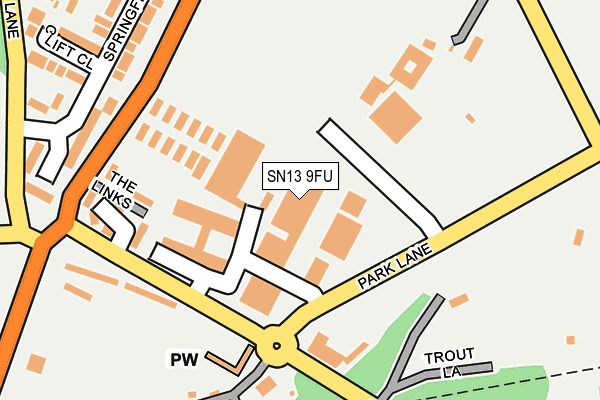
SN13 9FU is located in the Corsham Without electoral ward, within the unitary authority of Wiltshire and the English Parliamentary constituency of North Wiltshire. The Sub Integrated Care Board (ICB) Location is NHS Bath and North East Somerset, Swindon and Wiltshire ICB - 92 and the police force is Wiltshire. This postcode has been in use since May 2016.


GetTheData
Source: OS OpenMap – Local (Ordnance Survey)
Source: OS VectorMap District (Ordnance Survey)
Licence: Open Government Licence (requires attribution)
| Easting | 384655 |
| Northing | 169542 |
| Latitude | 51.424674 |
| Longitude | -2.222084 |
GetTheData
Source: Open Postcode Geo
Licence: Open Government Licence
| Country | England |
| Postcode District | SN13 |
➜ See where SN13 is on a map ➜ Where is Rudloe? | |
GetTheData
Source: Land Registry Price Paid Data
Licence: Open Government Licence
Elevation or altitude of SN13 9FU as distance above sea level:
| Metres | Feet | |
|---|---|---|
| Elevation | 140m | 459ft |
Elevation is measured from the approximate centre of the postcode, to the nearest point on an OS contour line from OS Terrain 50, which has contour spacing of ten vertical metres.
➜ How high above sea level am I? Find the elevation of your current position using your device's GPS.
GetTheData
Source: Open Postcode Elevation
Licence: Open Government Licence
| Ward | Corsham Without |
| Constituency | North Wiltshire |
GetTheData
Source: ONS Postcode Database
Licence: Open Government Licence
| The Links (Westwells Road) | Rudloe | 197m |
| Fiveways Industrial Estate (Westwells Road) | Rudloe | 210m |
| Fiveways (Leafy Lane) | Rudloe | 242m |
| Fiveways (Leafy Lane) | Rudloe | 254m |
| Leafy Lane | Rudloe | 425m |
GetTheData
Source: NaPTAN
Licence: Open Government Licence
GetTheData
Source: ONS Postcode Database
Licence: Open Government Licence


➜ Get more ratings from the Food Standards Agency
GetTheData
Source: Food Standards Agency
Licence: FSA terms & conditions
| Last Collection | |||
|---|---|---|---|
| Location | Mon-Fri | Sat | Distance |
| Hawthorn Post Office | 17:00 | 11:15 | 697m |
| Quarrymans Arms | 16:00 | 09:00 | 1,204m |
| Valley Road | 17:45 | 11:45 | 1,982m |
GetTheData
Source: Dracos
Licence: Creative Commons Attribution-ShareAlike
The below table lists the International Territorial Level (ITL) codes (formerly Nomenclature of Territorial Units for Statistics (NUTS) codes) and Local Administrative Units (LAU) codes for SN13 9FU:
| ITL 1 Code | Name |
|---|---|
| TLK | South West (England) |
| ITL 2 Code | Name |
| TLK1 | Gloucestershire, Wiltshire and Bath/Bristol area |
| ITL 3 Code | Name |
| TLK15 | Wiltshire |
| LAU 1 Code | Name |
| E06000054 | Wiltshire |
GetTheData
Source: ONS Postcode Directory
Licence: Open Government Licence
The below table lists the Census Output Area (OA), Lower Layer Super Output Area (LSOA), and Middle Layer Super Output Area (MSOA) for SN13 9FU:
| Code | Name | |
|---|---|---|
| OA | E00162656 | |
| LSOA | E01031890 | Wiltshire 017C |
| MSOA | E02006659 | Wiltshire 017 |
GetTheData
Source: ONS Postcode Directory
Licence: Open Government Licence
| SN13 0NX | The Links | 164m |
| SN13 0JP | Springfield Close | 173m |
| SN13 0JR | Springfield Close | 180m |
| SN13 0JS | Clift Close | 198m |
| SN13 0LA | Highlands Close | 242m |
| SN13 0JY | Leafy Lane | 278m |
| SN13 0JZ | Kidston Way | 317m |
| SN13 0LY | Bankwaters Road | 395m |
| SN13 0LX | Broadwood Avenue | 419m |
| SN13 0LZ | Westwood Road | 424m |
GetTheData
Source: Open Postcode Geo; Land Registry Price Paid Data
Licence: Open Government Licence