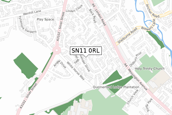
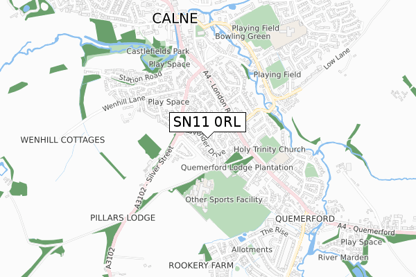
SN11 0RL lies on Elder Court in Calne. SN11 0RL is located in the Calne South electoral ward, within the unitary authority of Wiltshire and the English Parliamentary constituency of North Wiltshire. The Sub Integrated Care Board (ICB) Location is NHS Bath and North East Somerset, Swindon and Wiltshire ICB - 92 and the police force is Wiltshire. This postcode has been in use since August 1993.


GetTheData
Source: OS Open Zoomstack (Ordnance Survey)
Licence: Open Government Licence (requires attribution)
Attribution: Contains OS data © Crown copyright and database right 2025
Source: Open Postcode Geo
Licence: Open Government Licence (requires attribution)
Attribution: Contains OS data © Crown copyright and database right 2025; Contains Royal Mail data © Royal Mail copyright and database right 2025; Source: Office for National Statistics licensed under the Open Government Licence v.3.0
| Easting | 399941 |
| Northing | 170268 |
| Latitude | 51.431415 |
| Longitude | -2.002238 |
GetTheData
Source: Open Postcode Geo
Licence: Open Government Licence
| Street | Elder Court |
| Town/City | Calne |
| Country | England |
| Postcode District | SN11 |
➜ See where SN11 is on a map ➜ Where is Calne? | |
GetTheData
Source: Land Registry Price Paid Data
Licence: Open Government Licence
Elevation or altitude of SN11 0RL as distance above sea level:
| Metres | Feet | |
|---|---|---|
| Elevation | 90m | 295ft |
Elevation is measured from the approximate centre of the postcode, to the nearest point on an OS contour line from OS Terrain 50, which has contour spacing of ten vertical metres.
➜ How high above sea level am I? Find the elevation of your current position using your device's GPS.
GetTheData
Source: Open Postcode Elevation
Licence: Open Government Licence
| Ward | Calne South |
| Constituency | North Wiltshire |
GetTheData
Source: ONS Postcode Database
Licence: Open Government Licence
2, ELDER COURT, CALNE, SN11 0RL 2023 11 JUL £370,000 |
2019 20 MAR £320,000 |
2019 28 FEB £320,000 |
2016 16 JUN £315,000 |
2006 13 JAN £226,500 |
2004 28 MAY £202,000 |
5, ELDER COURT, CALNE, SN11 0RL 2002 12 SEP £143,950 |
1999 29 APR £119,000 |
1998 20 NOV £108,000 |
1, ELDER COURT, CALNE, SN11 0RL 1997 30 APR £71,500 |
GetTheData
Source: HM Land Registry Price Paid Data
Licence: Contains HM Land Registry data © Crown copyright and database right 2025. This data is licensed under the Open Government Licence v3.0.
| John Bently School (Grounds) | Calne | 189m |
| Police Station (Silver Street) | Calne | 201m |
| Shelburne Road (London Road) | Calne | 225m |
| Police Station (Silver Street) | Calne | 226m |
| Shelburne Road (London Road) | Calne | 249m |
GetTheData
Source: NaPTAN
Licence: Open Government Licence
| Percentage of properties with Next Generation Access | 100.0% |
| Percentage of properties with Superfast Broadband | 100.0% |
| Percentage of properties with Ultrafast Broadband | 0.0% |
| Percentage of properties with Full Fibre Broadband | 0.0% |
Superfast Broadband is between 30Mbps and 300Mbps
Ultrafast Broadband is > 300Mbps
| Median download speed | 55.0Mbps |
| Average download speed | 49.0Mbps |
| Maximum download speed | 70.91Mbps |
| Median upload speed | 10.0Mbps |
| Average upload speed | 10.5Mbps |
| Maximum upload speed | 16.80Mbps |
| Percentage of properties unable to receive 2Mbps | 0.0% |
| Percentage of properties unable to receive 5Mbps | 0.0% |
| Percentage of properties unable to receive 10Mbps | 0.0% |
| Percentage of properties unable to receive 30Mbps | 0.0% |
GetTheData
Source: Ofcom
Licence: Ofcom Terms of Use (requires attribution)
GetTheData
Source: ONS Postcode Database
Licence: Open Government Licence


➜ Get more ratings from the Food Standards Agency
GetTheData
Source: Food Standards Agency
Licence: FSA terms & conditions
| Last Collection | |||
|---|---|---|---|
| Location | Mon-Fri | Sat | Distance |
| Silverglades | 17:45 | 12:00 | 60m |
| London Road | 17:30 | 12:00 | 250m |
| Wessington | 17:30 | 12:00 | 438m |
GetTheData
Source: Dracos
Licence: Creative Commons Attribution-ShareAlike
The below table lists the International Territorial Level (ITL) codes (formerly Nomenclature of Territorial Units for Statistics (NUTS) codes) and Local Administrative Units (LAU) codes for SN11 0RL:
| ITL 1 Code | Name |
|---|---|
| TLK | South West (England) |
| ITL 2 Code | Name |
| TLK1 | Gloucestershire, Wiltshire and Bath/Bristol area |
| ITL 3 Code | Name |
| TLK15 | Wiltshire |
| LAU 1 Code | Name |
| E06000054 | Wiltshire |
GetTheData
Source: ONS Postcode Directory
Licence: Open Government Licence
The below table lists the Census Output Area (OA), Lower Layer Super Output Area (LSOA), and Middle Layer Super Output Area (MSOA) for SN11 0RL:
| Code | Name | |
|---|---|---|
| OA | E00162708 | |
| LSOA | E01031900 | Wiltshire 016A |
| MSOA | E02006658 | Wiltshire 016 |
GetTheData
Source: ONS Postcode Directory
Licence: Open Government Licence
| SN11 0QP | Magnolia Rise | 36m |
| SN11 0QJ | Lavender Drive | 42m |
| SN11 0QU | Tamarisk Close | 53m |
| SN11 0QG | Lilac Way | 71m |
| SN11 0QN | Jasmine Close | 90m |
| SN11 0QQ | Lavender Drive | 91m |
| SN11 0QT | Azalea Close | 113m |
| SN11 0QL | Magnolia Rise | 115m |
| SN11 0QW | Maple Close | 128m |
| SN11 0QR | Heather Way | 138m |
GetTheData
Source: Open Postcode Geo; Land Registry Price Paid Data
Licence: Open Government Licence