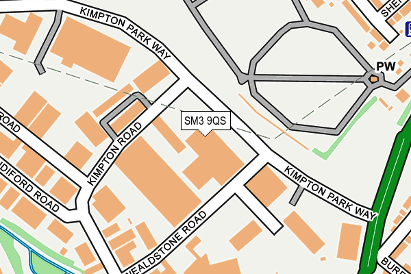
SM3 9QS lies on Kimpton Park Way in Sutton. SM3 9QS is located in the Stonecot electoral ward, within the London borough of Sutton and the English Parliamentary constituency of Sutton and Cheam. The Sub Integrated Care Board (ICB) Location is NHS South West London ICB - 36L and the police force is Metropolitan Police. This postcode has been in use since November 2006.


GetTheData
Source: OS OpenMap – Local (Ordnance Survey)
Source: OS VectorMap District (Ordnance Survey)
Licence: Open Government Licence (requires attribution)
| Easting | 524887 |
| Northing | 165777 |
| Latitude | 51.377318 |
| Longitude | -0.206970 |
GetTheData
Source: Open Postcode Geo
Licence: Open Government Licence
| Street | Kimpton Park Way |
| Town/City | Sutton |
| Country | England |
| Postcode District | SM3 |
➜ See where SM3 is on a map ➜ Where is London? | |
GetTheData
Source: Land Registry Price Paid Data
Licence: Open Government Licence
Elevation or altitude of SM3 9QS as distance above sea level:
| Metres | Feet | |
|---|---|---|
| Elevation | 30m | 98ft |
Elevation is measured from the approximate centre of the postcode, to the nearest point on an OS contour line from OS Terrain 50, which has contour spacing of ten vertical metres.
➜ How high above sea level am I? Find the elevation of your current position using your device's GPS.
GetTheData
Source: Open Postcode Elevation
Licence: Open Government Licence
| Ward | Stonecot |
| Constituency | Sutton And Cheam |
GetTheData
Source: ONS Postcode Database
Licence: Open Government Licence
| Tesco Sutton Cheam | Benhilton | 118m |
| Tesco Sutton Cheam | Benhilton | 152m |
| Stayton Road | Benhilton | 303m |
| Stayton Road | Benhilton | 318m |
| Kimpton Road | Benhilton | 322m |
| Sutton Common Station | 0.8km |
| West Sutton Station | 1.3km |
| St Helier (London) Station | 1.5km |
GetTheData
Source: NaPTAN
Licence: Open Government Licence
| Median download speed | 30.8Mbps |
| Average download speed | 40.6Mbps |
| Maximum download speed | 80.00Mbps |
| Median upload speed | 5.6Mbps |
| Average upload speed | 8.9Mbps |
| Maximum upload speed | 20.00Mbps |
GetTheData
Source: Ofcom
Licence: Ofcom Terms of Use (requires attribution)
GetTheData
Source: ONS Postcode Database
Licence: Open Government Licence


➜ Get more ratings from the Food Standards Agency
GetTheData
Source: Food Standards Agency
Licence: FSA terms & conditions
| Last Collection | |||
|---|---|---|---|
| Location | Mon-Fri | Sat | Distance |
| Tesco - Instore Box | 17:15 | 12:00 | 255m |
| Stayton Road (142) | 17:45 | 12:00 | 449m |
| Sutton Common Road (177) | 17:00 | 12:00 | 489m |
GetTheData
Source: Dracos
Licence: Creative Commons Attribution-ShareAlike
The below table lists the International Territorial Level (ITL) codes (formerly Nomenclature of Territorial Units for Statistics (NUTS) codes) and Local Administrative Units (LAU) codes for SM3 9QS:
| ITL 1 Code | Name |
|---|---|
| TLI | London |
| ITL 2 Code | Name |
| TLI6 | Outer London - South |
| ITL 3 Code | Name |
| TLI63 | Merton, Kingston upon Thames and Sutton |
| LAU 1 Code | Name |
| E09000029 | Sutton |
GetTheData
Source: ONS Postcode Directory
Licence: Open Government Licence
The below table lists the Census Output Area (OA), Lower Layer Super Output Area (LSOA), and Middle Layer Super Output Area (MSOA) for SM3 9QS:
| Code | Name | |
|---|---|---|
| OA | E00020790 | |
| LSOA | E01004130 | Sutton 003A |
| MSOA | E02000842 | Sutton 003 |
GetTheData
Source: ONS Postcode Directory
Licence: Open Government Licence
| SM3 9QP | Kimpton Road | 57m |
| SM3 9QN | Wealdstone Road | 167m |
| SM3 9QL | Kimpton Road | 247m |
| SM3 9PR | Barrington Road | 282m |
| SM3 9RN | Sandiford Road | 294m |
| SM1 2NN | Oldfields Road | 336m |
| SM3 9LL | Ridge Road | 351m |
| SM1 2ND | Clensham Lane | 351m |
| SM3 9RL | Hamilton Avenue | 358m |
| SM3 9QQ | Willow Walk | 361m |
GetTheData
Source: Open Postcode Geo; Land Registry Price Paid Data
Licence: Open Government Licence