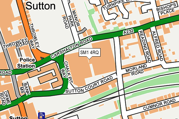
SM1 4RQ is located in the Sutton Central electoral ward, within the London borough of Sutton and the English Parliamentary constituency of Sutton and Cheam. The Sub Integrated Care Board (ICB) Location is NHS South West London ICB - 36L and the police force is Metropolitan Police. This postcode has been in use since February 1990.


GetTheData
Source: OS OpenMap – Local (Ordnance Survey)
Source: OS VectorMap District (Ordnance Survey)
Licence: Open Government Licence (requires attribution)
| Easting | 526227 |
| Northing | 164060 |
| Latitude | 51.361592 |
| Longitude | -0.188361 |
GetTheData
Source: Open Postcode Geo
Licence: Open Government Licence
| Country | England |
| Postcode District | SM1 |
➜ See where SM1 is on a map ➜ Where is Sutton? | |
GetTheData
Source: Land Registry Price Paid Data
Licence: Open Government Licence
Elevation or altitude of SM1 4RQ as distance above sea level:
| Metres | Feet | |
|---|---|---|
| Elevation | 60m | 197ft |
Elevation is measured from the approximate centre of the postcode, to the nearest point on an OS contour line from OS Terrain 50, which has contour spacing of ten vertical metres.
➜ How high above sea level am I? Find the elevation of your current position using your device's GPS.
GetTheData
Source: Open Postcode Elevation
Licence: Open Government Licence
| Ward | Sutton Central |
| Constituency | Sutton And Cheam |
GetTheData
Source: ONS Postcode Database
Licence: Open Government Licence
| Chalk Pit Way | Sutton | 89m |
| Langley Park Road | Sutton | 109m |
| Langley Park Road | Sutton | 114m |
| Lind Road | Sutton | 171m |
| Sutton Court Road | Sutton | 198m |
| Sutton (London) Station | 0.3km |
| West Sutton Station | 1.3km |
| Carshalton Beeches Station | 1.4km |
GetTheData
Source: NaPTAN
Licence: Open Government Licence
GetTheData
Source: ONS Postcode Database
Licence: Open Government Licence


➜ Get more ratings from the Food Standards Agency
GetTheData
Source: Food Standards Agency
Licence: FSA terms & conditions
| Last Collection | |||
|---|---|---|---|
| Location | Mon-Fri | Sat | Distance |
| Manor Park Road (Manor Lodge) | 17:30 | 12:00 | 132m |
| Br Sutton Station | 18:45 | 12:00 | 288m |
| Safeways High Street | 18:45 | 12:00 | 298m |
GetTheData
Source: Dracos
Licence: Creative Commons Attribution-ShareAlike
The below table lists the International Territorial Level (ITL) codes (formerly Nomenclature of Territorial Units for Statistics (NUTS) codes) and Local Administrative Units (LAU) codes for SM1 4RQ:
| ITL 1 Code | Name |
|---|---|
| TLI | London |
| ITL 2 Code | Name |
| TLI6 | Outer London - South |
| ITL 3 Code | Name |
| TLI63 | Merton, Kingston upon Thames and Sutton |
| LAU 1 Code | Name |
| E09000029 | Sutton |
GetTheData
Source: ONS Postcode Directory
Licence: Open Government Licence
The below table lists the Census Output Area (OA), Lower Layer Super Output Area (LSOA), and Middle Layer Super Output Area (MSOA) for SM1 4RQ:
| Code | Name | |
|---|---|---|
| OA | E00020827 | |
| LSOA | E01004137 | Sutton 012A |
| MSOA | E02000851 | Sutton 012 |
GetTheData
Source: ONS Postcode Directory
Licence: Open Government Licence
| SM1 4LF | Carshalton Road | 90m |
| SM1 4FF | Sutton Court Road | 101m |
| SM1 4SL | Sutton Court Road | 104m |
| SM1 4TB | Langley Park Road | 113m |
| SM1 4AJ | Manor Park Road | 114m |
| SM1 4HB | Turnpike Lane | 131m |
| SM1 4JA | Turnpike Lane | 152m |
| SM1 4JJ | Turnpike Lane | 166m |
| SM1 4RP | Morland Road | 171m |
| SM1 4RL | Carshalton Road | 178m |
GetTheData
Source: Open Postcode Geo; Land Registry Price Paid Data
Licence: Open Government Licence