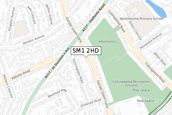
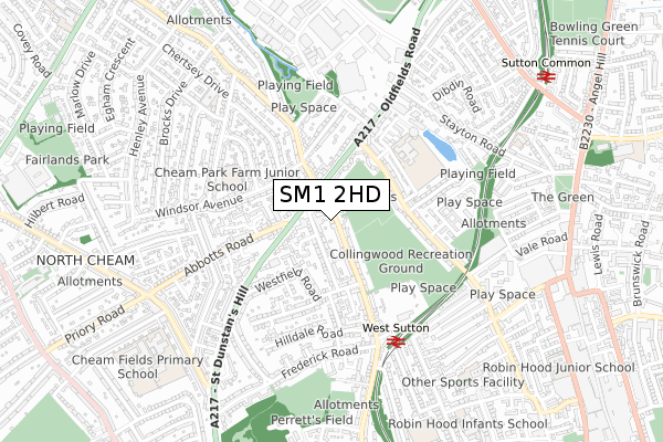
SM1 2HD lies on Gander Green Lane in Sutton. SM1 2HD is located in the Sutton West & East Cheam electoral ward, within the London borough of Sutton and the English Parliamentary constituency of Sutton and Cheam. The Sub Integrated Care Board (ICB) Location is NHS South West London ICB - 36L and the police force is Metropolitan Police. This postcode has been in use since January 1980.


GetTheData
Source: OS Open Zoomstack (Ordnance Survey)
Licence: Open Government Licence (requires attribution)
Attribution: Contains OS data © Crown copyright and database right 2025
Source: Open Postcode Geo
Licence: Open Government Licence (requires attribution)
Attribution: Contains OS data © Crown copyright and database right 2025; Contains Royal Mail data © Royal Mail copyright and database right 2025; Source: Office for National Statistics licensed under the Open Government Licence v.3.0
| Easting | 524839 |
| Northing | 165001 |
| Latitude | 51.370355 |
| Longitude | -0.207957 |
GetTheData
Source: Open Postcode Geo
Licence: Open Government Licence
| Street | Gander Green Lane |
| Town/City | Sutton |
| Country | England |
| Postcode District | SM1 |
➜ See where SM1 is on a map ➜ Where is London? | |
GetTheData
Source: Land Registry Price Paid Data
Licence: Open Government Licence
Elevation or altitude of SM1 2HD as distance above sea level:
| Metres | Feet | |
|---|---|---|
| Elevation | 30m | 98ft |
Elevation is measured from the approximate centre of the postcode, to the nearest point on an OS contour line from OS Terrain 50, which has contour spacing of ten vertical metres.
➜ How high above sea level am I? Find the elevation of your current position using your device's GPS.
GetTheData
Source: Open Postcode Elevation
Licence: Open Government Licence
| Ward | Sutton West & East Cheam |
| Constituency | Sutton And Cheam |
GetTheData
Source: ONS Postcode Database
Licence: Open Government Licence
| Gander Green Lane | Benhilton | 238m |
| Gander Green Lane | Benhilton | 250m |
| Windsor Avenue Kew Cress | North Cheam | 288m |
| Collingwood Road Oldfields Road | Benhilton | 290m |
| Alexandra Avenue (Sm1) | Benhilton | 298m |
| West Sutton Station | 0.5km |
| Sutton Common Station | 1km |
| Sutton (London) Station | 1.7km |
GetTheData
Source: NaPTAN
Licence: Open Government Licence
| Percentage of properties with Next Generation Access | 100.0% |
| Percentage of properties with Superfast Broadband | 100.0% |
| Percentage of properties with Ultrafast Broadband | 100.0% |
| Percentage of properties with Full Fibre Broadband | 0.0% |
Superfast Broadband is between 30Mbps and 300Mbps
Ultrafast Broadband is > 300Mbps
| Median download speed | 45.9Mbps |
| Average download speed | 57.7Mbps |
| Maximum download speed | 150.00Mbps |
| Median upload speed | 9.8Mbps |
| Average upload speed | 8.5Mbps |
| Maximum upload speed | 20.00Mbps |
| Percentage of properties unable to receive 2Mbps | 0.0% |
| Percentage of properties unable to receive 5Mbps | 0.0% |
| Percentage of properties unable to receive 10Mbps | 0.0% |
| Percentage of properties unable to receive 30Mbps | 0.0% |
GetTheData
Source: Ofcom
Licence: Ofcom Terms of Use (requires attribution)
Estimated total energy consumption in SM1 2HD by fuel type, 2015.
| Consumption (kWh) | 449,438 |
|---|---|
| Meter count | 27 |
| Mean (kWh/meter) | 16,646 |
| Median (kWh/meter) | 16,723 |
| Consumption (kWh) | 94,520 |
|---|---|
| Meter count | 22 |
| Mean (kWh/meter) | 4,296 |
| Median (kWh/meter) | 4,221 |
GetTheData
Source: Postcode level gas estimates: 2015 (experimental)
Source: Postcode level electricity estimates: 2015 (experimental)
Licence: Open Government Licence
GetTheData
Source: ONS Postcode Database
Licence: Open Government Licence


➜ Get more ratings from the Food Standards Agency
GetTheData
Source: Food Standards Agency
Licence: FSA terms & conditions
| Last Collection | |||
|---|---|---|---|
| Location | Mon-Fri | Sat | Distance |
| Oldfields Road | 17:30 | 12:00 | 140m |
| Windsor Avenue (62) | 17:30 | 12:00 | 425m |
| St.dunstans Hill (61) | 17:00 | 12:00 | 435m |
GetTheData
Source: Dracos
Licence: Creative Commons Attribution-ShareAlike
The below table lists the International Territorial Level (ITL) codes (formerly Nomenclature of Territorial Units for Statistics (NUTS) codes) and Local Administrative Units (LAU) codes for SM1 2HD:
| ITL 1 Code | Name |
|---|---|
| TLI | London |
| ITL 2 Code | Name |
| TLI6 | Outer London - South |
| ITL 3 Code | Name |
| TLI63 | Merton, Kingston upon Thames and Sutton |
| LAU 1 Code | Name |
| E09000029 | Sutton |
GetTheData
Source: ONS Postcode Directory
Licence: Open Government Licence
The below table lists the Census Output Area (OA), Lower Layer Super Output Area (LSOA), and Middle Layer Super Output Area (MSOA) for SM1 2HD:
| Code | Name | |
|---|---|---|
| OA | E00020944 | |
| LSOA | E01004159 | Sutton 014C |
| MSOA | E02000853 | Sutton 014 |
GetTheData
Source: ONS Postcode Directory
Licence: Open Government Licence
| SM1 2HE | Gander Green Lane | 71m |
| SM1 2JS | Sunningdale Road | 112m |
| SM1 2HB | Gander Green Lane | 119m |
| SM1 2UE | St Dunstans Hill | 137m |
| SM1 2JU | Sunningdale Road | 147m |
| SM1 2JW | Elizabeth Close | 151m |
| SM1 2HG | Gander Green Lane | 164m |
| SM3 9QE | Gander Green Lane | 185m |
| SM1 2JX | St Dunstans Hill | 190m |
| SM1 2LZ | Oldfields Road | 194m |
GetTheData
Source: Open Postcode Geo; Land Registry Price Paid Data
Licence: Open Government Licence