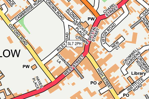
SL7 2PH is located in the Marlow electoral ward, within the unitary authority of Buckinghamshire and the English Parliamentary constituency of Beaconsfield. The Sub Integrated Care Board (ICB) Location is NHS Buckinghamshire, Oxfordshire and Berkshire West ICB - 14Y and the police force is Thames Valley. This postcode has been in use since September 2013.


GetTheData
Source: OS OpenMap – Local (Ordnance Survey)
Source: OS VectorMap District (Ordnance Survey)
Licence: Open Government Licence (requires attribution)
| Easting | 484814 |
| Northing | 186609 |
| Latitude | 51.571981 |
| Longitude | -0.777601 |
GetTheData
Source: Open Postcode Geo
Licence: Open Government Licence
| Country | England |
| Postcode District | SL7 |
➜ See where SL7 is on a map ➜ Where is Marlow? | |
GetTheData
Source: Land Registry Price Paid Data
Licence: Open Government Licence
Elevation or altitude of SL7 2PH as distance above sea level:
| Metres | Feet | |
|---|---|---|
| Elevation | 30m | 98ft |
Elevation is measured from the approximate centre of the postcode, to the nearest point on an OS contour line from OS Terrain 50, which has contour spacing of ten vertical metres.
➜ How high above sea level am I? Find the elevation of your current position using your device's GPS.
GetTheData
Source: Open Postcode Elevation
Licence: Open Government Licence
| Ward | Marlow |
| Constituency | Beaconsfield |
GetTheData
Source: ONS Postcode Database
Licence: Open Government Licence
| High Street | Marlow | 149m |
| West Street (Oxford Road) | Marlow | 154m |
| High Street | Marlow | 171m |
| West Street | Marlow | 204m |
| Spittal Street | Marlow | 205m |
| Marlow Station | 0.8km |
| Cookham Station | 4.2km |
| Bourne End Station | 4.7km |
GetTheData
Source: NaPTAN
Licence: Open Government Licence
GetTheData
Source: ONS Postcode Database
Licence: Open Government Licence


➜ Get more ratings from the Food Standards Agency
GetTheData
Source: Food Standards Agency
Licence: FSA terms & conditions
| Last Collection | |||
|---|---|---|---|
| Location | Mon-Fri | Sat | Distance |
| High Street | 17:45 | 12:15 | 167m |
| Trinity Road | 17:30 | 11:45 | 181m |
| Dean Street | 17:30 | 11:45 | 330m |
GetTheData
Source: Dracos
Licence: Creative Commons Attribution-ShareAlike
The below table lists the International Territorial Level (ITL) codes (formerly Nomenclature of Territorial Units for Statistics (NUTS) codes) and Local Administrative Units (LAU) codes for SL7 2PH:
| ITL 1 Code | Name |
|---|---|
| TLJ | South East (England) |
| ITL 2 Code | Name |
| TLJ1 | Berkshire, Buckinghamshire and Oxfordshire |
| ITL 3 Code | Name |
| TLJ13 | Buckinghamshire |
| LAU 1 Code | Name |
| E06000060 | Buckinghamshire |
GetTheData
Source: ONS Postcode Directory
Licence: Open Government Licence
The below table lists the Census Output Area (OA), Lower Layer Super Output Area (LSOA), and Middle Layer Super Output Area (MSOA) for SL7 2PH:
| Code | Name | |
|---|---|---|
| OA | E00090264 | |
| LSOA | E01017893 | Wycombe 022E |
| MSOA | E02003717 | Wycombe 022 |
GetTheData
Source: ONS Postcode Directory
Licence: Open Government Licence
| SL7 1BE | Market Square | 46m |
| SL7 1DA | Market Square | 60m |
| SL7 3HL | Crown Place | 64m |
| SL7 1AR | High Street | 71m |
| SL7 2NB | West Street | 84m |
| SL7 2LY | Potts Place | 85m |
| SL7 2QH | Dukes Place | 91m |
| SL7 1DB | Spittal Street | 102m |
| SL7 2LS | West Street | 118m |
| SL7 1AW | High Street | 133m |
GetTheData
Source: Open Postcode Geo; Land Registry Price Paid Data
Licence: Open Government Licence