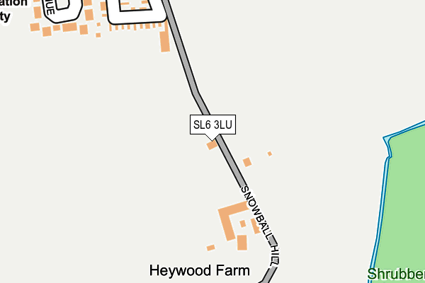
SL6 3LU lies on Heywood Villas in Maidenhead. SL6 3LU is located in the Hurley & Walthams electoral ward, within the unitary authority of Windsor and Maidenhead and the English Parliamentary constituency of Maidenhead. The Sub Integrated Care Board (ICB) Location is NHS Frimley ICB - D4U1Y and the police force is Thames Valley. This postcode has been in use since January 1980.


GetTheData
Source: OS OpenMap – Local (Ordnance Survey)
Source: OS VectorMap District (Ordnance Survey)
Licence: Open Government Licence (requires attribution)
| Easting | 486402 |
| Northing | 178342 |
| Latitude | 51.497428 |
| Longitude | -0.756702 |
GetTheData
Source: Open Postcode Geo
Licence: Open Government Licence
| Street | Heywood Villas |
| Town/City | Maidenhead |
| Country | England |
| Postcode District | SL6 |
➜ See where SL6 is on a map ➜ Where is Maidenhead? | |
GetTheData
Source: Land Registry Price Paid Data
Licence: Open Government Licence
Elevation or altitude of SL6 3LU as distance above sea level:
| Metres | Feet | |
|---|---|---|
| Elevation | 30m | 98ft |
Elevation is measured from the approximate centre of the postcode, to the nearest point on an OS contour line from OS Terrain 50, which has contour spacing of ten vertical metres.
➜ How high above sea level am I? Find the elevation of your current position using your device's GPS.
GetTheData
Source: Open Postcode Elevation
Licence: Open Government Licence
| Ward | Hurley & Walthams |
| Constituency | Maidenhead |
GetTheData
Source: ONS Postcode Database
Licence: Open Government Licence
| Sawyers Crescent | Woodlands Park | 281m |
| Foliejohn Way (Sawyers Crescent) | Woodlands Park | 491m |
| Woodlands Park Village Centre (Manifold Way) | White Waltham | 514m |
| Airfield (Waltham Road) | Woodlands Park | 554m |
| Airfield (Waltham Road) | Woodlands Park | 563m |
| Maidenhead Station | 3.3km |
| Furze Platt Station | 4.4km |
GetTheData
Source: NaPTAN
Licence: Open Government Licence
| Percentage of properties with Next Generation Access | 100.0% |
| Percentage of properties with Superfast Broadband | 100.0% |
| Percentage of properties with Ultrafast Broadband | 0.0% |
| Percentage of properties with Full Fibre Broadband | 0.0% |
Superfast Broadband is between 30Mbps and 300Mbps
Ultrafast Broadband is > 300Mbps
| Percentage of properties unable to receive 2Mbps | 0.0% |
| Percentage of properties unable to receive 5Mbps | 0.0% |
| Percentage of properties unable to receive 10Mbps | 0.0% |
| Percentage of properties unable to receive 30Mbps | 0.0% |
GetTheData
Source: Ofcom
Licence: Ofcom Terms of Use (requires attribution)
GetTheData
Source: ONS Postcode Database
Licence: Open Government Licence


➜ Get more ratings from the Food Standards Agency
GetTheData
Source: Food Standards Agency
Licence: FSA terms & conditions
| Last Collection | |||
|---|---|---|---|
| Location | Mon-Fri | Sat | Distance |
| Woodlands Park Post Office | 16:15 | 11:30 | 715m |
| Lowbrooke Drive | 17:00 | 11:30 | 830m |
| Wessex Way | 17:00 | 11:45 | 1,374m |
GetTheData
Source: Dracos
Licence: Creative Commons Attribution-ShareAlike
The below table lists the International Territorial Level (ITL) codes (formerly Nomenclature of Territorial Units for Statistics (NUTS) codes) and Local Administrative Units (LAU) codes for SL6 3LU:
| ITL 1 Code | Name |
|---|---|
| TLJ | South East (England) |
| ITL 2 Code | Name |
| TLJ1 | Berkshire, Buckinghamshire and Oxfordshire |
| ITL 3 Code | Name |
| TLJ11 | Berkshire |
| LAU 1 Code | Name |
| E06000040 | Windsor and Maidenhead |
GetTheData
Source: ONS Postcode Directory
Licence: Open Government Licence
The below table lists the Census Output Area (OA), Lower Layer Super Output Area (LSOA), and Middle Layer Super Output Area (MSOA) for SL6 3LU:
| Code | Name | |
|---|---|---|
| OA | E00083714 | |
| LSOA | E01016580 | Windsor and Maidenhead 008F |
| MSOA | E02003428 | Windsor and Maidenhead 008 |
GetTheData
Source: ONS Postcode Directory
Licence: Open Government Licence
| SL6 3UA | Woodlands Business Park | 230m |
| SL6 3JA | Heywood Avenue | 236m |
| SL6 3NB | Heywood Court Close | 253m |
| SL6 3LL | Waltham Road | 275m |
| SL6 3XD | Phipps Close | 350m |
| SL6 3ND | Sawyers Crescent | 366m |
| SL6 3XY | Foliejohn Way | 402m |
| SL6 3XX | Foliejohn Way | 419m |
| SL6 3LS | Woodlands Park Avenue | 434m |
| SL6 3NE | Sawyers Close | 450m |
GetTheData
Source: Open Postcode Geo; Land Registry Price Paid Data
Licence: Open Government Licence