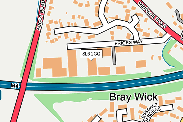
SL6 2GQ is located in the Bray electoral ward, within the unitary authority of Windsor and Maidenhead and the English Parliamentary constituency of Maidenhead. The Sub Integrated Care Board (ICB) Location is NHS Frimley ICB - D4U1Y and the police force is Thames Valley. This postcode has been in use since January 2008.


GetTheData
Source: OS OpenMap – Local (Ordnance Survey)
Source: OS VectorMap District (Ordnance Survey)
Licence: Open Government Licence (requires attribution)
| Easting | 489655 |
| Northing | 178683 |
| Latitude | 51.499988 |
| Longitude | -0.709767 |
GetTheData
Source: Open Postcode Geo
Licence: Open Government Licence
| Country | England |
| Postcode District | SL6 |
➜ See where SL6 is on a map ➜ Where is Maidenhead? | |
GetTheData
Source: Land Registry Price Paid Data
Licence: Open Government Licence
Elevation or altitude of SL6 2GQ as distance above sea level:
| Metres | Feet | |
|---|---|---|
| Elevation | 30m | 98ft |
Elevation is measured from the approximate centre of the postcode, to the nearest point on an OS contour line from OS Terrain 50, which has contour spacing of ten vertical metres.
➜ How high above sea level am I? Find the elevation of your current position using your device's GPS.
GetTheData
Source: Open Postcode Elevation
Licence: Open Government Licence
| Ward | Bray |
| Constituency | Maidenhead |
GetTheData
Source: ONS Postcode Database
Licence: Open Government Licence
| Cannon Hill Way (Windsor Road) | Bray Wick | 252m |
| Cannon Hill Way (Windsor Road) | Bray Wick | 286m |
| Earlsfield (Holyport Road) | Holyport | 363m |
| Earlsfield (Holyport Road) | Holyport | 389m |
| Hastings Close (Upper Bray Road) | Bray | 414m |
| Maidenhead Station | 2.3km |
| Taplow Station | 3.3km |
| Furze Platt Station | 3.9km |
GetTheData
Source: NaPTAN
Licence: Open Government Licence
GetTheData
Source: ONS Postcode Database
Licence: Open Government Licence


➜ Get more ratings from the Food Standards Agency
GetTheData
Source: Food Standards Agency
Licence: FSA terms & conditions
| Last Collection | |||
|---|---|---|---|
| Location | Mon-Fri | Sat | Distance |
| Braywick Road | 17:30 | 11:30 | 769m |
| Ascot Road | 16:30 | 09:30 | 940m |
| Bray Village Post Office | 17:30 | 11:30 | 959m |
GetTheData
Source: Dracos
Licence: Creative Commons Attribution-ShareAlike
The below table lists the International Territorial Level (ITL) codes (formerly Nomenclature of Territorial Units for Statistics (NUTS) codes) and Local Administrative Units (LAU) codes for SL6 2GQ:
| ITL 1 Code | Name |
|---|---|
| TLJ | South East (England) |
| ITL 2 Code | Name |
| TLJ1 | Berkshire, Buckinghamshire and Oxfordshire |
| ITL 3 Code | Name |
| TLJ11 | Berkshire |
| LAU 1 Code | Name |
| E06000040 | Windsor and Maidenhead |
GetTheData
Source: ONS Postcode Directory
Licence: Open Government Licence
The below table lists the Census Output Area (OA), Lower Layer Super Output Area (LSOA), and Middle Layer Super Output Area (MSOA) for SL6 2GQ:
| Code | Name | |
|---|---|---|
| OA | E00083505 | |
| LSOA | E01016541 | Windsor and Maidenhead 009C |
| MSOA | E02003429 | Windsor and Maidenhead 009 |
GetTheData
Source: ONS Postcode Directory
Licence: Open Government Licence
| SL6 2EL | Priors Way | 110m |
| SL6 2EN | Priors Way | 186m |
| SL6 2HQ | Aysgarth Park | 212m |
| SL6 2UF | Heathcote | 212m |
| SL6 2EP | Windsor Road | 237m |
| SL6 2JX | Willow Drive | 239m |
| SL6 2ER | Priors Close | 287m |
| SL6 2HG | Aysgarth Park | 287m |
| SL6 2HE | Eskdale Gardens | 294m |
| SL6 2HT | Ascot Road | 321m |
GetTheData
Source: Open Postcode Geo; Land Registry Price Paid Data
Licence: Open Government Licence