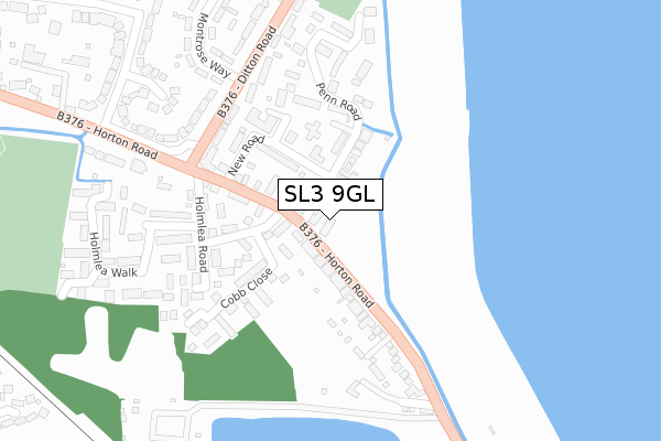
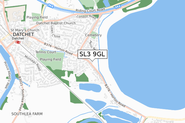
SL3 9GL is located in the Datchet, Horton & Wraysbury electoral ward, within the unitary authority of Windsor and Maidenhead and the English Parliamentary constituency of Windsor. The Sub Integrated Care Board (ICB) Location is NHS Frimley ICB - D4U1Y and the police force is Thames Valley. This postcode has been in use since March 2017.


GetTheData
Source: OS Open Zoomstack (Ordnance Survey)
Licence: Open Government Licence (requires attribution)
Attribution: Contains OS data © Crown copyright and database right 2024
Source: Open Postcode Geo
Licence: Open Government Licence (requires attribution)
Attribution: Contains OS data © Crown copyright and database right 2024; Contains Royal Mail data © Royal Mail copyright and database right 2024; Source: Office for National Statistics licensed under the Open Government Licence v.3.0
| Easting | 499580 |
| Northing | 177742 |
| Latitude | 51.489869 |
| Longitude | -0.567094 |
GetTheData
Source: Open Postcode Geo
Licence: Open Government Licence
| Country | England |
| Postcode District | SL3 |
| ➜ SL3 open data dashboard ➜ See where SL3 is on a map | |
GetTheData
Source: Land Registry Price Paid Data
Licence: Open Government Licence
| Ward | Datchet, Horton & Wraysbury |
| Constituency | Windsor |
GetTheData
Source: ONS Postcode Database
Licence: Open Government Licence
| May 2022 | Violence and sexual offences | On or near London Road | 431m |
| May 2022 | Public order | On or near London Road | 431m |
| March 2022 | Vehicle crime | On or near M4 | 487m |
| ➜ Get more crime data in our Crime section | |||
GetTheData
Source: data.police.uk
Licence: Open Government Licence
| Majors Farm Road | Datchet | 394m |
| Majors Farm Road | Datchet | 405m |
| Montrose Avenue (London Road) | Datchet | 524m |
| Ditton Road Cemetery (Ditton Road) | Datchet | 638m |
| Montrose Avenue (London Road) | Datchet | 657m |
| Datchet Station | 1.1km |
| Sunnymeads Station | 2.2km |
| Langley (Berks) Station | 2.7km |
GetTheData
Source: NaPTAN
Licence: Open Government Licence
GetTheData
Source: ONS Postcode Database
Licence: Open Government Licence


➜ Get more ratings from the Food Standards Agency
GetTheData
Source: Food Standards Agency
Licence: FSA terms & conditions
| Last Collection | |||
|---|---|---|---|
| Location | Mon-Fri | Sat | Distance |
| Montrose Avenue | 17:30 | 11:00 | 564m |
| Leigh Park | 17:30 | 11:00 | 811m |
| Datchet Common | 17:45 | 11:15 | 941m |
GetTheData
Source: Dracos
Licence: Creative Commons Attribution-ShareAlike
| Facility | Distance |
|---|---|
| Ca Sports Centre Riding Court Road, Datchet, Slough Health and Fitness Gym, Grass Pitches, Outdoor Tennis Courts | 66m |
| Wally Gage Memorial Ground Riding Court Road, Datchet, Slough Grass Pitches | 748m |
| Slough Cricket Club Upton Court Road, Slough Grass Pitches | 845m |
GetTheData
Source: Active Places
Licence: Open Government Licence
| School | Phase of Education | Distance |
|---|---|---|
| Castleview Primary School Woodstock Avenue, Slough, SL3 7LJ | Primary | 901m |
| Ditton Park Academy Kings Reach, Slough, SL3 7UX | Secondary | 949m |
| Churchmead Church of England (VA) School Priory Way, Datchet, Slough, SL3 9JQ | Secondary | 994m |
GetTheData
Source: Edubase
Licence: Open Government Licence
| Risk of SL3 9GL flooding from rivers and sea | Low |
| ➜ SL3 9GL flood map | |
GetTheData
Source: Open Flood Risk by Postcode
Licence: Open Government Licence
The below table lists the International Territorial Level (ITL) codes (formerly Nomenclature of Territorial Units for Statistics (NUTS) codes) and Local Administrative Units (LAU) codes for SL3 9GL:
| ITL 1 Code | Name |
|---|---|
| TLJ | South East (England) |
| ITL 2 Code | Name |
| TLJ1 | Berkshire, Buckinghamshire and Oxfordshire |
| ITL 3 Code | Name |
| TLJ11 | Berkshire |
| LAU 1 Code | Name |
| E06000040 | Windsor and Maidenhead |
GetTheData
Source: ONS Postcode Directory
Licence: Open Government Licence
The below table lists the Census Output Area (OA), Lower Layer Super Output Area (LSOA), and Middle Layer Super Output Area (MSOA) for SL3 9GL:
| Code | Name | |
|---|---|---|
| OA | E00083629 | |
| LSOA | E01016564 | Windsor and Maidenhead 011A |
| MSOA | E02003431 | Windsor and Maidenhead 011 |
GetTheData
Source: ONS Postcode Directory
Licence: Open Government Licence
| SL3 9LH | London Road | 447m |
| SL3 9JT | Riding Court Road | 475m |
| SL3 9LQ | London Road | 476m |
| SL3 9NQ | Fairfield Avenue | 541m |
| SL3 9NG | Fairfield Close | 544m |
| SL3 9NF | Fairfield Avenue | 583m |
| SL3 9LR | Ditton Road | 593m |
| SL3 9JY | London Road | 599m |
| SL3 9NH | Montrose Avenue | 599m |
| SL3 9LJ | Ditton Road | 604m |
GetTheData
Source: Open Postcode Geo; Land Registry Price Paid Data
Licence: Open Government Licence