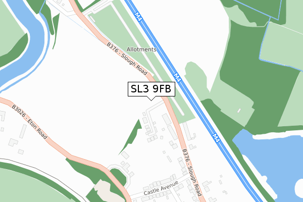
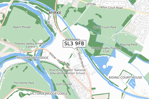
SL3 9FB is located in the Datchet, Horton & Wraysbury electoral ward, within the unitary authority of Windsor and Maidenhead and the English Parliamentary constituency of Windsor. The Sub Integrated Care Board (ICB) Location is NHS Frimley ICB - D4U1Y and the police force is Thames Valley. This postcode has been in use since November 2019.


GetTheData
Source: OS Open Zoomstack (Ordnance Survey)
Licence: Open Government Licence (requires attribution)
Attribution: Contains OS data © Crown copyright and database right 2024
Source: Open Postcode Geo
Licence: Open Government Licence (requires attribution)
Attribution: Contains OS data © Crown copyright and database right 2024; Contains Royal Mail data © Royal Mail copyright and database right 2024; Source: Office for National Statistics licensed under the Open Government Licence v.3.0
| Easting | 498255 |
| Northing | 178205 |
| Latitude | 51.494262 |
| Longitude | -0.586044 |
GetTheData
Source: Open Postcode Geo
Licence: Open Government Licence
| Country | England |
| Postcode District | SL3 |
| ➜ SL3 open data dashboard ➜ See where SL3 is on a map ➜ Where is Datchet? | |
GetTheData
Source: Land Registry Price Paid Data
Licence: Open Government Licence
| Ward | Datchet, Horton & Wraysbury |
| Constituency | Windsor |
GetTheData
Source: ONS Postcode Database
Licence: Open Government Licence
| June 2022 | Criminal damage and arson | On or near Datchet Road | 467m |
| June 2022 | Public order | On or near Datchet Road | 467m |
| May 2022 | Violence and sexual offences | On or near Datchet Road | 467m |
| ➜ Get more crime data in our Crime section | |||
GetTheData
Source: data.police.uk
Licence: Open Government Licence
| Slough Road | Datchet | 63m |
| The Myrke (Datchet Road) | Upton | 461m |
| Whites Lane (Slough Road) | Datchet | 475m |
| Whites Lane (Slough Road) | Datchet | 483m |
| The Myrke (Datchet Road) | Upton | 539m |
| Datchet Station | 1.3km |
| Windsor & Eton Riverside Station | 1.7km |
| Slough Station | 2km |
GetTheData
Source: NaPTAN
Licence: Open Government Licence
GetTheData
Source: ONS Postcode Database
Licence: Open Government Licence


➜ Get more ratings from the Food Standards Agency
GetTheData
Source: Food Standards Agency
Licence: FSA terms & conditions
| Last Collection | |||
|---|---|---|---|
| Location | Mon-Fri | Sat | Distance |
| Slough Road Datchet | 16:00 | 11:30 | 832m |
| Albert Street | 17:45 | 13:00 | 1,130m |
| Leigh Park | 17:30 | 11:00 | 1,258m |
GetTheData
Source: Dracos
Licence: Creative Commons Attribution-ShareAlike
| Facility | Distance |
|---|---|
| Slough Rugby Club Upton Court Park, Slough Grass Pitches | 664m |
| Thames Valley Athletics Centre Wallace Walk, Pococks Lane, Eton, Windsor Sports Hall, Athletics, Health and Fitness Gym, Studio, Squash Courts | 705m |
| Upton Court Park Upton Court Road, Slough Grass Pitches | 783m |
GetTheData
Source: Active Places
Licence: Open Government Licence
| School | Phase of Education | Distance |
|---|---|---|
| Eton End School Trust (Datchet) Limited 35 Eton Road, Datchet, Datchet, Slough, SL3 9AX | Not applicable | 439m |
| Long Close School Upton Court Road, Upton, Slough, SL3 7LU | Not applicable | 825m |
| Churchmead Church of England (VA) School Priory Way, Datchet, Slough, SL3 9JQ | Secondary | 1km |
GetTheData
Source: Edubase
Licence: Open Government Licence
| Risk of SL3 9FB flooding from rivers and sea | Very Low |
| ➜ SL3 9FB flood map | |
GetTheData
Source: Open Flood Risk by Postcode
Licence: Open Government Licence
The below table lists the International Territorial Level (ITL) codes (formerly Nomenclature of Territorial Units for Statistics (NUTS) codes) and Local Administrative Units (LAU) codes for SL3 9FB:
| ITL 1 Code | Name |
|---|---|
| TLJ | South East (England) |
| ITL 2 Code | Name |
| TLJ1 | Berkshire, Buckinghamshire and Oxfordshire |
| ITL 3 Code | Name |
| TLJ11 | Berkshire |
| LAU 1 Code | Name |
| E06000040 | Windsor and Maidenhead |
GetTheData
Source: ONS Postcode Directory
Licence: Open Government Licence
The below table lists the Census Output Area (OA), Lower Layer Super Output Area (LSOA), and Middle Layer Super Output Area (MSOA) for SL3 9FB:
| Code | Name | |
|---|---|---|
| OA | E00083642 | |
| LSOA | E01016565 | Windsor and Maidenhead 011B |
| MSOA | E02003431 | Windsor and Maidenhead 011 |
GetTheData
Source: ONS Postcode Directory
Licence: Open Government Licence
| SL3 9AE | Slough Road | 145m |
| SL3 9AF | Slough Road | 159m |
| SL3 9BA | Castle Avenue | 273m |
| SL3 9AQ | Slough Road | 382m |
| SL3 9AG | Slough Road | 383m |
| SL3 9AH | Agars Place | 400m |
| SL3 9AN | Whites Lane | 508m |
| SL3 9AA | Ellesmere Close | 511m |
| SL3 9AY | Eton Road | 513m |
| SL3 9AD | The Myrke | 522m |
GetTheData
Source: Open Postcode Geo; Land Registry Price Paid Data
Licence: Open Government Licence