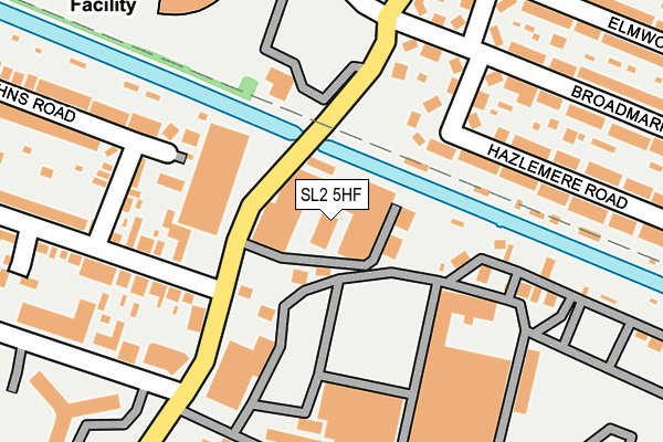
SL2 5HF lies on Business Village in Slough. SL2 5HF is located in the Upton Lea electoral ward, within the unitary authority of Slough and the English Parliamentary constituency of Slough. The Sub Integrated Care Board (ICB) Location is NHS Frimley ICB - D4U1Y and the police force is Thames Valley. This postcode has been in use since March 1988.


GetTheData
Source: OS OpenMap – Local (Ordnance Survey)
Source: OS VectorMap District (Ordnance Survey)
Licence: Open Government Licence (requires attribution)
| Easting | 498631 |
| Northing | 180426 |
| Latitude | 51.514159 |
| Longitude | -0.580026 |
GetTheData
Source: Open Postcode Geo
Licence: Open Government Licence
| Street | Business Village |
| Town/City | Slough |
| Country | England |
| Postcode District | SL2 |
➜ See where SL2 is on a map ➜ Where is Slough? | |
GetTheData
Source: Land Registry Price Paid Data
Licence: Open Government Licence
Elevation or altitude of SL2 5HF as distance above sea level:
| Metres | Feet | |
|---|---|---|
| Elevation | 30m | 98ft |
Elevation is measured from the approximate centre of the postcode, to the nearest point on an OS contour line from OS Terrain 50, which has contour spacing of ten vertical metres.
➜ How high above sea level am I? Find the elevation of your current position using your device's GPS.
GetTheData
Source: Open Postcode Elevation
Licence: Open Government Licence
| Ward | Upton Lea |
| Constituency | Slough |
GetTheData
Source: ONS Postcode Database
Licence: Open Government Licence
4, BUSINESS VILLAGE, SLOUGH, SL2 5HF 2003 28 NOV £210,000 |
4, BUSINESS VILLAGE, SLOUGH, SL2 5HF 1996 16 DEC £160,000 |
GetTheData
Source: HM Land Registry Price Paid Data
Licence: Contains HM Land Registry data © Crown copyright and database right 2025. This data is licensed under the Open Government Licence v3.0.
| St Pauls Avenue (Wexham Road) | Upton Lea | 99m |
| St Pauls Avenue (Wexham Road) | Upton Lea | 145m |
| Lea School (Wexham Road) | Upton Lea | 154m |
| Carlton Road (Broadmark Road) | Upton Lea | 209m |
| Carlton Road (Broadmark Road) | Upton Lea | 217m |
| Slough Station | 0.8km |
| Langley (Berks) Station | 2.7km |
| Datchet Station | 3.5km |
GetTheData
Source: NaPTAN
Licence: Open Government Licence
| Median download speed | 80.0Mbps |
| Average download speed | 58.0Mbps |
| Maximum download speed | 80.00Mbps |
| Median upload speed | 20.0Mbps |
| Average upload speed | 13.7Mbps |
| Maximum upload speed | 20.00Mbps |
GetTheData
Source: Ofcom
Licence: Ofcom Terms of Use (requires attribution)
Estimated total energy consumption in SL2 5HF by fuel type, 2015.
| Consumption (kWh) | 301,836 |
|---|---|
| Meter count | 20 |
| Mean (kWh/meter) | 15,092 |
| Median (kWh/meter) | 8,508 |
GetTheData
Source: Postcode level gas estimates: 2015 (experimental)
Source: Postcode level electricity estimates: 2015 (experimental)
Licence: Open Government Licence
GetTheData
Source: ONS Postcode Database
Licence: Open Government Licence

➜ Get more ratings from the Food Standards Agency
GetTheData
Source: Food Standards Agency
Licence: FSA terms & conditions
| Last Collection | |||
|---|---|---|---|
| Location | Mon-Fri | Sat | Distance |
| Business Village Wexham Road | 18:45 | 10:30 | 84m |
| Petersfield Avenue | 18:30 | 10:30 | 399m |
| Broadmark Road | 18:45 | 10:45 | 422m |
GetTheData
Source: Dracos
Licence: Creative Commons Attribution-ShareAlike
The below table lists the International Territorial Level (ITL) codes (formerly Nomenclature of Territorial Units for Statistics (NUTS) codes) and Local Administrative Units (LAU) codes for SL2 5HF:
| ITL 1 Code | Name |
|---|---|
| TLJ | South East (England) |
| ITL 2 Code | Name |
| TLJ1 | Berkshire, Buckinghamshire and Oxfordshire |
| ITL 3 Code | Name |
| TLJ11 | Berkshire |
| LAU 1 Code | Name |
| E06000039 | Slough |
GetTheData
Source: ONS Postcode Directory
Licence: Open Government Licence
The below table lists the Census Output Area (OA), Lower Layer Super Output Area (LSOA), and Middle Layer Super Output Area (MSOA) for SL2 5HF:
| Code | Name | |
|---|---|---|
| OA | E00166682 | |
| LSOA | E01016461 | Slough 007F |
| MSOA | E02003413 | Slough 007 |
GetTheData
Source: ONS Postcode Directory
Licence: Open Government Licence
| SL2 5EJ | Wexham Road | 100m |
| SL2 5HA | St Johns Road | 177m |
| SL2 5PT | Broadmark Road | 180m |
| SL2 5JW | Wexham Road | 234m |
| SL2 5PS | Broadmark Road | 238m |
| SL2 5PW | Hazlemere Road | 241m |
| SL2 5PU | Carlton Road | 246m |
| SL2 5PP | Hazlemere Road | 248m |
| SL2 5QB | Carlton Road | 253m |
| SL2 5QD | Broadmark Road | 256m |
GetTheData
Source: Open Postcode Geo; Land Registry Price Paid Data
Licence: Open Government Licence