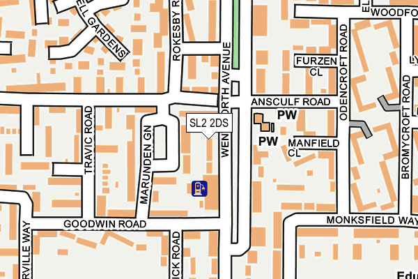
SL2 2DS is located in the Britwell electoral ward, within the unitary authority of Slough and the English Parliamentary constituency of Slough. The Sub Integrated Care Board (ICB) Location is NHS Frimley ICB - D4U1Y and the police force is Thames Valley. This postcode has been in use since January 1980.


GetTheData
Source: OS OpenMap – Local (Ordnance Survey)
Source: OS VectorMap District (Ordnance Survey)
Licence: Open Government Licence (requires attribution)
| Easting | 495038 |
| Northing | 182692 |
| Latitude | 51.535146 |
| Longitude | -0.631160 |
GetTheData
Source: Open Postcode Geo
Licence: Open Government Licence
| Country | England |
| Postcode District | SL2 |
➜ See where SL2 is on a map ➜ Where is Slough? | |
GetTheData
Source: Land Registry Price Paid Data
Licence: Open Government Licence
Elevation or altitude of SL2 2DS as distance above sea level:
| Metres | Feet | |
|---|---|---|
| Elevation | 40m | 131ft |
Elevation is measured from the approximate centre of the postcode, to the nearest point on an OS contour line from OS Terrain 50, which has contour spacing of ten vertical metres.
➜ How high above sea level am I? Find the elevation of your current position using your device's GPS.
GetTheData
Source: Open Postcode Elevation
Licence: Open Government Licence
| Ward | Britwell |
| Constituency | Slough |
GetTheData
Source: ONS Postcode Database
Licence: Open Government Licence
| The Britwell Centre (Wentworth Avenue) | Britwell | 96m |
| Rokesby Road (Wentworth Avenue) | Britwell | 100m |
| Kidderminster Road (Doddsfield Road) | Britwell | 246m |
| Wentworth Avenue | Britwell | 249m |
| Kidderminster Road (Doddsfield Road) | Britwell | 283m |
| Burnham (Berks) Station | 1.7km |
| Taplow Station | 3.7km |
| Slough Station | 3.8km |
GetTheData
Source: NaPTAN
Licence: Open Government Licence
| Percentage of properties with Next Generation Access | 100.0% |
| Percentage of properties with Superfast Broadband | 100.0% |
| Percentage of properties with Ultrafast Broadband | 46.7% |
| Percentage of properties with Full Fibre Broadband | 0.0% |
Superfast Broadband is between 30Mbps and 300Mbps
Ultrafast Broadband is > 300Mbps
| Median download speed | 60.0Mbps |
| Average download speed | 70.2Mbps |
| Maximum download speed | 200.00Mbps |
| Median upload speed | 7.0Mbps |
| Average upload speed | 7.2Mbps |
| Maximum upload speed | 17.43Mbps |
| Percentage of properties unable to receive 2Mbps | 0.0% |
| Percentage of properties unable to receive 5Mbps | 0.0% |
| Percentage of properties unable to receive 10Mbps | 0.0% |
| Percentage of properties unable to receive 30Mbps | 0.0% |
GetTheData
Source: Ofcom
Licence: Ofcom Terms of Use (requires attribution)
GetTheData
Source: ONS Postcode Database
Licence: Open Government Licence


➜ Get more ratings from the Food Standards Agency
GetTheData
Source: Food Standards Agency
Licence: FSA terms & conditions
| Last Collection | |||
|---|---|---|---|
| Location | Mon-Fri | Sat | Distance |
| Wentworth Avenue | 17:00 | 12:15 | 65m |
| Monksfield Way | 18:15 | 10:30 | 509m |
| Gaveston Road | 18:30 | 10:30 | 513m |
GetTheData
Source: Dracos
Licence: Creative Commons Attribution-ShareAlike
The below table lists the International Territorial Level (ITL) codes (formerly Nomenclature of Territorial Units for Statistics (NUTS) codes) and Local Administrative Units (LAU) codes for SL2 2DS:
| ITL 1 Code | Name |
|---|---|
| TLJ | South East (England) |
| ITL 2 Code | Name |
| TLJ1 | Berkshire, Buckinghamshire and Oxfordshire |
| ITL 3 Code | Name |
| TLJ11 | Berkshire |
| LAU 1 Code | Name |
| E06000039 | Slough |
GetTheData
Source: ONS Postcode Directory
Licence: Open Government Licence
The below table lists the Census Output Area (OA), Lower Layer Super Output Area (LSOA), and Middle Layer Super Output Area (MSOA) for SL2 2DS:
| Code | Name | |
|---|---|---|
| OA | E00083094 | |
| LSOA | E01016451 | Slough 001B |
| MSOA | E02003407 | Slough 001 |
GetTheData
Source: ONS Postcode Directory
Licence: Open Government Licence
| SL2 2FD | Oakcroft | 22m |
| SL2 2DX | Rokesby Road | 86m |
| SL2 2DF | Ansculf Road | 114m |
| SL2 2ED | Rokesby Road | 115m |
| SL2 2DU | Marunden Green | 117m |
| SL2 2DG | Wentworth Avenue | 129m |
| SL2 2DH | Wentworth Avenue | 133m |
| SL2 2ES | Goodwin Road | 136m |
| SL2 2BT | Manfield Close | 139m |
| SL2 2BX | Furzen Close | 162m |
GetTheData
Source: Open Postcode Geo; Land Registry Price Paid Data
Licence: Open Government Licence