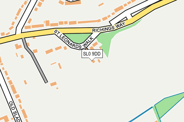
SL0 9DD lies on St Leonards Walk in Iver. SL0 9DD is located in the Iver electoral ward, within the unitary authority of Buckinghamshire and the English Parliamentary constituency of Beaconsfield. The Sub Integrated Care Board (ICB) Location is NHS Buckinghamshire, Oxfordshire and Berkshire West ICB - 14Y and the police force is Thames Valley. This postcode has been in use since January 1980.


GetTheData
Source: OS OpenMap – Local (Ordnance Survey)
Source: OS VectorMap District (Ordnance Survey)
Licence: Open Government Licence (requires attribution)
| Easting | 503746 |
| Northing | 179172 |
| Latitude | 51.501974 |
| Longitude | -0.506689 |
GetTheData
Source: Open Postcode Geo
Licence: Open Government Licence
| Street | St Leonards Walk |
| Town/City | Iver |
| Country | England |
| Postcode District | SL0 |
➜ See where SL0 is on a map ➜ Where is Richings Park? | |
GetTheData
Source: Land Registry Price Paid Data
Licence: Open Government Licence
Elevation or altitude of SL0 9DD as distance above sea level:
| Metres | Feet | |
|---|---|---|
| Elevation | 30m | 98ft |
Elevation is measured from the approximate centre of the postcode, to the nearest point on an OS contour line from OS Terrain 50, which has contour spacing of ten vertical metres.
➜ How high above sea level am I? Find the elevation of your current position using your device's GPS.
GetTheData
Source: Open Postcode Elevation
Licence: Open Government Licence
| Ward | Iver |
| Constituency | Beaconsfield |
GetTheData
Source: ONS Postcode Database
Licence: Open Government Licence
| Richings Park (Thorney Lane South) | Richings Park | 653m |
| Richings Park (Thorney Lane South) | Richings Park | 673m |
| North Park | Richings Park | 1,383m |
| Sutton Lane North (Sutton Lane) | Langley | 1,472m |
| Sutton Lane North (Sutton Lane) | Langley | 1,483m |
| Iver Station | 0.7km |
| Langley (Berks) Station | 2.5km |
| West Drayton Station | 2.6km |
GetTheData
Source: NaPTAN
Licence: Open Government Licence
| Percentage of properties with Next Generation Access | 100.0% |
| Percentage of properties with Superfast Broadband | 100.0% |
| Percentage of properties with Ultrafast Broadband | 0.0% |
| Percentage of properties with Full Fibre Broadband | 0.0% |
Superfast Broadband is between 30Mbps and 300Mbps
Ultrafast Broadband is > 300Mbps
| Percentage of properties unable to receive 2Mbps | 0.0% |
| Percentage of properties unable to receive 5Mbps | 0.0% |
| Percentage of properties unable to receive 10Mbps | 0.0% |
| Percentage of properties unable to receive 30Mbps | 0.0% |
GetTheData
Source: Ofcom
Licence: Ofcom Terms of Use (requires attribution)
GetTheData
Source: ONS Postcode Database
Licence: Open Government Licence


➜ Get more ratings from the Food Standards Agency
GetTheData
Source: Food Standards Agency
Licence: FSA terms & conditions
| Last Collection | |||
|---|---|---|---|
| Location | Mon-Fri | Sat | Distance |
| Iver Post Office | 17:30 | 12:15 | 621m |
| Bathurst Walk | 18:30 | 12:30 | 671m |
| Mill Road | 18:00 | 12:30 | 1,781m |
GetTheData
Source: Dracos
Licence: Creative Commons Attribution-ShareAlike
The below table lists the International Territorial Level (ITL) codes (formerly Nomenclature of Territorial Units for Statistics (NUTS) codes) and Local Administrative Units (LAU) codes for SL0 9DD:
| ITL 1 Code | Name |
|---|---|
| TLJ | South East (England) |
| ITL 2 Code | Name |
| TLJ1 | Berkshire, Buckinghamshire and Oxfordshire |
| ITL 3 Code | Name |
| TLJ13 | Buckinghamshire |
| LAU 1 Code | Name |
| E06000060 | Buckinghamshire |
GetTheData
Source: ONS Postcode Directory
Licence: Open Government Licence
The below table lists the Census Output Area (OA), Lower Layer Super Output Area (LSOA), and Middle Layer Super Output Area (MSOA) for SL0 9DD:
| Code | Name | |
|---|---|---|
| OA | E00089961 | |
| LSOA | E01017829 | South Bucks 008F |
| MSOA | E02003695 | South Bucks 008 |
GetTheData
Source: ONS Postcode Directory
Licence: Open Government Licence
| SL0 9DE | Richings Way | 142m |
| SL0 9DB | Richings Way | 163m |
| SL0 9BQ | Apsley Walk | 221m |
| SL0 9DA | Richings Way | 266m |
| SL0 9DR | Old Slade Lane | 279m |
| SL0 9DS | The Poynings | 286m |
| SL0 9DF | Richings Way | 303m |
| SL0 9DT | The Poynings | 320m |
| SL0 9BN | Wellesley Avenue | 328m |
| SL0 9DY | Old Slade Lane | 348m |
GetTheData
Source: Open Postcode Geo; Land Registry Price Paid Data
Licence: Open Government Licence