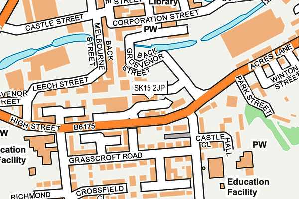
SK15 2JP is located in the Dukinfield Stalybridge electoral ward, within the metropolitan district of Tameside and the English Parliamentary constituency of Stalybridge and Hyde. The Sub Integrated Care Board (ICB) Location is NHS Greater Manchester ICB - 01Y and the police force is Greater Manchester. This postcode has been in use since June 1981.


GetTheData
Source: OS OpenMap – Local (Ordnance Survey)
Source: OS VectorMap District (Ordnance Survey)
Licence: Open Government Licence (requires attribution)
| Easting | 396360 |
| Northing | 398291 |
| Latitude | 53.481344 |
| Longitude | -2.056317 |
GetTheData
Source: Open Postcode Geo
Licence: Open Government Licence
| Country | England |
| Postcode District | SK15 |
➜ See where SK15 is on a map ➜ Where is Stalybridge? | |
GetTheData
Source: Land Registry Price Paid Data
Licence: Open Government Licence
Elevation or altitude of SK15 2JP as distance above sea level:
| Metres | Feet | |
|---|---|---|
| Elevation | 120m | 394ft |
Elevation is measured from the approximate centre of the postcode, to the nearest point on an OS contour line from OS Terrain 50, which has contour spacing of ten vertical metres.
➜ How high above sea level am I? Find the elevation of your current position using your device's GPS.
GetTheData
Source: Open Postcode Elevation
Licence: Open Government Licence
| Ward | Dukinfield Stalybridge |
| Constituency | Stalybridge And Hyde |
GetTheData
Source: ONS Postcode Database
Licence: Open Government Licence
| Armentieres Square (Armentieres Sq.) | Stalybridge | 72m |
| Armentieres Square (Armentieres Sq.) | Stalybridge | 79m |
| High St/The Pineapple (High St) | Stalybridge | 99m |
| Armentieres Square (Armentieres Sq.) | Stalybridge | 130m |
| Armentieres Square (Armentieres Sq.) | Stalybridge | 130m |
| Stalybridge Station | 0.6km |
| Hyde North Station | 2.7km |
| Flowery Field Station | 2.7km |
GetTheData
Source: NaPTAN
Licence: Open Government Licence
GetTheData
Source: ONS Postcode Database
Licence: Open Government Licence


➜ Get more ratings from the Food Standards Agency
GetTheData
Source: Food Standards Agency
Licence: FSA terms & conditions
| Last Collection | |||
|---|---|---|---|
| Location | Mon-Fri | Sat | Distance |
| Trinity Street | 18:30 | 12:30 | 236m |
| Springbank | 17:00 | 11:30 | 332m |
| Market Street | 18:15 | 11:30 | 380m |
GetTheData
Source: Dracos
Licence: Creative Commons Attribution-ShareAlike
The below table lists the International Territorial Level (ITL) codes (formerly Nomenclature of Territorial Units for Statistics (NUTS) codes) and Local Administrative Units (LAU) codes for SK15 2JP:
| ITL 1 Code | Name |
|---|---|
| TLD | North West (England) |
| ITL 2 Code | Name |
| TLD3 | Greater Manchester |
| ITL 3 Code | Name |
| TLD35 | Greater Manchester South East |
| LAU 1 Code | Name |
| E08000008 | Tameside |
GetTheData
Source: ONS Postcode Directory
Licence: Open Government Licence
The below table lists the Census Output Area (OA), Lower Layer Super Output Area (LSOA), and Middle Layer Super Output Area (MSOA) for SK15 2JP:
| Code | Name | |
|---|---|---|
| OA | E00168640 | |
| LSOA | E01006022 | Tameside 015A |
| MSOA | E02001243 | Tameside 015 |
GetTheData
Source: ONS Postcode Directory
Licence: Open Government Licence
| SK15 2JN | Grosvenor Street | 41m |
| SK15 2EJ | South Walk | 85m |
| SK15 2JJ | Melbourne Street | 103m |
| SK15 2DZ | Castle Hall Court | 103m |
| SK15 2DF | Grasscroft Road | 107m |
| SK15 1RR | Grosvenor Street | 109m |
| SK15 2EG | Edge Walk | 130m |
| SK15 2BP | Rose Terrace | 141m |
| SK15 2JL | Corporation Street | 144m |
| SK15 1RW | Grosvenor House Square | 157m |
GetTheData
Source: Open Postcode Geo; Land Registry Price Paid Data
Licence: Open Government Licence