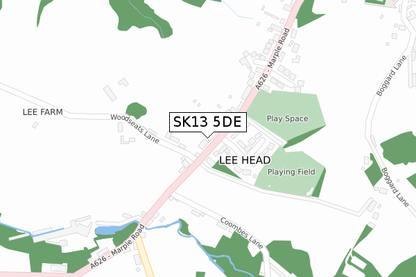
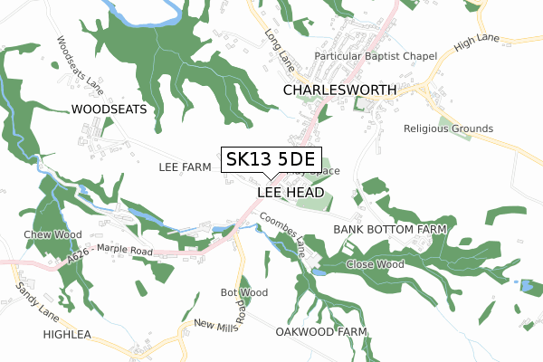
SK13 5DE lies on Marple Road in Charlesworth, Glossop. SK13 5DE is located in the St John's electoral ward, within the local authority district of High Peak and the English Parliamentary constituency of High Peak. The Sub Integrated Care Board (ICB) Location is NHS Derby and Derbyshire ICB - 15M and the police force is Derbyshire. This postcode has been in use since December 1997.


GetTheData
Source: OS Open Zoomstack (Ordnance Survey)
Licence: Open Government Licence (requires attribution)
Attribution: Contains OS data © Crown copyright and database right 2025
Source: Open Postcode Geo
Licence: Open Government Licence (requires attribution)
Attribution: Contains OS data © Crown copyright and database right 2025; Contains Royal Mail data © Royal Mail copyright and database right 2025; Source: Office for National Statistics licensed under the Open Government Licence v.3.0
| Easting | 400252 |
| Northing | 392496 |
| Latitude | 53.429252 |
| Longitude | -1.997673 |
GetTheData
Source: Open Postcode Geo
Licence: Open Government Licence
| Street | Marple Road |
| Locality | Charlesworth |
| Town/City | Glossop |
| Country | England |
| Postcode District | SK13 |
➜ See where SK13 is on a map ➜ Where is Lee Head? | |
GetTheData
Source: Land Registry Price Paid Data
Licence: Open Government Licence
Elevation or altitude of SK13 5DE as distance above sea level:
| Metres | Feet | |
|---|---|---|
| Elevation | 180m | 591ft |
Elevation is measured from the approximate centre of the postcode, to the nearest point on an OS contour line from OS Terrain 50, which has contour spacing of ten vertical metres.
➜ How high above sea level am I? Find the elevation of your current position using your device's GPS.
GetTheData
Source: Open Postcode Elevation
Licence: Open Government Licence
| Ward | St John's |
| Constituency | High Peak |
GetTheData
Source: ONS Postcode Database
Licence: Open Government Licence
| Lee Head (Marple Road) | Charlesworth | 15m |
| Lee Head (Marple Road) | Charlesworth | 105m |
| Holehouse (Marple Road) | Chisworth | 402m |
| Holehouse (Marple Road) | Chisworth | 435m |
| Long Lane | Charlesworth | 493m |
| Broadbottom Station | 1.8km |
| Dinting Station | 2.9km |
| Hattersley Station | 3.3km |
GetTheData
Source: NaPTAN
Licence: Open Government Licence
| Percentage of properties with Next Generation Access | 100.0% |
| Percentage of properties with Superfast Broadband | 100.0% |
| Percentage of properties with Ultrafast Broadband | 0.0% |
| Percentage of properties with Full Fibre Broadband | 0.0% |
Superfast Broadband is between 30Mbps and 300Mbps
Ultrafast Broadband is > 300Mbps
| Median download speed | 51.2Mbps |
| Average download speed | 48.0Mbps |
| Maximum download speed | 80.00Mbps |
| Median upload speed | 13.8Mbps |
| Average upload speed | 12.3Mbps |
| Maximum upload speed | 20.00Mbps |
| Percentage of properties unable to receive 2Mbps | 0.0% |
| Percentage of properties unable to receive 5Mbps | 0.0% |
| Percentage of properties unable to receive 10Mbps | 0.0% |
| Percentage of properties unable to receive 30Mbps | 0.0% |
GetTheData
Source: Ofcom
Licence: Ofcom Terms of Use (requires attribution)
Estimated total energy consumption in SK13 5DE by fuel type, 2015.
| Consumption (kWh) | 274,857 |
|---|---|
| Meter count | 17 |
| Mean (kWh/meter) | 16,168 |
| Median (kWh/meter) | 13,277 |
| Consumption (kWh) | 61,853 |
|---|---|
| Meter count | 14 |
| Mean (kWh/meter) | 4,418 |
| Median (kWh/meter) | 2,868 |
GetTheData
Source: Postcode level gas estimates: 2015 (experimental)
Source: Postcode level electricity estimates: 2015 (experimental)
Licence: Open Government Licence
GetTheData
Source: ONS Postcode Database
Licence: Open Government Licence


➜ Get more ratings from the Food Standards Agency
GetTheData
Source: Food Standards Agency
Licence: FSA terms & conditions
| Last Collection | |||
|---|---|---|---|
| Location | Mon-Fri | Sat | Distance |
| Glossop Road | 17:00 | 12:00 | 530m |
| Hunters Pub | 16:50 | 11:45 | 766m |
| Long Lane | 16:45 | 11:45 | 1,153m |
GetTheData
Source: Dracos
Licence: Creative Commons Attribution-ShareAlike
The below table lists the International Territorial Level (ITL) codes (formerly Nomenclature of Territorial Units for Statistics (NUTS) codes) and Local Administrative Units (LAU) codes for SK13 5DE:
| ITL 1 Code | Name |
|---|---|
| TLF | East Midlands (England) |
| ITL 2 Code | Name |
| TLF1 | Derbyshire and Nottinghamshire |
| ITL 3 Code | Name |
| TLF13 | South and West Derbyshire |
| LAU 1 Code | Name |
| E07000037 | High Peak |
GetTheData
Source: ONS Postcode Directory
Licence: Open Government Licence
The below table lists the Census Output Area (OA), Lower Layer Super Output Area (LSOA), and Middle Layer Super Output Area (MSOA) for SK13 5DE:
| Code | Name | |
|---|---|---|
| OA | E00099948 | |
| LSOA | E01019754 | High Peak 004C |
| MSOA | E02004096 | High Peak 004 |
GetTheData
Source: ONS Postcode Directory
Licence: Open Government Licence
| SK13 5DD | Lee Head | 96m |
| SK13 5DP | Woodseats Lane | 141m |
| SK13 5DG | Coombes Lane | 209m |
| SK13 5DA | Marple Road | 210m |
| SK13 5DF | Marple Road | 220m |
| SK13 5BZ | Tomwood Rise | 230m |
| SK13 5DW | Springfield | 254m |
| SK13 5DJ | New Mills Road | 334m |
| SK13 5HL | Boggard Lane | 443m |
| SK13 5DH | Marple Road | 473m |
GetTheData
Source: Open Postcode Geo; Land Registry Price Paid Data
Licence: Open Government Licence