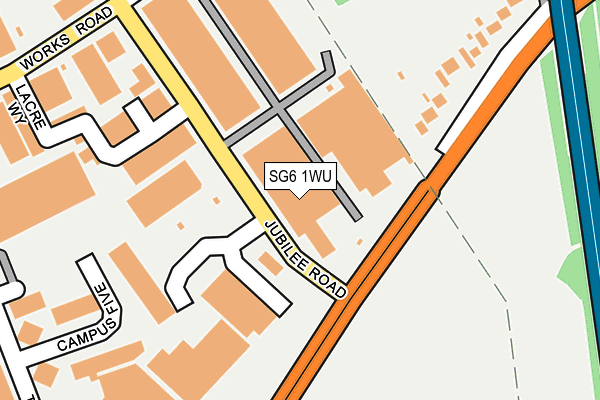
SG6 1WU is located in the Letchworth East electoral ward, within the local authority district of North Hertfordshire and the English Parliamentary constituency of North East Hertfordshire. The Sub Integrated Care Board (ICB) Location is NHS Hertfordshire and West Essex ICB - 06K and the police force is Hertfordshire. This postcode has been in use since June 2000.


GetTheData
Source: OS OpenMap – Local (Ordnance Survey)
Source: OS VectorMap District (Ordnance Survey)
Licence: Open Government Licence (requires attribution)
| Easting | 523621 |
| Northing | 233249 |
| Latitude | 51.983954 |
| Longitude | -0.201307 |
GetTheData
Source: Open Postcode Geo
Licence: Open Government Licence
| Country | England |
| Postcode District | SG6 |
➜ See where SG6 is on a map ➜ Where is Baldock? | |
GetTheData
Source: Land Registry Price Paid Data
Licence: Open Government Licence
Elevation or altitude of SG6 1WU as distance above sea level:
| Metres | Feet | |
|---|---|---|
| Elevation | 80m | 262ft |
Elevation is measured from the approximate centre of the postcode, to the nearest point on an OS contour line from OS Terrain 50, which has contour spacing of ten vertical metres.
➜ How high above sea level am I? Find the elevation of your current position using your device's GPS.
GetTheData
Source: Open Postcode Elevation
Licence: Open Government Licence
| Ward | Letchworth East |
| Constituency | North East Hertfordshire |
GetTheData
Source: ONS Postcode Database
Licence: Open Government Licence
| Jubilee Road (Baldock Road) | Letchworth | 83m |
| Jubilee Road (Baldock Road) | Letchworth | 147m |
| Hopewell Road (Letchworth Road) | Baldock | 359m |
| Sainsbury's (Third Avenue) | Letchworth | 361m |
| Hopewell Road (Letchworth Road) | Baldock | 408m |
| Baldock Station | 1.4km |
| Letchworth Station | 2km |
| Hitchin Station | 5.5km |
GetTheData
Source: NaPTAN
Licence: Open Government Licence
GetTheData
Source: ONS Postcode Database
Licence: Open Government Licence


➜ Get more ratings from the Food Standards Agency
GetTheData
Source: Food Standards Agency
Licence: FSA terms & conditions
| Last Collection | |||
|---|---|---|---|
| Location | Mon-Fri | Sat | Distance |
| Jubilee Road | 59m | ||
| Jubilee Road | 18:45 | 12:00 | 59m |
| Hopewell Road | 16:15 | 12:00 | 450m |
GetTheData
Source: Dracos
Licence: Creative Commons Attribution-ShareAlike
The below table lists the International Territorial Level (ITL) codes (formerly Nomenclature of Territorial Units for Statistics (NUTS) codes) and Local Administrative Units (LAU) codes for SG6 1WU:
| ITL 1 Code | Name |
|---|---|
| TLH | East |
| ITL 2 Code | Name |
| TLH2 | Bedfordshire and Hertfordshire |
| ITL 3 Code | Name |
| TLH23 | Hertfordshire CC |
| LAU 1 Code | Name |
| E07000099 | North Hertfordshire |
GetTheData
Source: ONS Postcode Directory
Licence: Open Government Licence
The below table lists the Census Output Area (OA), Lower Layer Super Output Area (LSOA), and Middle Layer Super Output Area (MSOA) for SG6 1WU:
| Code | Name | |
|---|---|---|
| OA | E00120008 | |
| LSOA | E01023633 | North Hertfordshire 006D |
| MSOA | E02004914 | North Hertfordshire 006 |
GetTheData
Source: ONS Postcode Directory
Licence: Open Government Licence
| SG6 1SP | Jubilee Trade Centre | 141m |
| SG6 1NP | Works Road | 247m |
| SG7 6AA | Letchworth Road | 259m |
| SG6 2JF | Campus 5 | 263m |
| SG7 6AW | Hadrian Way | 301m |
| SG6 1LD | Works Road | 383m |
| SG7 6HU | Hilltop | 451m |
| SG7 6HT | Chilvers Bank | 482m |
| SG7 6HS | Chilvers Bank | 506m |
| SG7 6AB | Letchworth Road | 507m |
GetTheData
Source: Open Postcode Geo; Land Registry Price Paid Data
Licence: Open Government Licence