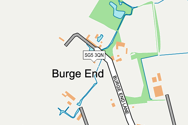
SG5 3QN lies on Burge End Lane in Pirton, Hitchin. SG5 3QN is located in the Hitchwood, Offa and Hoo electoral ward, within the local authority district of North Hertfordshire and the English Parliamentary constituency of Hitchin and Harpenden. The Sub Integrated Care Board (ICB) Location is NHS Hertfordshire and West Essex ICB - 06K and the police force is Hertfordshire. This postcode has been in use since January 1980.


GetTheData
Source: OS OpenMap – Local (Ordnance Survey)
Source: OS VectorMap District (Ordnance Survey)
Licence: Open Government Licence (requires attribution)
| Easting | 514364 |
| Northing | 232282 |
| Latitude | 51.977253 |
| Longitude | -0.336334 |
GetTheData
Source: Open Postcode Geo
Licence: Open Government Licence
| Street | Burge End Lane |
| Locality | Pirton |
| Town/City | Hitchin |
| Country | England |
| Postcode District | SG5 |
➜ See where SG5 is on a map ➜ Where is Burge End? | |
GetTheData
Source: Land Registry Price Paid Data
Licence: Open Government Licence
Elevation or altitude of SG5 3QN as distance above sea level:
| Metres | Feet | |
|---|---|---|
| Elevation | 60m | 197ft |
Elevation is measured from the approximate centre of the postcode, to the nearest point on an OS contour line from OS Terrain 50, which has contour spacing of ten vertical metres.
➜ How high above sea level am I? Find the elevation of your current position using your device's GPS.
GetTheData
Source: Open Postcode Elevation
Licence: Open Government Licence
| Ward | Hitchwood, Offa And Hoo |
| Constituency | Hitchin And Harpenden |
GetTheData
Source: ONS Postcode Database
Licence: Open Government Licence
| Danefield Road (Priors Hill) | Pirton | 630m |
| War Memorial (Crab Tree Lane) | Pirton | 634m |
| Post Office (High Street) | Pirton | 662m |
| Royal Oak Lane (Holwell Road) | Pirton | 700m |
| Royal Oak Lane (Holwell Road) | Pirton | 705m |
GetTheData
Source: NaPTAN
Licence: Open Government Licence
| Percentage of properties with Next Generation Access | 100.0% |
| Percentage of properties with Superfast Broadband | 100.0% |
| Percentage of properties with Ultrafast Broadband | 0.0% |
| Percentage of properties with Full Fibre Broadband | 0.0% |
Superfast Broadband is between 30Mbps and 300Mbps
Ultrafast Broadband is > 300Mbps
| Median download speed | 27.8Mbps |
| Average download speed | 27.4Mbps |
| Maximum download speed | 41.48Mbps |
| Median upload speed | 6.6Mbps |
| Average upload speed | 6.4Mbps |
| Maximum upload speed | 6.87Mbps |
| Percentage of properties unable to receive 2Mbps | 0.0% |
| Percentage of properties unable to receive 5Mbps | 0.0% |
| Percentage of properties unable to receive 10Mbps | 0.0% |
| Percentage of properties unable to receive 30Mbps | 0.0% |
GetTheData
Source: Ofcom
Licence: Ofcom Terms of Use (requires attribution)
GetTheData
Source: ONS Postcode Database
Licence: Open Government Licence


➜ Get more ratings from the Food Standards Agency
GetTheData
Source: Food Standards Agency
Licence: FSA terms & conditions
| Last Collection | |||
|---|---|---|---|
| Location | Mon-Fri | Sat | Distance |
| West Lane | 17:00 | 09:45 | 575m |
| Pirton | 17:00 | 09:45 | 672m |
| Pirton | 17:00 | 09:45 | 672m |
GetTheData
Source: Dracos
Licence: Creative Commons Attribution-ShareAlike
The below table lists the International Territorial Level (ITL) codes (formerly Nomenclature of Territorial Units for Statistics (NUTS) codes) and Local Administrative Units (LAU) codes for SG5 3QN:
| ITL 1 Code | Name |
|---|---|
| TLH | East |
| ITL 2 Code | Name |
| TLH2 | Bedfordshire and Hertfordshire |
| ITL 3 Code | Name |
| TLH23 | Hertfordshire CC |
| LAU 1 Code | Name |
| E07000099 | North Hertfordshire |
GetTheData
Source: ONS Postcode Directory
Licence: Open Government Licence
The below table lists the Census Output Area (OA), Lower Layer Super Output Area (LSOA), and Middle Layer Super Output Area (MSOA) for SG5 3QN:
| Code | Name | |
|---|---|---|
| OA | E00120122 | |
| LSOA | E01023653 | North Hertfordshire 014F |
| MSOA | E02004922 | North Hertfordshire 014 |
GetTheData
Source: ONS Postcode Directory
Licence: Open Government Licence
| SG5 3QJ | Shillington Road | 320m |
| SG5 3QP | West Lane | 323m |
| SG5 3QL | Shillington Road | 408m |
| SG5 3DH | Rectory Manor | 442m |
| SG5 3PS | High Street | 446m |
| SG5 3QR | Little Lane | 452m |
| SG5 3RB | Davis Crescent | 503m |
| SG5 3PR | Franklin Close | 506m |
| SG5 3FJ | Colemans Close | 510m |
| SG5 3RA | West Lane | 532m |
GetTheData
Source: Open Postcode Geo; Land Registry Price Paid Data
Licence: Open Government Licence