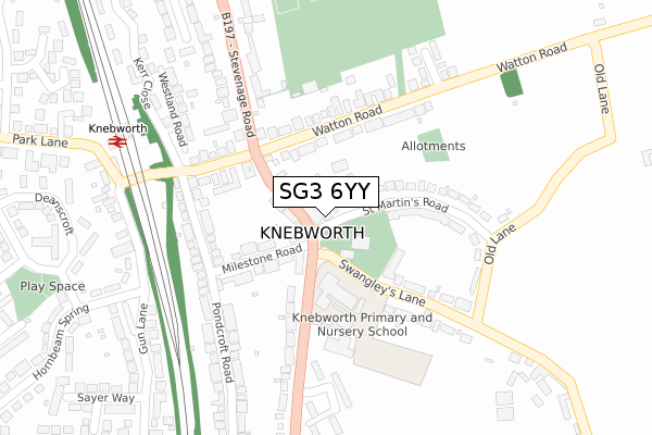
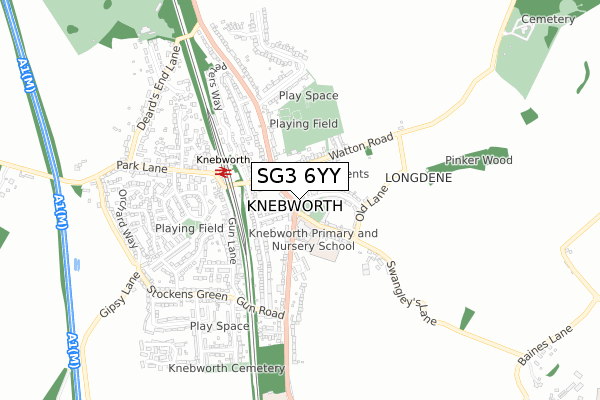
SG3 6YY is located in the Knebworth electoral ward, within the local authority district of North Hertfordshire and the English Parliamentary constituency of Stevenage. The Sub Integrated Care Board (ICB) Location is NHS Hertfordshire and West Essex ICB - 06K and the police force is Hertfordshire. This postcode has been in use since May 2023.


GetTheData
Source: OS Open Zoomstack (Ordnance Survey)
Licence: Open Government Licence (requires attribution)
Attribution: Contains OS data © Crown copyright and database right 2024
Source: Open Postcode Geo
Licence: Open Government Licence (requires attribution)
Attribution: Contains OS data © Crown copyright and database right 2024; Contains Royal Mail data © Royal Mail copyright and database right 2024; Source: Office for National Statistics licensed under the Open Government Licence v.3.0
| Easting | 525237 |
| Northing | 220134 |
| Latitude | 51.865744 |
| Longitude | -0.182531 |
GetTheData
Source: Open Postcode Geo
Licence: Open Government Licence
| Country | England |
| Postcode District | SG3 |
| ➜ SG3 open data dashboard ➜ See where SG3 is on a map ➜ Where is Knebworth? | |
GetTheData
Source: Land Registry Price Paid Data
Licence: Open Government Licence
| Ward | Knebworth |
| Constituency | Stevenage |
GetTheData
Source: ONS Postcode Database
Licence: Open Government Licence
| June 2022 | Shoplifting | On or near Supermarket | 28m |
| June 2022 | Anti-social behaviour | On or near Strafford Court | 190m |
| June 2022 | Anti-social behaviour | On or near Bell Close | 279m |
| ➜ Get more crime data in our Crime section | |||
GetTheData
Source: data.police.uk
Licence: Open Government Licence
| Station Road (Stevenage Road) | Knebworth | 191m |
| Station Road (Stevenage Road) | Knebworth | 220m |
| Knebworth Railway Station (Station Approach) | Knebworth | 401m |
| Gun Road (London Road) | Knebworth | 424m |
| Knebworth Railway Station (Station Approach) | Knebworth | 434m |
| Knebworth Station | 0.3km |
| Stevenage Station | 4.3km |
| Watton-at-Stone Station | 4.5km |
GetTheData
Source: NaPTAN
Licence: Open Government Licence
GetTheData
Source: ONS Postcode Database
Licence: Open Government Licence


➜ Get more ratings from the Food Standards Agency
GetTheData
Source: Food Standards Agency
Licence: FSA terms & conditions
| Last Collection | |||
|---|---|---|---|
| Location | Mon-Fri | Sat | Distance |
| Knebworth | 17:30 | 11:30 | 3m |
| Railway Station | 16:00 | 09:00 | 358m |
| Oakfield Road | 16:00 | 08:30 | 449m |
GetTheData
Source: Dracos
Licence: Creative Commons Attribution-ShareAlike
| Facility | Distance |
|---|---|
| Knebworth Primary School Swangleys Lane, Knebworth Grass Pitches | 130m |
| Knebworth Recreation Ground Watton Road, Knebworth Grass Pitches, Outdoor Tennis Courts | 295m |
| Knebworth Golf Club Deards End Lane, Knebworth Golf | 958m |
GetTheData
Source: Active Places
Licence: Open Government Licence
| School | Phase of Education | Distance |
|---|---|---|
| Knebworth Primary and Nursery School Swangleys Lane, Knebworth, SG3 6AA | Primary | 130m |
| All Saints Church of England Voluntary Aided Primary School, Datchworth Hollybush Lane, Datchworth, Knebworth, SG3 6RE | Primary | 1.6km |
| St Michael's Woolmer Green CofE VA Primary School London Road, Woolmer Green, SG3 6JP | Primary | 1.7km |
GetTheData
Source: Edubase
Licence: Open Government Licence
The below table lists the International Territorial Level (ITL) codes (formerly Nomenclature of Territorial Units for Statistics (NUTS) codes) and Local Administrative Units (LAU) codes for SG3 6YY:
| ITL 1 Code | Name |
|---|---|
| TLH | East |
| ITL 2 Code | Name |
| TLH2 | Bedfordshire and Hertfordshire |
| ITL 3 Code | Name |
| TLH23 | Hertfordshire CC |
| LAU 1 Code | Name |
| E07000099 | North Hertfordshire |
GetTheData
Source: ONS Postcode Directory
Licence: Open Government Licence
The below table lists the Census Output Area (OA), Lower Layer Super Output Area (LSOA), and Middle Layer Super Output Area (MSOA) for SG3 6YY:
| Code | Name | |
|---|---|---|
| OA | E00119996 | |
| LSOA | E01023628 | North Hertfordshire 015E |
| MSOA | E02004923 | North Hertfordshire 015 |
GetTheData
Source: ONS Postcode Directory
Licence: Open Government Licence
| SG3 6DD | St Martins Road | 48m |
| SG3 6EY | London Road | 53m |
| SG3 6EL | St Martins Road | 58m |
| SG3 6EX | London Road | 61m |
| SG3 6DA | Milestone Road | 120m |
| SG3 6ER | St Martins Road | 137m |
| SG3 6DR | Hollycroft Mews | 159m |
| SG3 6AH | Watton Road | 165m |
| SG3 6AP | Station Road | 169m |
| SG3 6DF | Pondcroft Road | 201m |
GetTheData
Source: Open Postcode Geo; Land Registry Price Paid Data
Licence: Open Government Licence