SG3 6DR maps, stats, and open data
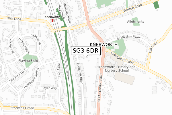
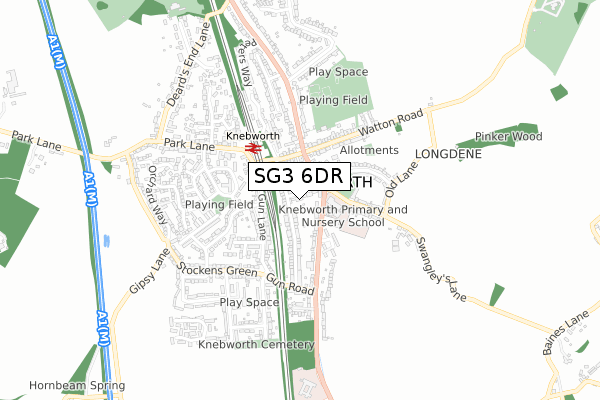
SG3 6DR lies on Hollycroft Mews in Knebworth. SG3 6DR is located in the Knebworth electoral ward, within the local authority district of North Hertfordshire and the English Parliamentary constituency of Stevenage. The Sub Integrated Care Board (ICB) Location is NHS Hertfordshire and West Essex ICB - 06K and the police force is Hertfordshire. This postcode has been in use since November 2004.
SG3 6DR maps


Licence: Open Government Licence (requires attribution)
Attribution: Contains OS data © Crown copyright and database right 2025
Source: Open Postcode Geo
Licence: Open Government Licence (requires attribution)
Attribution: Contains OS data © Crown copyright and database right 2025; Contains Royal Mail data © Royal Mail copyright and database right 2025; Source: Office for National Statistics licensed under the Open Government Licence v.3.0
SG3 6DR geodata
| Easting | 525113 |
| Northing | 220035 |
| Latitude | 51.864875 |
| Longitude | -0.184391 |
Where is SG3 6DR?
| Street | Hollycroft Mews |
| Town/City | Knebworth |
| Country | England |
| Postcode District | SG3 |
SG3 6DR Elevation
Elevation or altitude of SG3 6DR as distance above sea level:
| Metres | Feet | |
|---|---|---|
| Elevation | 90m | 295ft |
Elevation is measured from the approximate centre of the postcode, to the nearest point on an OS contour line from OS Terrain 50, which has contour spacing of ten vertical metres.
➜ How high above sea level am I? Find the elevation of your current position using your device's GPS.
Politics
| Ward | Knebworth |
|---|---|
| Constituency | Stevenage |
House Prices
Sales of detached houses in SG3 6DR
2, HOLLYCROFT MEWS, KNEBWORTH, SG3 6DR 2007 11 MAY £425,000 |
Licence: Contains HM Land Registry data © Crown copyright and database right 2025. This data is licensed under the Open Government Licence v3.0.
Transport
Nearest bus stops to SG3 6DR
| Station Road (Stevenage Road) | Knebworth | 251m |
| Station Road (Stevenage Road) | Knebworth | 275m |
| Gun Road (London Road) | Knebworth | 331m |
| Knebworth Railway Station (Station Approach) | Knebworth | 339m |
| Knebworth Railway Station (Station Approach) | Knebworth | 363m |
Nearest railway stations to SG3 6DR
| Knebworth Station | 0.3km |
| Stevenage Station | 4.4km |
| Watton-at-Stone Station | 4.6km |
Broadband
Broadband access in SG3 6DR (2020 data)
| Percentage of properties with Next Generation Access | 100.0% |
| Percentage of properties with Superfast Broadband | 100.0% |
| Percentage of properties with Ultrafast Broadband | 100.0% |
| Percentage of properties with Full Fibre Broadband | 0.0% |
Superfast Broadband is between 30Mbps and 300Mbps
Ultrafast Broadband is > 300Mbps
Broadband limitations in SG3 6DR (2020 data)
| Percentage of properties unable to receive 2Mbps | 0.0% |
| Percentage of properties unable to receive 5Mbps | 0.0% |
| Percentage of properties unable to receive 10Mbps | 0.0% |
| Percentage of properties unable to receive 30Mbps | 0.0% |
Deprivation
5.5% of English postcodes are less deprived than SG3 6DR:Food Standards Agency
Three nearest food hygiene ratings to SG3 6DR (metres)


➜ Get more ratings from the Food Standards Agency
Nearest post box to SG3 6DR
| Last Collection | |||
|---|---|---|---|
| Location | Mon-Fri | Sat | Distance |
| Knebworth | 17:30 | 11:30 | 156m |
| Railway Station | 16:00 | 09:00 | 306m |
| London Road | 17:00 | 09:30 | 400m |
SG3 6DR ITL and SG3 6DR LAU
The below table lists the International Territorial Level (ITL) codes (formerly Nomenclature of Territorial Units for Statistics (NUTS) codes) and Local Administrative Units (LAU) codes for SG3 6DR:
| ITL 1 Code | Name |
|---|---|
| TLH | East |
| ITL 2 Code | Name |
| TLH2 | Bedfordshire and Hertfordshire |
| ITL 3 Code | Name |
| TLH23 | Hertfordshire CC |
| LAU 1 Code | Name |
| E07000099 | North Hertfordshire |
SG3 6DR census areas
The below table lists the Census Output Area (OA), Lower Layer Super Output Area (LSOA), and Middle Layer Super Output Area (MSOA) for SG3 6DR:
| Code | Name | |
|---|---|---|
| OA | E00119998 | |
| LSOA | E01023628 | North Hertfordshire 015E |
| MSOA | E02004923 | North Hertfordshire 015 |
Nearest postcodes to SG3 6DR
| SG3 6DA | Milestone Road | 39m |
| SG3 6DB | Pondcroft Road | 88m |
| SG3 6EY | London Road | 123m |
| SG3 6HB | London Road | 126m |
| SG3 6DF | Pondcroft Road | 154m |
| SG3 6EX | London Road | 165m |
| SG3 6AP | Station Road | 168m |
| SG3 6EL | St Martins Road | 193m |
| SG3 6DE | Pondcroft Road | 197m |
| SG3 6AU | Gun Lane | 206m |