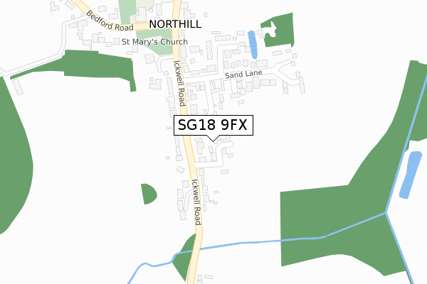
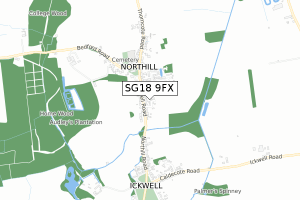
SG18 9FX is located in the Northill electoral ward, within the unitary authority of Central Bedfordshire and the English Parliamentary constituency of North East Bedfordshire. The Sub Integrated Care Board (ICB) Location is NHS Bedfordshire, Luton and Milton Keynes ICB - M1J4Y and the police force is Bedfordshire. This postcode has been in use since December 2019.


GetTheData
Source: OS Open Zoomstack (Ordnance Survey)
Licence: Open Government Licence (requires attribution)
Attribution: Contains OS data © Crown copyright and database right 2024
Source: Open Postcode Geo
Licence: Open Government Licence (requires attribution)
Attribution: Contains OS data © Crown copyright and database right 2024; Contains Royal Mail data © Royal Mail copyright and database right 2024; Source: Office for National Statistics licensed under the Open Government Licence v.3.0
| Easting | 515090 |
| Northing | 246322 |
| Latitude | 52.103280 |
| Longitude | -0.321051 |
GetTheData
Source: Open Postcode Geo
Licence: Open Government Licence
| Country | England |
| Postcode District | SG18 |
| ➜ SG18 open data dashboard ➜ See where SG18 is on a map ➜ Where is Northill? | |
GetTheData
Source: Land Registry Price Paid Data
Licence: Open Government Licence
| Ward | Northill |
| Constituency | North East Bedfordshire |
GetTheData
Source: ONS Postcode Database
Licence: Open Government Licence
6, COOKES MEADOW, NORTHILL, BIGGLESWADE, SG18 9FX 2022 27 APR £1,275,000 |
7, COOKES MEADOW, NORTHILL, BIGGLESWADE, SG18 9FX 2021 29 OCT £1,250,000 |
9, COOKES MEADOW, NORTHILL, BIGGLESWADE, SG18 9FX 2021 9 SEP £1,420,000 |
11, COOKES MEADOW, NORTHILL, BIGGLESWADE, SG18 9FX 2021 29 JUN £1,400,000 |
15, COOKES MEADOW, NORTHILL, BIGGLESWADE, SG18 9FX 2021 2 JUN £1,180,000 |
17, COOKES MEADOW, NORTHILL, BIGGLESWADE, SG18 9FX 2021 14 MAY £1,000,000 |
4, COOKES MEADOW, NORTHILL, BIGGLESWADE, SG18 9FX 2021 16 APR £1,100,000 |
2020 23 OCT £950,000 |
2, COOKES MEADOW, NORTHILL, BIGGLESWADE, SG18 9FX 2020 12 JUN £1,300,000 |
5, COOKES MEADOW, NORTHILL, BIGGLESWADE, SG18 9FX 2020 14 FEB £1,160,000 |
GetTheData
Source: HM Land Registry Price Paid Data
Licence: Contains HM Land Registry data © Crown copyright and database right 2024. This data is licensed under the Open Government Licence v3.0.
| June 2022 | Anti-social behaviour | On or near Garner Close | 183m |
| April 2022 | Violence and sexual offences | On or near Garner Close | 183m |
| February 2022 | Violence and sexual offences | On or near Garner Close | 183m |
| ➜ Get more crime data in our Crime section | |||
GetTheData
Source: data.police.uk
Licence: Open Government Licence
| Penible House (Ickwell Road) | Northill | 141m |
| Penible House (Ickwell Road) | Northill | 151m |
| St Mary's Church (Not Specified) | Northill | 262m |
| St Mary's Church (Ickwell Road) | Northill | 270m |
| Northill Lower School (Bedford Road) | Northill | 336m |
| Sandy Station | 3.6km |
| Biggleswade Station | 4.6km |
GetTheData
Source: NaPTAN
Licence: Open Government Licence
GetTheData
Source: ONS Postcode Database
Licence: Open Government Licence


➜ Get more ratings from the Food Standards Agency
GetTheData
Source: Food Standards Agency
Licence: FSA terms & conditions
| Last Collection | |||
|---|---|---|---|
| Location | Mon-Fri | Sat | Distance |
| Ickwell Road | 16:00 | 09:00 | 230m |
| Ickwell Green | 16:00 | 09:00 | 723m |
| Thorncote Green | 16:15 | 09:20 | 1,306m |
GetTheData
Source: Dracos
Licence: Creative Commons Attribution-ShareAlike
| Facility | Distance |
|---|---|
| Ickwell Green Ickwell Cricket Club, Ickwell Green, Ickwell, Biggleswade Grass Pitches | 894m |
| Shuttleworth College Old Warden Park, Biggleswade Health and Fitness Gym, Sports Hall, Grass Pitches, Squash Courts, Outdoor Tennis Courts | 2km |
| Upper Caldecote Playing Field Harvey Close, Upper Caldecote Grass Pitches | 2.3km |
GetTheData
Source: Active Places
Licence: Open Government Licence
| School | Phase of Education | Distance |
|---|---|---|
| Northill CofE Academy Bedford Road, Northill, Biggleswade, SG18 9AH | Primary | 359m |
| Caldecote Church of England Academy Manor Place, Upper Caldecote, Biggleswade, SG18 9DA | Primary | 1.8km |
| Moggerhanger Primary School Blunham Road, Bedford, MK44 3RD | Primary | 3.2km |
GetTheData
Source: Edubase
Licence: Open Government Licence
The below table lists the International Territorial Level (ITL) codes (formerly Nomenclature of Territorial Units for Statistics (NUTS) codes) and Local Administrative Units (LAU) codes for SG18 9FX:
| ITL 1 Code | Name |
|---|---|
| TLH | East |
| ITL 2 Code | Name |
| TLH2 | Bedfordshire and Hertfordshire |
| ITL 3 Code | Name |
| TLH25 | Central Bedfordshire |
| LAU 1 Code | Name |
| E06000056 | Central Bedfordshire |
GetTheData
Source: ONS Postcode Directory
Licence: Open Government Licence
The below table lists the Census Output Area (OA), Lower Layer Super Output Area (LSOA), and Middle Layer Super Output Area (MSOA) for SG18 9FX:
| Code | Name | |
|---|---|---|
| OA | E00087990 | |
| LSOA | E01017424 | Central Bedfordshire 004D |
| MSOA | E02003602 | Central Bedfordshire 004 |
GetTheData
Source: ONS Postcode Directory
Licence: Open Government Licence
| SG18 9AR | Queens Close | 91m |
| SG18 9AB | Ickwell Road | 93m |
| SG18 9AD | Sand Lane | 116m |
| SG18 9AE | Sand Lane | 165m |
| SG18 9AF | Garner Close | 195m |
| SG18 9AA | Ickwell Road | 201m |
| SG18 9AH | Bedford Road | 391m |
| SG18 9AQ | Thorncote Road | 454m |
| SG18 9ED | Northill Road | 471m |
| SG18 9EN | Tompions End | 583m |
GetTheData
Source: Open Postcode Geo; Land Registry Price Paid Data
Licence: Open Government Licence