SG16 6JU maps, stats, and open data
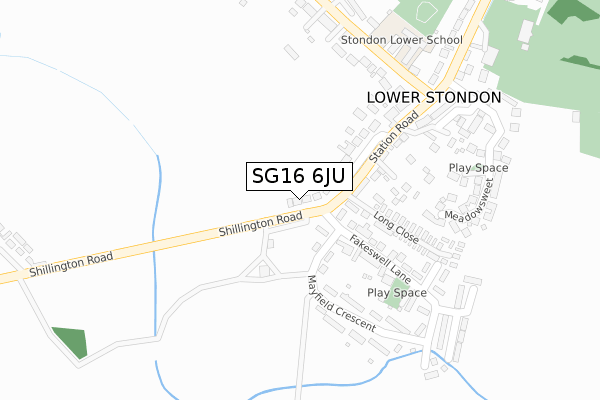
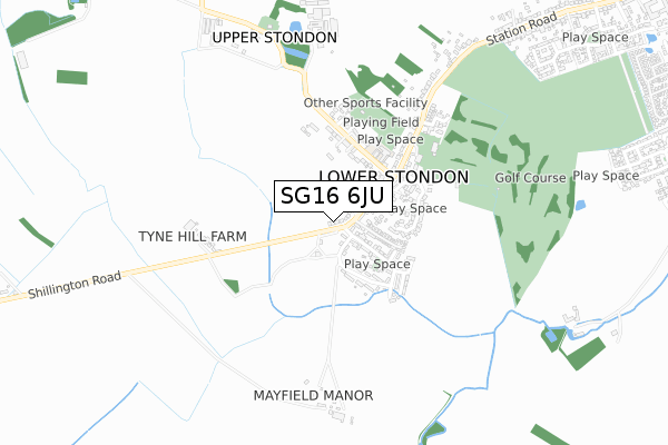
SG16 6JU lies on Shillington Road in Lower Stondon, Henlow. SG16 6JU is located in the Clifton, Henlow & Langford electoral ward, within the unitary authority of Central Bedfordshire and the English Parliamentary constituency of Mid Bedfordshire. The Sub Integrated Care Board (ICB) Location is NHS Bedfordshire, Luton and Milton Keynes ICB - M1J4Y and the police force is Bedfordshire. This postcode has been in use since January 1980.
SG16 6JU maps


Licence: Open Government Licence (requires attribution)
Attribution: Contains OS data © Crown copyright and database right 2025
Source: Open Postcode Geo
Licence: Open Government Licence (requires attribution)
Attribution: Contains OS data © Crown copyright and database right 2025; Contains Royal Mail data © Royal Mail copyright and database right 2025; Source: Office for National Statistics licensed under the Open Government Licence v.3.0
SG16 6JU geodata
| Easting | 515244 |
| Northing | 234819 |
| Latitude | 51.999862 |
| Longitude | -0.322702 |
Where is SG16 6JU?
| Street | Shillington Road |
| Locality | Lower Stondon |
| Town/City | Henlow |
| Country | England |
| Postcode District | SG16 |
SG16 6JU Elevation
Elevation or altitude of SG16 6JU as distance above sea level:
| Metres | Feet | |
|---|---|---|
| Elevation | 60m | 197ft |
Elevation is measured from the approximate centre of the postcode, to the nearest point on an OS contour line from OS Terrain 50, which has contour spacing of ten vertical metres.
➜ How high above sea level am I? Find the elevation of your current position using your device's GPS.
Politics
| Ward | Clifton, Henlow & Langford |
|---|---|
| Constituency | Mid Bedfordshire |
Transport
Nearest bus stops to SG16 6JU
| Post Office (Station Road) | Lower Stondon | 186m |
| Post Office (Station Road) | Lower Stondon | 189m |
| Stondon Lower School (Hillside Road) | Upper Stondon | 272m |
| Stondon Lower School (Hillside Road) | Lower Stondon | 280m |
| Mount Pleasant Farm (Station Road) | Lower Stondon | 372m |
Nearest railway stations to SG16 6JU
| Arlesey Station | 4.8km |
Broadband
Broadband access in SG16 6JU (2020 data)
| Percentage of properties with Next Generation Access | 100.0% |
| Percentage of properties with Superfast Broadband | 100.0% |
| Percentage of properties with Ultrafast Broadband | 0.0% |
| Percentage of properties with Full Fibre Broadband | 0.0% |
Superfast Broadband is between 30Mbps and 300Mbps
Ultrafast Broadband is > 300Mbps
Broadband limitations in SG16 6JU (2020 data)
| Percentage of properties unable to receive 2Mbps | 0.0% |
| Percentage of properties unable to receive 5Mbps | 0.0% |
| Percentage of properties unable to receive 10Mbps | 0.0% |
| Percentage of properties unable to receive 30Mbps | 0.0% |
Deprivation
6.8% of English postcodes are less deprived than SG16 6JU:Food Standards Agency
Three nearest food hygiene ratings to SG16 6JU (metres)


➜ Get more ratings from the Food Standards Agency
Nearest post box to SG16 6JU
| Last Collection | |||
|---|---|---|---|
| Location | Mon-Fri | Sat | Distance |
| Lower Stondon | 17:00 | 10:15 | 171m |
| Rectory Farm Business | 16:45 | 08:30 | 669m |
| 3 Star Caravan Park | 16:00 | 09:45 | 1,474m |
SG16 6JU ITL and SG16 6JU LAU
The below table lists the International Territorial Level (ITL) codes (formerly Nomenclature of Territorial Units for Statistics (NUTS) codes) and Local Administrative Units (LAU) codes for SG16 6JU:
| ITL 1 Code | Name |
|---|---|
| TLH | East |
| ITL 2 Code | Name |
| TLH2 | Bedfordshire and Hertfordshire |
| ITL 3 Code | Name |
| TLH25 | Central Bedfordshire |
| LAU 1 Code | Name |
| E06000056 | Central Bedfordshire |
SG16 6JU census areas
The below table lists the Census Output Area (OA), Lower Layer Super Output Area (LSOA), and Middle Layer Super Output Area (MSOA) for SG16 6JU:
| Code | Name | |
|---|---|---|
| OA | E00088086 | |
| LSOA | E01017442 | Central Bedfordshire 013D |
| MSOA | E02003611 | Central Bedfordshire 013 |
Nearest postcodes to SG16 6JU
| SG16 6JW | Station Road | 44m |
| SG16 6JT | Brittains Rise | 122m |
| SG16 6JP | Station Road | 162m |
| SG16 6JY | Fakeswell Lane | 173m |
| SG16 6JS | Long Close | 188m |
| SG16 6LE | Mayfield Crescent | 209m |
| SG16 6LF | Mayfield Crescent | 224m |
| SG16 6LB | Cooper Close | 241m |
| SG16 6LQ | Hillside Road | 255m |
| SG16 6LP | Hillside Road | 277m |