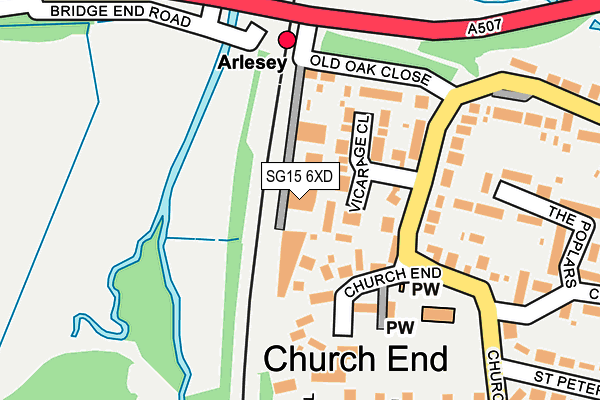
SG15 6XD is located in the Arlesey & Fairfield electoral ward, within the unitary authority of Central Bedfordshire and the English Parliamentary constituency of North East Bedfordshire. The Sub Integrated Care Board (ICB) Location is NHS Bedfordshire, Luton and Milton Keynes ICB - M1J4Y and the police force is Bedfordshire. This postcode has been in use since January 1980.


GetTheData
Source: OS OpenMap – Local (Ordnance Survey)
Source: OS VectorMap District (Ordnance Survey)
Licence: Open Government Licence (requires attribution)
| Easting | 519061 |
| Northing | 237670 |
| Latitude | 52.024688 |
| Longitude | -0.266113 |
GetTheData
Source: Open Postcode Geo
Licence: Open Government Licence
| Country | England |
| Postcode District | SG15 |
➜ See where SG15 is on a map ➜ Where is Arlesey? | |
GetTheData
Source: Land Registry Price Paid Data
Licence: Open Government Licence
Elevation or altitude of SG15 6XD as distance above sea level:
| Metres | Feet | |
|---|---|---|
| Elevation | 40m | 131ft |
Elevation is measured from the approximate centre of the postcode, to the nearest point on an OS contour line from OS Terrain 50, which has contour spacing of ten vertical metres.
➜ How high above sea level am I? Find the elevation of your current position using your device's GPS.
GetTheData
Source: Open Postcode Elevation
Licence: Open Government Licence
| Ward | Arlesey & Fairfield |
| Constituency | North East Bedfordshire |
GetTheData
Source: ONS Postcode Database
Licence: Open Government Licence
| Arlesey Railway Station (Old Oak Close) | Arlesey | 118m |
| The Old Oak (Stotfold Road) | Arlesey | 141m |
| The Old Oak (Stotfold Road) | Arlesey | 143m |
| Arlesey Bridge (Arlesey Road) | Arlesey | 157m |
| Glebe Avenue (Church Lane) | Arlesey | 315m |
| Arlesey Station | 0.2km |
| Letchworth Station | 5.6km |
GetTheData
Source: NaPTAN
Licence: Open Government Licence
GetTheData
Source: ONS Postcode Database
Licence: Open Government Licence


➜ Get more ratings from the Food Standards Agency
GetTheData
Source: Food Standards Agency
Licence: FSA terms & conditions
| Last Collection | |||
|---|---|---|---|
| Location | Mon-Fri | Sat | Distance |
| Church Lane | 16:00 | 09:45 | 329m |
| Church End | 16:00 | 11:45 | 486m |
| High Street North | 16:00 | 09:45 | 1,013m |
GetTheData
Source: Dracos
Licence: Creative Commons Attribution-ShareAlike
The below table lists the International Territorial Level (ITL) codes (formerly Nomenclature of Territorial Units for Statistics (NUTS) codes) and Local Administrative Units (LAU) codes for SG15 6XD:
| ITL 1 Code | Name |
|---|---|
| TLH | East |
| ITL 2 Code | Name |
| TLH2 | Bedfordshire and Hertfordshire |
| ITL 3 Code | Name |
| TLH25 | Central Bedfordshire |
| LAU 1 Code | Name |
| E06000056 | Central Bedfordshire |
GetTheData
Source: ONS Postcode Directory
Licence: Open Government Licence
The below table lists the Census Output Area (OA), Lower Layer Super Output Area (LSOA), and Middle Layer Super Output Area (MSOA) for SG15 6XD:
| Code | Name | |
|---|---|---|
| OA | E00087765 | |
| LSOA | E01017377 | Central Bedfordshire 010B |
| MSOA | E02003608 | Central Bedfordshire 010 |
GetTheData
Source: ONS Postcode Directory
Licence: Open Government Licence
| SG15 6XH | Vicarage Close | 43m |
| SG15 6XA | Old Oak Close | 101m |
| SG15 6UY | Church End | 139m |
| SG15 6UX | Church Lane | 177m |
| SG15 6UZ | Grove Court | 196m |
| SG15 6UW | The Poplars | 200m |
| SG15 6TW | Saffron Close | 234m |
| SG15 6UN | Church Lane | 252m |
| SG15 6UT | Chase Close | 261m |
| SG15 6TN | The Rally | 295m |
GetTheData
Source: Open Postcode Geo; Land Registry Price Paid Data
Licence: Open Government Licence