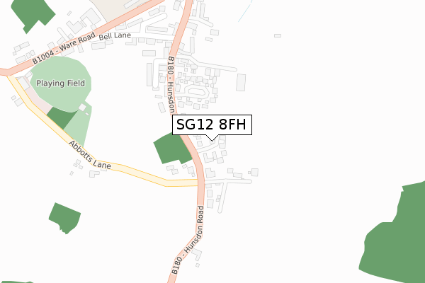
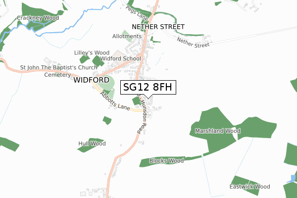
SG12 8FH is located in the Ware Rural electoral ward, within the local authority district of East Hertfordshire and the English Parliamentary constituency of Hertford and Stortford. The Sub Integrated Care Board (ICB) Location is NHS Hertfordshire and West Essex ICB - 06K and the police force is Hertfordshire. This postcode has been in use since April 2019.


GetTheData
Source: OS Open Zoomstack (Ordnance Survey)
Licence: Open Government Licence (requires attribution)
Attribution: Contains OS data © Crown copyright and database right 2024
Source: Open Postcode Geo
Licence: Open Government Licence (requires attribution)
Attribution: Contains OS data © Crown copyright and database right 2024; Contains Royal Mail data © Royal Mail copyright and database right 2024; Source: Office for National Statistics licensed under the Open Government Licence v.3.0
| Easting | 542072 |
| Northing | 215518 |
| Latitude | 51.820240 |
| Longitude | 0.059916 |
GetTheData
Source: Open Postcode Geo
Licence: Open Government Licence
| Country | England |
| Postcode District | SG12 |
| ➜ SG12 open data dashboard ➜ See where SG12 is on a map ➜ Where is Widford? | |
GetTheData
Source: Land Registry Price Paid Data
Licence: Open Government Licence
| Ward | Ware Rural |
| Constituency | Hertford And Stortford |
GetTheData
Source: ONS Postcode Database
Licence: Open Government Licence
2021 24 AUG £750,000 |
2020 2 SEP £810,000 |
12, MEADOW GARDENS, WIDFORD, WARE, SG12 8FH 2019 1 NOV £825,000 |
13, MEADOW GARDENS, WIDFORD, WARE, SG12 8FH 2019 31 OCT £830,000 |
11, MEADOW GARDENS, WIDFORD, WARE, SG12 8FH 2019 29 OCT £889,950 |
17, MEADOW GARDENS, WIDFORD, WARE, SG12 8FH 2019 22 OCT £599,950 |
2019 12 SEP £621,950 |
9, MEADOW GARDENS, WIDFORD, WARE, SG12 8FH 2019 23 AUG £599,950 |
8, MEADOW GARDENS, WIDFORD, WARE, SG12 8FH 2019 16 AUG £585,000 |
14, MEADOW GARDENS, WIDFORD, WARE, SG12 8FH 2019 8 AUG £774,950 |
GetTheData
Source: HM Land Registry Price Paid Data
Licence: Contains HM Land Registry data © Crown copyright and database right 2024. This data is licensed under the Open Government Licence v3.0.
| January 2024 | Violence and sexual offences | On or near Bell Lane | 320m |
| July 2023 | Anti-social behaviour | On or near Bell Lane | 320m |
| February 2023 | Anti-social behaviour | On or near Bell Lane | 320m |
| ➜ Get more crime data in our Crime section | |||
GetTheData
Source: data.police.uk
Licence: Open Government Licence
| Bell Lane (High Street) | Widford | 242m |
| Bell Lane (High Street) | Widford | 248m |
| Green Man Ph (High Street) | Widford | 381m |
| Field House (Ware Road) | Widford | 391m |
| Field House (Ware Road) | Widford | 409m |
| Harlow Town Station | 5km |
| St Margarets (Herts) Station | 5.4km |
GetTheData
Source: NaPTAN
Licence: Open Government Licence
| Percentage of properties with Next Generation Access | 100.0% |
| Percentage of properties with Superfast Broadband | 100.0% |
| Percentage of properties with Ultrafast Broadband | 0.0% |
| Percentage of properties with Full Fibre Broadband | 0.0% |
Superfast Broadband is between 30Mbps and 300Mbps
Ultrafast Broadband is > 300Mbps
| Percentage of properties unable to receive 2Mbps | 0.0% |
| Percentage of properties unable to receive 5Mbps | 0.0% |
| Percentage of properties unable to receive 10Mbps | 0.0% |
| Percentage of properties unable to receive 30Mbps | 0.0% |
GetTheData
Source: Ofcom
Licence: Ofcom Terms of Use (requires attribution)
GetTheData
Source: ONS Postcode Database
Licence: Open Government Licence


➜ Get more ratings from the Food Standards Agency
GetTheData
Source: Food Standards Agency
Licence: FSA terms & conditions
| Last Collection | |||
|---|---|---|---|
| Location | Mon-Fri | Sat | Distance |
| Beningfield Road | 17:00 | 11:00 | 374m |
| Hadham Mill | 17:00 | 10:00 | 1,487m |
| The Convent | 17:15 | 10:00 | 2,560m |
GetTheData
Source: Dracos
Licence: Creative Commons Attribution-ShareAlike
| Facility | Distance |
|---|---|
| Widford Playing Field Bell Lane, Widford, Ware Grass Pitches | 311m |
| Ware Cricket Club Bell Lane, Widford Grass Pitches | 320m |
| Much Hadham Recreation Ground High Street, Much Hadham Grass Pitches, Outdoor Tennis Courts | 3.5km |
GetTheData
Source: Active Places
Licence: Open Government Licence
| School | Phase of Education | Distance |
|---|---|---|
| Widford School Ware Road, Widford, Ware, SG12 8RE | Primary | 378m |
| Hunsdon Junior Mixed and Infant School High Street, Hunsdon, Ware, SG12 8NT | Primary | 1.3km |
| St Elizabeth's School South End, Much Hadham, SG10 6EW | Not applicable | 2.3km |
GetTheData
Source: Edubase
Licence: Open Government Licence
The below table lists the International Territorial Level (ITL) codes (formerly Nomenclature of Territorial Units for Statistics (NUTS) codes) and Local Administrative Units (LAU) codes for SG12 8FH:
| ITL 1 Code | Name |
|---|---|
| TLH | East |
| ITL 2 Code | Name |
| TLH2 | Bedfordshire and Hertfordshire |
| ITL 3 Code | Name |
| TLH23 | Hertfordshire CC |
| LAU 1 Code | Name |
| E07000242 | East Hertfordshire |
GetTheData
Source: ONS Postcode Directory
Licence: Open Government Licence
The below table lists the Census Output Area (OA), Lower Layer Super Output Area (LSOA), and Middle Layer Super Output Area (MSOA) for SG12 8FH:
| Code | Name | |
|---|---|---|
| OA | E00119325 | |
| LSOA | E01023492 | East Hertfordshire 009B |
| MSOA | E02004886 | East Hertfordshire 009 |
GetTheData
Source: ONS Postcode Directory
Licence: Open Government Licence
| SG12 8UA | Levenage Lane | 80m |
| SG12 8RT | Abbotts Lane | 83m |
| SG12 8SE | Hunsdon Road | 95m |
| SG12 8SL | Daintrees | 152m |
| SG12 8SF | Lambs Gardens | 228m |
| SG12 8SA | Poets Gate | 240m |
| SG12 8SD | Poets Gate | 267m |
| SG12 8RS | Abbotts Lane | 300m |
| SG12 8SH | Bell Lane | 333m |
| SG12 8SJ | Hunsdon Road | 333m |
GetTheData
Source: Open Postcode Geo; Land Registry Price Paid Data
Licence: Open Government Licence