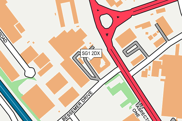
SG1 2DX is located in the Symonds Green electoral ward, within the local authority district of Stevenage and the English Parliamentary constituency of Stevenage. The Sub Integrated Care Board (ICB) Location is NHS Hertfordshire and West Essex ICB - 06K and the police force is Hertfordshire. This postcode has been in use since December 1994.


GetTheData
Source: OS OpenMap – Local (Ordnance Survey)
Source: OS VectorMap District (Ordnance Survey)
Licence: Open Government Licence (requires attribution)
| Easting | 522822 |
| Northing | 224092 |
| Latitude | 51.901842 |
| Longitude | -0.216203 |
GetTheData
Source: Open Postcode Geo
Licence: Open Government Licence
| Country | England |
| Postcode District | SG1 |
➜ See where SG1 is on a map ➜ Where is Stevenage? | |
GetTheData
Source: Land Registry Price Paid Data
Licence: Open Government Licence
Elevation or altitude of SG1 2DX as distance above sea level:
| Metres | Feet | |
|---|---|---|
| Elevation | 100m | 328ft |
Elevation is measured from the approximate centre of the postcode, to the nearest point on an OS contour line from OS Terrain 50, which has contour spacing of ten vertical metres.
➜ How high above sea level am I? Find the elevation of your current position using your device's GPS.
GetTheData
Source: Open Postcode Elevation
Licence: Open Government Licence
| Ward | Symonds Green |
| Constituency | Stevenage |
GetTheData
Source: ONS Postcode Database
Licence: Open Government Licence
| Gunnels Wood Road | Stevenage | 159m |
| Gunnels Wood Road (Fairlands Way) | Stevenage | 233m |
| Cavendish Road (Gunnels Wood Road) | Stevenage | 239m |
| Cavendish Road (Gunnels Wood Road) | Stevenage | 308m |
| Robertson House (Gunnels Wood Road) | Stevenage | 321m |
| Stevenage Station | 0.6km |
| Knebworth Station | 4.4km |
GetTheData
Source: NaPTAN
Licence: Open Government Licence
GetTheData
Source: ONS Postcode Database
Licence: Open Government Licence


➜ Get more ratings from the Food Standards Agency
GetTheData
Source: Food Standards Agency
Licence: FSA terms & conditions
| Last Collection | |||
|---|---|---|---|
| Location | Mon-Fri | Sat | Distance |
| Cavendish Road | 18:00 | 11:00 | 380m |
| Railway Station | 18:45 | 12:00 | 654m |
| Fairview Road | 18:45 | 12:00 | 664m |
GetTheData
Source: Dracos
Licence: Creative Commons Attribution-ShareAlike
The below table lists the International Territorial Level (ITL) codes (formerly Nomenclature of Territorial Units for Statistics (NUTS) codes) and Local Administrative Units (LAU) codes for SG1 2DX:
| ITL 1 Code | Name |
|---|---|
| TLH | East |
| ITL 2 Code | Name |
| TLH2 | Bedfordshire and Hertfordshire |
| ITL 3 Code | Name |
| TLH23 | Hertfordshire CC |
| LAU 1 Code | Name |
| E07000243 | Stevenage |
GetTheData
Source: ONS Postcode Directory
Licence: Open Government Licence
The below table lists the Census Output Area (OA), Lower Layer Super Output Area (LSOA), and Middle Layer Super Output Area (MSOA) for SG1 2DX:
| Code | Name | |
|---|---|---|
| OA | E00120837 | |
| LSOA | E01023798 | Stevenage 005D |
| MSOA | E02004948 | Stevenage 005 |
GetTheData
Source: ONS Postcode Directory
Licence: Open Government Licence
| SG1 2DL | Bessemer Drive | 135m |
| SG1 2DY | Babbage Road | 217m |
| SG1 2EP | Maxwell Road | 288m |
| SG1 2DG | Aspect One | 309m |
| SG1 2NA | Fairview Road | 434m |
| SG1 2EQ | Hyatt Trading Estate | 467m |
| SG1 2DF | Caxton Way | 491m |
| SG1 2FY | Gunnells | 525m |
| SG1 2LS | Watson Road | 527m |
| SG1 2EE | Crompton Road | 532m |
GetTheData
Source: Open Postcode Geo; Land Registry Price Paid Data
Licence: Open Government Licence