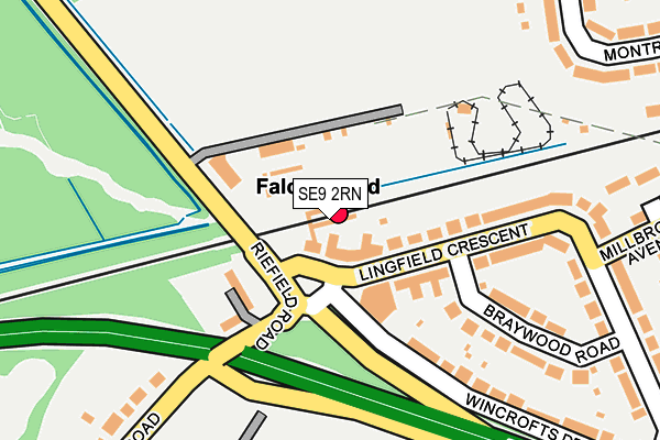
SE9 2RN is located in the Falconwood & Welling electoral ward, within the London borough of Bexley and the English Parliamentary constituency of Old Bexley and Sidcup. The Sub Integrated Care Board (ICB) Location is NHS South East London ICB - 72Q and the police force is Metropolitan Police. This postcode has been in use since January 1980.


GetTheData
Source: OS OpenMap – Local (Ordnance Survey)
Source: OS VectorMap District (Ordnance Survey)
Licence: Open Government Licence (requires attribution)
| Easting | 544635 |
| Northing | 175329 |
| Latitude | 51.458467 |
| Longitude | 0.080480 |
GetTheData
Source: Open Postcode Geo
Licence: Open Government Licence
| Country | England |
| Postcode District | SE9 |
➜ See where SE9 is on a map ➜ Where is London? | |
GetTheData
Source: Land Registry Price Paid Data
Licence: Open Government Licence
Elevation or altitude of SE9 2RN as distance above sea level:
| Metres | Feet | |
|---|---|---|
| Elevation | 70m | 230ft |
Elevation is measured from the approximate centre of the postcode, to the nearest point on an OS contour line from OS Terrain 50, which has contour spacing of ten vertical metres.
➜ How high above sea level am I? Find the elevation of your current position using your device's GPS.
GetTheData
Source: Open Postcode Elevation
Licence: Open Government Licence
| Ward | Falconwood & Welling |
| Constituency | Old Bexley And Sidcup |
GetTheData
Source: ONS Postcode Database
Licence: Open Government Licence
| Falconwood (Lingfield Crescent) | Falconwood | 37m |
| Falconwood (Lingfield Crescent) | Falconwood | 46m |
| Rochester Way Falconwood Stn | Avery Hill | 167m |
| Rochester Way Falconwood Stn | Avery Hill | 173m |
| Eltham Cemetery (Riefield Road) | Avery Hill | 210m |
| Falconwood Station | 0.1km |
| Welling Station | 1.6km |
| Eltham Station | 2km |
GetTheData
Source: NaPTAN
Licence: Open Government Licence
GetTheData
Source: ONS Postcode Database
Licence: Open Government Licence


➜ Get more ratings from the Food Standards Agency
GetTheData
Source: Food Standards Agency
Licence: FSA terms & conditions
| Last Collection | |||
|---|---|---|---|
| Location | Mon-Fri | Sat | Distance |
| Lingfield Crescent | 17:30 | 12:00 | 63m |
| Colepits Wood Road | 17:30 | 12:00 | 434m |
| Gipsy Road | 17:30 | 11:00 | 501m |
GetTheData
Source: Dracos
Licence: Creative Commons Attribution-ShareAlike
The below table lists the International Territorial Level (ITL) codes (formerly Nomenclature of Territorial Units for Statistics (NUTS) codes) and Local Administrative Units (LAU) codes for SE9 2RN:
| ITL 1 Code | Name |
|---|---|
| TLI | London |
| ITL 2 Code | Name |
| TLI5 | Outer London - East and North East |
| ITL 3 Code | Name |
| TLI51 | Bexley and Greenwich |
| LAU 1 Code | Name |
| E09000004 | Bexley |
GetTheData
Source: ONS Postcode Directory
Licence: Open Government Licence
The below table lists the Census Output Area (OA), Lower Layer Super Output Area (LSOA), and Middle Layer Super Output Area (MSOA) for SE9 2RN:
| Code | Name | |
|---|---|---|
| OA | E00002022 | |
| LSOA | E01000412 | Bexley 018E |
| MSOA | E02000082 | Bexley 018 |
GetTheData
Source: ONS Postcode Directory
Licence: Open Government Licence
| SE9 2RW | Lingfield Crescent | 40m |
| SE9 2RL | Lingfield Crescent | 86m |
| SE9 2RD | Riefield Road | 127m |
| SE9 2RH | Braywood Road | 127m |
| SE9 2RJ | Lingfield Crescent | 181m |
| SE9 2RG | Wincrofts Drive | 200m |
| DA16 2QQ | Millbrook Avenue | 264m |
| SE9 2RQ | Lingfield Crescent | 267m |
| DA16 2QG | Northumberland Avenue | 320m |
| SE9 2RB | Riefield Road | 335m |
GetTheData
Source: Open Postcode Geo; Land Registry Price Paid Data
Licence: Open Government Licence