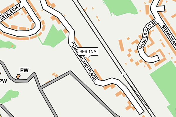
SE6 1NA lies on Cumberland Place in London. SE6 1NA is located in the Hither Green electoral ward, within the London borough of Lewisham and the English Parliamentary constituency of Lewisham East. The Sub Integrated Care Board (ICB) Location is NHS South East London ICB - 72Q and the police force is Metropolitan Police. This postcode has been in use since December 1997.


GetTheData
Source: OS OpenMap – Local (Ordnance Survey)
Source: OS VectorMap District (Ordnance Survey)
Licence: Open Government Licence (requires attribution)
| Easting | 539874 |
| Northing | 172996 |
| Latitude | 51.438698 |
| Longitude | 0.011050 |
GetTheData
Source: Open Postcode Geo
Licence: Open Government Licence
| Street | Cumberland Place |
| Town/City | London |
| Country | England |
| Postcode District | SE6 |
➜ See where SE6 is on a map ➜ Where is Catford? | |
GetTheData
Source: Land Registry Price Paid Data
Licence: Open Government Licence
Elevation or altitude of SE6 1NA as distance above sea level:
| Metres | Feet | |
|---|---|---|
| Elevation | 40m | 131ft |
Elevation is measured from the approximate centre of the postcode, to the nearest point on an OS contour line from OS Terrain 50, which has contour spacing of ten vertical metres.
➜ How high above sea level am I? Find the elevation of your current position using your device's GPS.
GetTheData
Source: Open Postcode Elevation
Licence: Open Government Licence
| Ward | Hither Green |
| Constituency | Lewisham East |
GetTheData
Source: ONS Postcode Database
Licence: Open Government Licence
| Hither Green Cemetery | Grove Park | 358m |
| Hither Green Cemetery | Grove Park | 371m |
| Pasture Road (Se6) (Verdant Lane) | Hither Green | 412m |
| Pasture Road (Se6) (Verdant Lane) | Hither Green | 421m |
| Farmcote Road (Baring Road) | Grove Park | 427m |
| Grove Park Station | 1.1km |
| Lee Station | 1.2km |
| Hither Green Station | 1.7km |
GetTheData
Source: NaPTAN
Licence: Open Government Licence
| Percentage of properties with Next Generation Access | 100.0% |
| Percentage of properties with Superfast Broadband | 100.0% |
| Percentage of properties with Ultrafast Broadband | 100.0% |
| Percentage of properties with Full Fibre Broadband | 0.0% |
Superfast Broadband is between 30Mbps and 300Mbps
Ultrafast Broadband is > 300Mbps
| Median download speed | 77.0Mbps |
| Average download speed | 90.6Mbps |
| Maximum download speed | 200.00Mbps |
| Median upload speed | 13.2Mbps |
| Average upload speed | 12.9Mbps |
| Maximum upload speed | 20.00Mbps |
| Percentage of properties unable to receive 2Mbps | 0.0% |
| Percentage of properties unable to receive 5Mbps | 0.0% |
| Percentage of properties unable to receive 10Mbps | 0.0% |
| Percentage of properties unable to receive 30Mbps | 0.0% |
GetTheData
Source: Ofcom
Licence: Ofcom Terms of Use (requires attribution)
Estimated total energy consumption in SE6 1NA by fuel type, 2015.
| Consumption (kWh) | 308,369 |
|---|---|
| Meter count | 44 |
| Mean (kWh/meter) | 7,008 |
| Median (kWh/meter) | 6,261 |
GetTheData
Source: Postcode level gas estimates: 2015 (experimental)
Source: Postcode level electricity estimates: 2015 (experimental)
Licence: Open Government Licence
GetTheData
Source: ONS Postcode Database
Licence: Open Government Licence


➜ Get more ratings from the Food Standards Agency
GetTheData
Source: Food Standards Agency
Licence: FSA terms & conditions
| Last Collection | |||
|---|---|---|---|
| Location | Mon-Fri | Sat | Distance |
| Pasture Road | 17:30 | 12:00 | 396m |
| Baring Road | 17:30 | 12:00 | 427m |
| Wellmeadow Road | 17:30 | 12:00 | 600m |
GetTheData
Source: Dracos
Licence: Creative Commons Attribution-ShareAlike
The below table lists the International Territorial Level (ITL) codes (formerly Nomenclature of Territorial Units for Statistics (NUTS) codes) and Local Administrative Units (LAU) codes for SE6 1NA:
| ITL 1 Code | Name |
|---|---|
| TLI | London |
| ITL 2 Code | Name |
| TLI4 | Inner London - East |
| ITL 3 Code | Name |
| TLI44 | Lewisham and Southwark |
| LAU 1 Code | Name |
| E09000023 | Lewisham |
GetTheData
Source: ONS Postcode Directory
Licence: Open Government Licence
The below table lists the Census Output Area (OA), Lower Layer Super Output Area (LSOA), and Middle Layer Super Output Area (MSOA) for SE6 1NA:
| Code | Name | |
|---|---|---|
| OA | E00016945 | |
| LSOA | E01003354 | Lewisham 026D |
| MSOA | E02000678 | Lewisham 026 |
GetTheData
Source: ONS Postcode Directory
Licence: Open Government Licence
| SE6 1NB | Cumberland Place | 125m |
| SE12 0UB | Oak Apple Court | 145m |
| SE12 0UE | Gables Close | 163m |
| SE6 1LY | Cumberland Place | 164m |
| SE6 1LX | Cumberland Place | 219m |
| SE6 1BB | Cumberland Place | 230m |
| SE12 0UD | Gables Close | 230m |
| SE6 1JL | South Park Crescent | 255m |
| SE6 1JP | South Park Crescent | 280m |
| SE6 1JN | South Park Crescent | 299m |
GetTheData
Source: Open Postcode Geo; Land Registry Price Paid Data
Licence: Open Government Licence