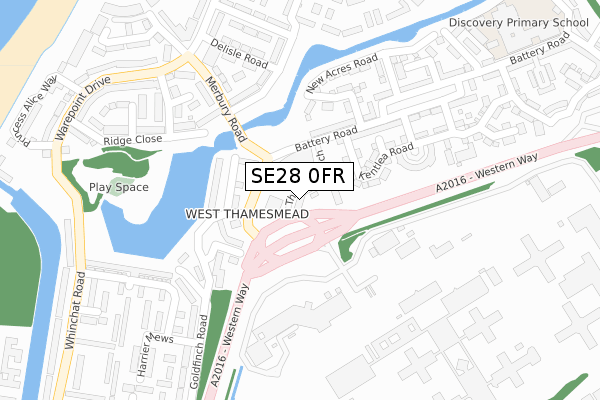
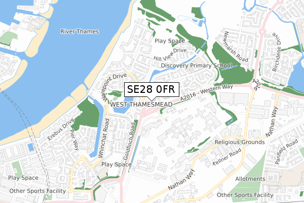
SE28 0FR is located in the West Thamesmead electoral ward, within the London borough of Greenwich and the English Parliamentary constituency of Erith and Thamesmead. The Sub Integrated Care Board (ICB) Location is NHS South East London ICB - 72Q and the police force is Metropolitan Police. This postcode has been in use since February 2019.


GetTheData
Source: OS Open Zoomstack (Ordnance Survey)
Licence: Open Government Licence (requires attribution)
Attribution: Contains OS data © Crown copyright and database right 2025
Source: Open Postcode Geo
Licence: Open Government Licence (requires attribution)
Attribution: Contains OS data © Crown copyright and database right 2025; Contains Royal Mail data © Royal Mail copyright and database right 2025; Source: Office for National Statistics licensed under the Open Government Licence v.3.0
| Easting | 545170 |
| Northing | 179776 |
| Latitude | 51.498289 |
| Longitude | 0.090002 |
GetTheData
Source: Open Postcode Geo
Licence: Open Government Licence
| Country | England |
| Postcode District | SE28 |
➜ See where SE28 is on a map ➜ Where is London? | |
GetTheData
Source: Land Registry Price Paid Data
Licence: Open Government Licence
| Ward | West Thamesmead |
| Constituency | Erith And Thamesmead |
GetTheData
Source: ONS Postcode Database
Licence: Open Government Licence
| Princess Alice (Western Way) | Thamesmead West | 29m |
| Goldfinch Road Thamesmead (Battery Road) | Thamesmead West | 71m |
| Goldfinch Road Thamesmead (Battery Road) | Thamesmead West | 89m |
| Belmarsh Prison (Western Way) | Thamesmead West | 110m |
| Merbury Road | Thamesmead West | 195m |
| Woolwich Arsenal Dlr Station (Woolwich New Road) | Woolwich | 1,716m |
| Gallions Reach Dlr Station (Royal Docks Road) | Gallions Reach | 1,743m |
| Plumstead Station | 1km |
| Woolwich Arsenal Station | 1.7km |
| Abbey Wood (London) Station | 2.3km |
GetTheData
Source: NaPTAN
Licence: Open Government Licence
| Percentage of properties with Next Generation Access | 100.0% |
| Percentage of properties with Superfast Broadband | 100.0% |
| Percentage of properties with Ultrafast Broadband | 100.0% |
| Percentage of properties with Full Fibre Broadband | 100.0% |
Superfast Broadband is between 30Mbps and 300Mbps
Ultrafast Broadband is > 300Mbps
| Percentage of properties unable to receive 2Mbps | 0.0% |
| Percentage of properties unable to receive 5Mbps | 0.0% |
| Percentage of properties unable to receive 10Mbps | 0.0% |
| Percentage of properties unable to receive 30Mbps | 0.0% |
GetTheData
Source: Ofcom
Licence: Ofcom Terms of Use (requires attribution)
GetTheData
Source: ONS Postcode Database
Licence: Open Government Licence


➜ Get more ratings from the Food Standards Agency
GetTheData
Source: Food Standards Agency
Licence: FSA terms & conditions
| Last Collection | |||
|---|---|---|---|
| Location | Mon-Fri | Sat | Distance |
| Goldfinch Road | 17:30 | 12:00 | 244m |
| Warepoint Drive | 17:30 | 12:00 | 315m |
| 113 Nathan Way | 17:30 | 12:00 | 580m |
GetTheData
Source: Dracos
Licence: Creative Commons Attribution-ShareAlike
| Risk of SE28 0FR flooding from rivers and sea | Very Low |
| ➜ SE28 0FR flood map | |
GetTheData
Source: Open Flood Risk by Postcode
Licence: Open Government Licence
The below table lists the International Territorial Level (ITL) codes (formerly Nomenclature of Territorial Units for Statistics (NUTS) codes) and Local Administrative Units (LAU) codes for SE28 0FR:
| ITL 1 Code | Name |
|---|---|
| TLI | London |
| ITL 2 Code | Name |
| TLI5 | Outer London - East and North East |
| ITL 3 Code | Name |
| TLI51 | Bexley and Greenwich |
| LAU 1 Code | Name |
| E09000011 | Greenwich |
GetTheData
Source: ONS Postcode Directory
Licence: Open Government Licence
The below table lists the Census Output Area (OA), Lower Layer Super Output Area (LSOA), and Middle Layer Super Output Area (MSOA) for SE28 0FR:
| Code | Name | |
|---|---|---|
| OA | E00176530 | |
| LSOA | E01033741 | Greenwich 002G |
| MSOA | E02000314 | Greenwich 002 |
GetTheData
Source: ONS Postcode Directory
Licence: Open Government Licence
| SE28 0NG | Thames Reach | 64m |
| SE28 0JR | Kentlea Road | 149m |
| SE28 0JL | Battery Road | 153m |
| SE28 0JS | Battery Road | 159m |
| SE28 0JP | Kentlea Road | 164m |
| SE28 0LD | New Acres Road | 202m |
| SE28 0HT | Ridge Close | 211m |
| SE28 0JE | Delisle Road | 231m |
| SE28 0HR | Merbury Road | 235m |
| SE28 0HU | Bluebird Way | 255m |
GetTheData
Source: Open Postcode Geo; Land Registry Price Paid Data
Licence: Open Government Licence