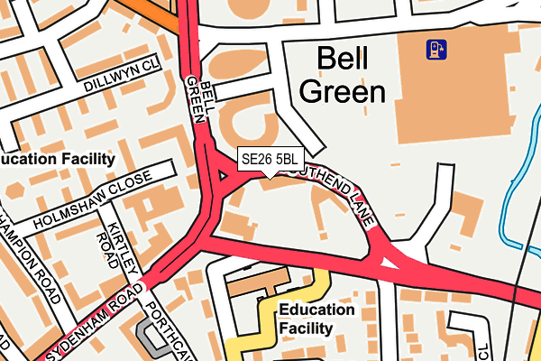
SE26 5BL is located in the Bellingham electoral ward, within the London borough of Lewisham and the English Parliamentary constituency of Lewisham West and Penge. The Sub Integrated Care Board (ICB) Location is NHS South East London ICB - 72Q and the police force is Metropolitan Police. This postcode has been in use since January 1980.


GetTheData
Source: OS OpenMap – Local (Ordnance Survey)
Source: OS VectorMap District (Ordnance Survey)
Licence: Open Government Licence (requires attribution)
| Easting | 536610 |
| Northing | 171851 |
| Latitude | 51.429204 |
| Longitude | -0.036322 |
GetTheData
Source: Open Postcode Geo
Licence: Open Government Licence
| Country | England |
| Postcode District | SE26 |
➜ See where SE26 is on a map ➜ Where is London? | |
GetTheData
Source: Land Registry Price Paid Data
Licence: Open Government Licence
Elevation or altitude of SE26 5BL as distance above sea level:
| Metres | Feet | |
|---|---|---|
| Elevation | 30m | 98ft |
Elevation is measured from the approximate centre of the postcode, to the nearest point on an OS contour line from OS Terrain 50, which has contour spacing of ten vertical metres.
➜ How high above sea level am I? Find the elevation of your current position using your device's GPS.
GetTheData
Source: Open Postcode Elevation
Licence: Open Government Licence
| Ward | Bellingham |
| Constituency | Lewisham West And Penge |
GetTheData
Source: ONS Postcode Database
Licence: Open Government Licence
| Bell Green Southend Lane (Bell Green) | Bell Green | 85m |
| Bell Green Southend Lane | Bell Green | 88m |
| Kirtley Road | Bell Green | 156m |
| Southend Lane | Bell Green | 159m |
| Bell Green Sainsbury's (Bell Green Savacentre) | Bell Green | 165m |
| Lower Sydenham Station | 0.5km |
| Bellingham Station | 1.3km |
| Sydenham Station | 1.3km |
GetTheData
Source: NaPTAN
Licence: Open Government Licence
GetTheData
Source: ONS Postcode Database
Licence: Open Government Licence


➜ Get more ratings from the Food Standards Agency
GetTheData
Source: Food Standards Agency
Licence: FSA terms & conditions
| Last Collection | |||
|---|---|---|---|
| Location | Mon-Fri | Sat | Distance |
| 58 Bell Green | 17:30 | 12:00 | 83m |
| 4 Kangley Bridge Road | 17:30 | 12:00 | 172m |
| Savacentre | 17:30 | 12:00 | 174m |
GetTheData
Source: Dracos
Licence: Creative Commons Attribution-ShareAlike
The below table lists the International Territorial Level (ITL) codes (formerly Nomenclature of Territorial Units for Statistics (NUTS) codes) and Local Administrative Units (LAU) codes for SE26 5BL:
| ITL 1 Code | Name |
|---|---|
| TLI | London |
| ITL 2 Code | Name |
| TLI4 | Inner London - East |
| ITL 3 Code | Name |
| TLI44 | Lewisham and Southwark |
| LAU 1 Code | Name |
| E09000023 | Lewisham |
GetTheData
Source: ONS Postcode Directory
Licence: Open Government Licence
The below table lists the Census Output Area (OA), Lower Layer Super Output Area (LSOA), and Middle Layer Super Output Area (MSOA) for SE26 5BL:
| Code | Name | |
|---|---|---|
| OA | E00016142 | |
| LSOA | E01003190 | Lewisham 034B |
| MSOA | E02000686 | Lewisham 034 |
GetTheData
Source: ONS Postcode Directory
Licence: Open Government Licence
| SE26 4AZ | Miall Walk | 138m |
| SE26 4PZ | Bell Green | 143m |
| SE26 5AF | Haseltine Road | 150m |
| SE26 5TB | Bell Green Lane | 159m |
| SE26 5SL | Sydenham Road | 172m |
| SE26 5TD | Bell Green Lane | 184m |
| SE26 4TL | Kirtley Road | 199m |
| SE26 4TH | Holmshaw Close | 201m |
| SE26 5BH | Southend Lane | 218m |
| SE26 4DD | Dillwyn Close | 220m |
GetTheData
Source: Open Postcode Geo; Land Registry Price Paid Data
Licence: Open Government Licence