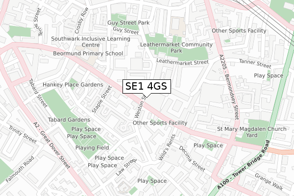
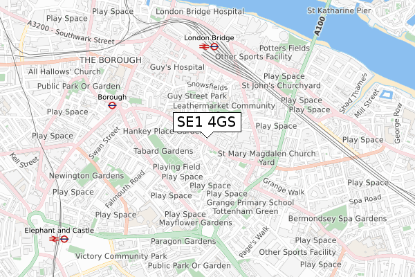
SE1 4GS is located in the London Bridge & West Bermondsey electoral ward, within the London borough of Southwark and the English Parliamentary constituency of Bermondsey and Old Southwark. The Sub Integrated Care Board (ICB) Location is NHS South East London ICB - 72Q and the police force is Metropolitan Police. This postcode has been in use since October 2018.


GetTheData
Source: OS Open Zoomstack (Ordnance Survey)
Licence: Open Government Licence (requires attribution)
Attribution: Contains OS data © Crown copyright and database right 2024
Source: Open Postcode Geo
Licence: Open Government Licence (requires attribution)
Attribution: Contains OS data © Crown copyright and database right 2024; Contains Royal Mail data © Royal Mail copyright and database right 2024; Source: Office for National Statistics licensed under the Open Government Licence v.3.0
| Easting | 532986 |
| Northing | 179562 |
| Latitude | 51.499362 |
| Longitude | -0.085496 |
GetTheData
Source: Open Postcode Geo
Licence: Open Government Licence
| Country | England |
| Postcode District | SE1 |
| ➜ SE1 open data dashboard ➜ See where SE1 is on a map ➜ Where is Bermondsey? | |
GetTheData
Source: Land Registry Price Paid Data
Licence: Open Government Licence
| Ward | London Bridge & West Bermondsey |
| Constituency | Bermondsey And Old Southwark |
GetTheData
Source: ONS Postcode Database
Licence: Open Government Licence
| January 2024 | Theft from the person | On or near Weston Street | 123m |
| January 2024 | Theft from the person | On or near Lockyer Street | 191m |
| January 2024 | Violence and sexual offences | On or near Hankey Place | 212m |
| ➜ Get more crime data in our Crime section | |||
GetTheData
Source: data.police.uk
Licence: Open Government Licence
| Staple Street | The Borough | 87m |
| Staple Street | The Borough | 159m |
| Bermondsey Street | The Borough | 262m |
| Blackhorse Court (Great Dover Street) | Newington | 354m |
| Tennis Street | The Borough | 376m |
| Borough Underground Station | The Borough | 582m |
| London Bridge Underground Station | London Bridge | 745m |
| Elephant & Castle Underground Station | Elephant & Castle | 1,177m |
| Monument Underground Station | Monument | 1,262m |
| Tower Hill Underground Station | Tower Hill | 1,334m |
| London Bridge Station | 0.6km |
| Elephant & Castle Station | 1.1km |
| London Cannon Street Station | 1.4km |
GetTheData
Source: NaPTAN
Licence: Open Government Licence
| Percentage of properties with Next Generation Access | 100.0% |
| Percentage of properties with Superfast Broadband | 100.0% |
| Percentage of properties with Ultrafast Broadband | 100.0% |
| Percentage of properties with Full Fibre Broadband | 100.0% |
Superfast Broadband is between 30Mbps and 300Mbps
Ultrafast Broadband is > 300Mbps
| Percentage of properties unable to receive 2Mbps | 0.0% |
| Percentage of properties unable to receive 5Mbps | 0.0% |
| Percentage of properties unable to receive 10Mbps | 0.0% |
| Percentage of properties unable to receive 30Mbps | 0.0% |
GetTheData
Source: Ofcom
Licence: Ofcom Terms of Use (requires attribution)
GetTheData
Source: ONS Postcode Database
Licence: Open Government Licence


➜ Get more ratings from the Food Standards Agency
GetTheData
Source: Food Standards Agency
Licence: FSA terms & conditions
| Last Collection | |||
|---|---|---|---|
| Location | Mon-Fri | Sat | Distance |
| Weston Street | 18:30 | 13:00 | 89m |
| Long Lane | 18:30 | 13:00 | 149m |
| Long Lane | 18:30 | 13:00 | 228m |
GetTheData
Source: Dracos
Licence: Creative Commons Attribution-ShareAlike
| Facility | Distance |
|---|---|
| Tabard Gardens Manciple Street, London Artificial Grass Pitch | 244m |
| Tanner Street Park Tanner Street, London Outdoor Tennis Courts | 369m |
| Orchard Lisle Swimming Pool At Guys Weston Street, London Swimming Pool | 392m |
GetTheData
Source: Active Places
Licence: Open Government Licence
| School | Phase of Education | Distance |
|---|---|---|
| Beormund Primary School Crosby Row, Long Lane, London, SE1 3PS | Not applicable | 257m |
| Snowsfields Primary School Kirby Grove, London, SE1 3TD | Primary | 265m |
| London Christian School 40 Tabard Street, London, SE1 4JU | Not applicable | 434m |
GetTheData
Source: Edubase
Licence: Open Government Licence
| Risk of SE1 4GS flooding from rivers and sea | Very Low |
| ➜ SE1 4GS flood map | |
GetTheData
Source: Open Flood Risk by Postcode
Licence: Open Government Licence
The below table lists the International Territorial Level (ITL) codes (formerly Nomenclature of Territorial Units for Statistics (NUTS) codes) and Local Administrative Units (LAU) codes for SE1 4GS:
| ITL 1 Code | Name |
|---|---|
| TLI | London |
| ITL 2 Code | Name |
| TLI4 | Inner London - East |
| ITL 3 Code | Name |
| TLI44 | Lewisham and Southwark |
| LAU 1 Code | Name |
| E09000028 | Southwark |
GetTheData
Source: ONS Postcode Directory
Licence: Open Government Licence
The below table lists the Census Output Area (OA), Lower Layer Super Output Area (LSOA), and Middle Layer Super Output Area (MSOA) for SE1 4GS:
| Code | Name | |
|---|---|---|
| OA | E00167987 | |
| LSOA | E01032803 | Southwark 003J |
| MSOA | E02000809 | Southwark 003 |
GetTheData
Source: ONS Postcode Directory
Licence: Open Government Licence
| SE1 4GR | Weston Street | 26m |
| SE1 4PN | Long Lane | 26m |
| SE1 4XE | Weston Street | 52m |
| SE1 3RH | Kipling Estate | 53m |
| SE1 4PZ | Long Lane | 61m |
| SE1 4BS | Long Lane | 73m |
| SE1 4PD | Long Lane | 73m |
| SE1 3RJ | Dunsterville Way | 83m |
| SE1 4BT | Long Lane | 84m |
| SE1 4BX | Weston Street | 87m |
GetTheData
Source: Open Postcode Geo; Land Registry Price Paid Data
Licence: Open Government Licence