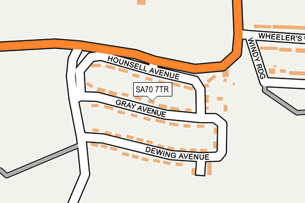
SA70 7TR lies on Gray Avenue in Manorbier, Tenby. SA70 7TR is located in the Manorbier and Penally electoral ward, within the unitary authority of Pembrokeshire and the Welsh Parliamentary constituency of Carmarthen West and South Pembrokeshire. The Local Health Board is Hywel Dda University and the police force is Dyfed-Powys. This postcode has been in use since January 1980.


GetTheData
Source: OS OpenMap – Local (Ordnance Survey)
Source: OS VectorMap District (Ordnance Survey)
Licence: Open Government Licence (requires attribution)
| Easting | 207655 |
| Northing | 197884 |
| Latitude | 51.646776 |
| Longitude | -4.781571 |
GetTheData
Source: Open Postcode Geo
Licence: Open Government Licence
| Street | Gray Avenue |
| Locality | Manorbier |
| Town/City | Tenby |
| Country | Wales |
| Postcode District | SA70 |
➜ See where SA70 is on a map ➜ Where is Manorbier? | |
GetTheData
Source: Land Registry Price Paid Data
Licence: Open Government Licence
Elevation or altitude of SA70 7TR as distance above sea level:
| Metres | Feet | |
|---|---|---|
| Elevation | 60m | 197ft |
Elevation is measured from the approximate centre of the postcode, to the nearest point on an OS contour line from OS Terrain 50, which has contour spacing of ten vertical metres.
➜ How high above sea level am I? Find the elevation of your current position using your device's GPS.
GetTheData
Source: Open Postcode Elevation
Licence: Open Government Licence
| Ward | Manorbier And Penally |
| Constituency | Carmarthen West And South Pembrokeshire |
GetTheData
Source: ONS Postcode Database
Licence: Open Government Licence
2021 10 DEC £160,000 |
2017 17 FEB £106,000 |
2004 31 MAR £88,000 |
2001 31 OCT £35,000 |
2001 29 JUN £42,000 |
GetTheData
Source: HM Land Registry Price Paid Data
Licence: Contains HM Land Registry data © Crown copyright and database right 2025. This data is licensed under the Open Government Licence v3.0.
| Skrinkle Estate (B4585) | Wind Hill | 96m |
| Skrinkle Estate (B4585) | Wind Hill | 113m |
| The Grange (A4139) | Wind Hill | 524m |
| Vicarage Fields (B4585) | Manorbier | 678m |
| Castle Cottages (B4585) | Manorbier | 926m |
| Manorbier Station | 1.7km |
| Penally Station | 4.3km |
GetTheData
Source: NaPTAN
Licence: Open Government Licence
| Percentage of properties with Next Generation Access | 100.0% |
| Percentage of properties with Superfast Broadband | 100.0% |
| Percentage of properties with Ultrafast Broadband | 0.0% |
| Percentage of properties with Full Fibre Broadband | 0.0% |
Superfast Broadband is between 30Mbps and 300Mbps
Ultrafast Broadband is > 300Mbps
| Median download speed | 60.0Mbps |
| Average download speed | 55.9Mbps |
| Maximum download speed | 79.97Mbps |
| Median upload speed | 18.9Mbps |
| Average upload speed | 15.0Mbps |
| Maximum upload speed | 20.00Mbps |
| Percentage of properties unable to receive 2Mbps | 0.0% |
| Percentage of properties unable to receive 5Mbps | 0.0% |
| Percentage of properties unable to receive 10Mbps | 0.0% |
| Percentage of properties unable to receive 30Mbps | 0.0% |
GetTheData
Source: Ofcom
Licence: Ofcom Terms of Use (requires attribution)
Estimated total energy consumption in SA70 7TR by fuel type, 2015.
| Consumption (kWh) | 381,688 |
|---|---|
| Meter count | 39 |
| Mean (kWh/meter) | 9,787 |
| Median (kWh/meter) | 9,005 |
| Consumption (kWh) | 141,641 |
|---|---|
| Meter count | 40 |
| Mean (kWh/meter) | 3,541 |
| Median (kWh/meter) | 3,187 |
GetTheData
Source: Postcode level gas estimates: 2015 (experimental)
Source: Postcode level electricity estimates: 2015 (experimental)
Licence: Open Government Licence
GetTheData
Source: ONS Postcode Database
Licence: Open Government Licence


➜ Get more ratings from the Food Standards Agency
GetTheData
Source: Food Standards Agency
Licence: FSA terms & conditions
The below table lists the International Territorial Level (ITL) codes (formerly Nomenclature of Territorial Units for Statistics (NUTS) codes) and Local Administrative Units (LAU) codes for SA70 7TR:
| ITL 1 Code | Name |
|---|---|
| TLL | Wales |
| ITL 2 Code | Name |
| TLL1 | West Wales and The Valleys |
| ITL 3 Code | Name |
| TLL14 | South West Wales |
| LAU 1 Code | Name |
| W06000009 | Pembrokeshire |
GetTheData
Source: ONS Postcode Directory
Licence: Open Government Licence
The below table lists the Census Output Area (OA), Lower Layer Super Output Area (LSOA), and Middle Layer Super Output Area (MSOA) for SA70 7TR:
| Code | Name | |
|---|---|---|
| OA | W00003126 | |
| LSOA | W01000584 | Pembrokeshire 014C |
| MSOA | W02000139 | Pembrokeshire 014 |
GetTheData
Source: ONS Postcode Directory
Licence: Open Government Licence
| SA70 7TP | Hounsell Avenue | 42m |
| SA70 7TS | Dewing Avenue | 87m |
| SA70 7TX | Windy Ridge | 262m |
| SA70 7TU | Wheelers Way | 321m |
| SA70 7SL | 609m | |
| SA70 7TN | 620m | |
| SA70 7SJ | 747m | |
| SA70 7TL | Manor Crescent | 807m |
| SA70 7TJ | 808m | |
| SA70 7TH | 872m |
GetTheData
Source: Open Postcode Geo; Land Registry Price Paid Data
Licence: Open Government Licence