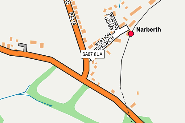
SA67 8UA lies on Kiln Park Road in Narberth. SA67 8UA is located in the Narberth: Rural electoral ward, within the unitary authority of Pembrokeshire and the Welsh Parliamentary constituency of Carmarthen West and South Pembrokeshire. The Local Health Board is Hywel Dda University and the police force is Dyfed-Powys. This postcode has been in use since January 1980.


GetTheData
Source: OS OpenMap – Local (Ordnance Survey)
Source: OS VectorMap District (Ordnance Survey)
Licence: Open Government Licence (requires attribution)
| Easting | 211928 |
| Northing | 214611 |
| Latitude | 51.798437 |
| Longitude | -4.728888 |
GetTheData
Source: Open Postcode Geo
Licence: Open Government Licence
| Street | Kiln Park Road |
| Town/City | Narberth |
| Country | Wales |
| Postcode District | SA67 |
➜ See where SA67 is on a map ➜ Where is Narberth? | |
GetTheData
Source: Land Registry Price Paid Data
Licence: Open Government Licence
Elevation or altitude of SA67 8UA as distance above sea level:
| Metres | Feet | |
|---|---|---|
| Elevation | 100m | 328ft |
Elevation is measured from the approximate centre of the postcode, to the nearest point on an OS contour line from OS Terrain 50, which has contour spacing of ten vertical metres.
➜ How high above sea level am I? Find the elevation of your current position using your device's GPS.
GetTheData
Source: Open Postcode Elevation
Licence: Open Government Licence
| Ward | Narberth: Rural |
| Constituency | Carmarthen West And South Pembrokeshire |
GetTheData
Source: ONS Postcode Database
Licence: Open Government Licence
2022 29 JUL £350,000 |
LYNWOOD, KILN PARK ROAD, NARBERTH, SA67 8UA 2017 14 SEP £210,000 |
ST CHADS, KILN PARK ROAD, NARBERTH, SA67 8UA 2012 23 MAR £160,000 |
LYNWOOD, KILN PARK ROAD, NARBERTH, SA67 8UA 2007 5 JAN £225,000 |
LYNWOOD, KILN PARK ROAD, NARBERTH, SA67 8UA 2003 19 DEC £170,000 |
2003 22 JUL £172,000 |
LYNWOOD, KILN PARK ROAD, NARBERTH, SA67 8UA 2002 19 APR £65,000 |
GetTheData
Source: HM Land Registry Price Paid Data
Licence: Contains HM Land Registry data © Crown copyright and database right 2025. This data is licensed under the Open Government Licence v3.0.
| Red Ford House (Kiln Park Road) | Narberth | 33m |
| Red Ford House (Kiln Park Road) | Narberth | 39m |
| Jesse Road (Jesse Road (A478)) | Narberth | 678m |
| Jesse Road (Jesse Road A478) | Narberth | 714m |
| Farmers Arms (Northfield Road) | Narberth | 1,040m |
| Narberth Station | 0.2km |
| Clunderwen Station | 4.7km |
GetTheData
Source: NaPTAN
Licence: Open Government Licence
| Percentage of properties with Next Generation Access | 100.0% |
| Percentage of properties with Superfast Broadband | 100.0% |
| Percentage of properties with Ultrafast Broadband | 0.0% |
| Percentage of properties with Full Fibre Broadband | 0.0% |
Superfast Broadband is between 30Mbps and 300Mbps
Ultrafast Broadband is > 300Mbps
| Percentage of properties unable to receive 2Mbps | 0.0% |
| Percentage of properties unable to receive 5Mbps | 0.0% |
| Percentage of properties unable to receive 10Mbps | 0.0% |
| Percentage of properties unable to receive 30Mbps | 0.0% |
GetTheData
Source: Ofcom
Licence: Ofcom Terms of Use (requires attribution)
GetTheData
Source: ONS Postcode Database
Licence: Open Government Licence


➜ Get more ratings from the Food Standards Agency
GetTheData
Source: Food Standards Agency
Licence: FSA terms & conditions
| Last Collection | |||
|---|---|---|---|
| Location | Mon-Fri | Sat | Distance |
| Market Sq | 16:45 | 11:30 | 930m |
| Narberth Delivery Office | 17:30 | 13:00 | 995m |
| Narberth Post Office | 17:15 | 12:30 | 1,044m |
GetTheData
Source: Dracos
Licence: Creative Commons Attribution-ShareAlike
The below table lists the International Territorial Level (ITL) codes (formerly Nomenclature of Territorial Units for Statistics (NUTS) codes) and Local Administrative Units (LAU) codes for SA67 8UA:
| ITL 1 Code | Name |
|---|---|
| TLL | Wales |
| ITL 2 Code | Name |
| TLL1 | West Wales and The Valleys |
| ITL 3 Code | Name |
| TLL14 | South West Wales |
| LAU 1 Code | Name |
| W06000009 | Pembrokeshire |
GetTheData
Source: ONS Postcode Directory
Licence: Open Government Licence
The below table lists the Census Output Area (OA), Lower Layer Super Output Area (LSOA), and Middle Layer Super Output Area (MSOA) for SA67 8UA:
| Code | Name | |
|---|---|---|
| OA | W00003194 | |
| LSOA | W01000596 | Pembrokeshire 007D |
| MSOA | W02000132 | Pembrokeshire 007 |
GetTheData
Source: ONS Postcode Directory
Licence: Open Government Licence
| SA67 8TA | 57m | |
| SA67 8TY | Station Approach | 86m |
| SA67 8UF | Panteg Uchaf | 182m |
| SA67 8TX | Kiln Park Road | 215m |
| SA67 7DX | Southmead | 509m |
| SA67 7FD | John Morgan Close | 516m |
| SA67 7DN | Northmead | 580m |
| SA67 7DP | Jesse Road | 590m |
| SA67 7DT | Station Road | 617m |
| SA67 7EB | Halkon Crescent | 635m |
GetTheData
Source: Open Postcode Geo; Land Registry Price Paid Data
Licence: Open Government Licence