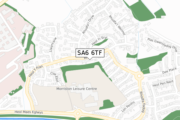
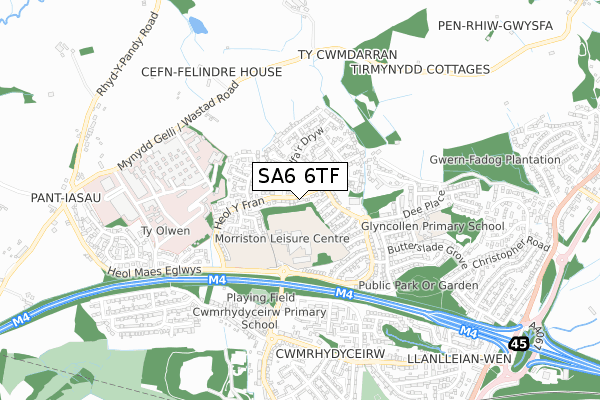
SA6 6TF lies on Rhodfar Eos in Cwmrhydyceirw, Swansea. SA6 6TF is located in the Morriston electoral ward, within the unitary authority of Swansea and the Welsh Parliamentary constituency of Swansea East. The Local Health Board is Swansea Bay University and the police force is South Wales. This postcode has been in use since June 1981.


GetTheData
Source: OS Open Zoomstack (Ordnance Survey)
Licence: Open Government Licence (requires attribution)
Attribution: Contains OS data © Crown copyright and database right 2025
Source: Open Postcode Geo
Licence: Open Government Licence (requires attribution)
Attribution: Contains OS data © Crown copyright and database right 2025; Contains Royal Mail data © Royal Mail copyright and database right 2025; Source: Office for National Statistics licensed under the Open Government Licence v.3.0
| Easting | 266899 |
| Northing | 200029 |
| Latitude | 51.683206 |
| Longitude | -3.926704 |
GetTheData
Source: Open Postcode Geo
Licence: Open Government Licence
| Street | Rhodfar Eos |
| Locality | Cwmrhydyceirw |
| Town/City | Swansea |
| Country | Wales |
| Postcode District | SA6 |
➜ See where SA6 is on a map ➜ Where is Swansea? | |
GetTheData
Source: Land Registry Price Paid Data
Licence: Open Government Licence
Elevation or altitude of SA6 6TF as distance above sea level:
| Metres | Feet | |
|---|---|---|
| Elevation | 80m | 262ft |
Elevation is measured from the approximate centre of the postcode, to the nearest point on an OS contour line from OS Terrain 50, which has contour spacing of ten vertical metres.
➜ How high above sea level am I? Find the elevation of your current position using your device's GPS.
GetTheData
Source: Open Postcode Elevation
Licence: Open Government Licence
| Ward | Morriston |
| Constituency | Swansea East |
GetTheData
Source: ONS Postcode Database
Licence: Open Government Licence
24, RHODFAR EOS, CWMRHYDYCEIRW, SWANSEA, SA6 6TF 2004 26 MAR £85,000 |
GetTheData
Source: HM Land Registry Price Paid Data
Licence: Contains HM Land Registry data © Crown copyright and database right 2025. This data is licensed under the Open Government Licence v3.0.
| Cwrt Merlyn (Rhodfa'r Dryw) | Parc Gwernfadog | 76m |
| Cwrt Merlyn (Rhodfa'r Dryw) | Parc Gwernfadog | 89m |
| Heol Y Fran | Parc Gwernfadog | 172m |
| Cwrt Yr Aeron (Rhodfa Fadof) | Parc Gwernfadog | 194m |
| Clos Crucywel (Rhodfa Fadog) | Parc Gwernfadog | 241m |
| Llansamlet Station | 3.8km |
GetTheData
Source: NaPTAN
Licence: Open Government Licence
| Percentage of properties with Next Generation Access | 100.0% |
| Percentage of properties with Superfast Broadband | 100.0% |
| Percentage of properties with Ultrafast Broadband | 77.4% |
| Percentage of properties with Full Fibre Broadband | 0.0% |
Superfast Broadband is between 30Mbps and 300Mbps
Ultrafast Broadband is > 300Mbps
| Median download speed | 65.5Mbps |
| Average download speed | 59.5Mbps |
| Maximum download speed | 200.00Mbps |
| Median upload speed | 1.0Mbps |
| Average upload speed | 6.7Mbps |
| Maximum upload speed | 20.00Mbps |
| Percentage of properties unable to receive 2Mbps | 0.0% |
| Percentage of properties unable to receive 5Mbps | 0.0% |
| Percentage of properties unable to receive 10Mbps | 0.0% |
| Percentage of properties unable to receive 30Mbps | 0.0% |
GetTheData
Source: Ofcom
Licence: Ofcom Terms of Use (requires attribution)
Estimated total energy consumption in SA6 6TF by fuel type, 2015.
| Consumption (kWh) | 192,252 |
|---|---|
| Meter count | 23 |
| Mean (kWh/meter) | 8,359 |
| Median (kWh/meter) | 7,230 |
| Consumption (kWh) | 93,481 |
|---|---|
| Meter count | 30 |
| Mean (kWh/meter) | 3,116 |
| Median (kWh/meter) | 2,700 |
GetTheData
Source: Postcode level gas estimates: 2015 (experimental)
Source: Postcode level electricity estimates: 2015 (experimental)
Licence: Open Government Licence
GetTheData
Source: ONS Postcode Database
Licence: Open Government Licence


➜ Get more ratings from the Food Standards Agency
GetTheData
Source: Food Standards Agency
Licence: FSA terms & conditions
| Last Collection | |||
|---|---|---|---|
| Location | Mon-Fri | Sat | Distance |
| Rhodfa Fadog | 17:30 | 12:15 | 193m |
| Maes Y Gwernen Road | 17:30 | 11:15 | 611m |
| Butterslade Gro | 17:45 | 12:15 | 727m |
GetTheData
Source: Dracos
Licence: Creative Commons Attribution-ShareAlike
The below table lists the International Territorial Level (ITL) codes (formerly Nomenclature of Territorial Units for Statistics (NUTS) codes) and Local Administrative Units (LAU) codes for SA6 6TF:
| ITL 1 Code | Name |
|---|---|
| TLL | Wales |
| ITL 2 Code | Name |
| TLL1 | West Wales and The Valleys |
| ITL 3 Code | Name |
| TLL18 | Swansea |
| LAU 1 Code | Name |
| W06000011 | Swansea |
GetTheData
Source: ONS Postcode Directory
Licence: Open Government Licence
The below table lists the Census Output Area (OA), Lower Layer Super Output Area (LSOA), and Middle Layer Super Output Area (MSOA) for SA6 6TF:
| Code | Name | |
|---|---|---|
| OA | W00004322 | |
| LSOA | W01000807 | Swansea 003B |
| MSOA | W02000170 | Swansea 003 |
GetTheData
Source: ONS Postcode Directory
Licence: Open Government Licence
| SA6 6TQ | Cwrt Merlyn | 74m |
| SA6 6PT | Clos Y Bont Faen | 98m |
| SA6 6TD | Llwyn Y Bioden | 139m |
| SA6 6NZ | Cwrt Yr Aeron | 143m |
| SA6 6ST | Heol Penfelyn | 144m |
| SA6 6SR | Heol Yr Eryr | 150m |
| SA6 6LQ | Rhodfa Fadog | 154m |
| SA6 6SW | Rhodfar Eos | 186m |
| SA6 6TB | Heol Yr Wylan | 194m |
| SA6 6TL | Heol Y Fran | 208m |
GetTheData
Source: Open Postcode Geo; Land Registry Price Paid Data
Licence: Open Government Licence