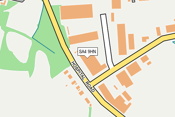
SA4 9HN is located in the Penllergaer electoral ward, within the unitary authority of Swansea and the Welsh Parliamentary constituency of Gower. The Local Health Board is Swansea Bay University and the police force is South Wales. This postcode has been in use since June 2002.


GetTheData
Source: OS OpenMap – Local (Ordnance Survey)
Source: OS VectorMap District (Ordnance Survey)
Licence: Open Government Licence (requires attribution)
| Easting | 260287 |
| Northing | 198154 |
| Latitude | 51.664746 |
| Longitude | -4.021513 |
GetTheData
Source: Open Postcode Geo
Licence: Open Government Licence
| Country | Wales |
| Postcode District | SA4 |
➜ See where SA4 is on a map ➜ Where is Penllergaer? | |
GetTheData
Source: Land Registry Price Paid Data
Licence: Open Government Licence
Elevation or altitude of SA4 9HN as distance above sea level:
| Metres | Feet | |
|---|---|---|
| Elevation | 40m | 131ft |
Elevation is measured from the approximate centre of the postcode, to the nearest point on an OS contour line from OS Terrain 50, which has contour spacing of ten vertical metres.
➜ How high above sea level am I? Find the elevation of your current position using your device's GPS.
GetTheData
Source: Open Postcode Elevation
Licence: Open Government Licence
| Ward | Penllergaer |
| Constituency | Gower |
GetTheData
Source: ONS Postcode Database
Licence: Open Government Licence
| Hospital Road (Gorseinon Road) | Penllergaer | 391m |
| Hospital Road (Gorseinon Road) | Penllergaer | 417m |
| B&q (Gorseinon Road) | Penllergaer | 591m |
| Llys Gwalia (Gorseinon Road) | Gorseinon | 634m |
| Llys Gwalia (Gorseinon Road) | Gorseinon | 686m |
| Gowerton Station | 2km |
| Llangennech Station | 4.9km |
GetTheData
Source: NaPTAN
Licence: Open Government Licence
GetTheData
Source: ONS Postcode Database
Licence: Open Government Licence


➜ Get more ratings from the Food Standards Agency
GetTheData
Source: Food Standards Agency
Licence: FSA terms & conditions
| Last Collection | |||
|---|---|---|---|
| Location | Mon-Fri | Sat | Distance |
| Gorseinon Do Left | 18:00 | 12:45 | 375m |
| Gorseinon Delivery Office | 18:00 | 12:45 | 376m |
| Garden Village P.o. | 17:45 | 12:30 | 840m |
GetTheData
Source: Dracos
Licence: Creative Commons Attribution-ShareAlike
The below table lists the International Territorial Level (ITL) codes (formerly Nomenclature of Territorial Units for Statistics (NUTS) codes) and Local Administrative Units (LAU) codes for SA4 9HN:
| ITL 1 Code | Name |
|---|---|
| TLL | Wales |
| ITL 2 Code | Name |
| TLL1 | West Wales and The Valleys |
| ITL 3 Code | Name |
| TLL18 | Swansea |
| LAU 1 Code | Name |
| W06000011 | Swansea |
GetTheData
Source: ONS Postcode Directory
Licence: Open Government Licence
The below table lists the Census Output Area (OA), Lower Layer Super Output Area (LSOA), and Middle Layer Super Output Area (MSOA) for SA4 9HN:
| Code | Name | |
|---|---|---|
| OA | W00004485 | |
| LSOA | W01000838 | Swansea 004E |
| MSOA | W02000171 | Swansea 004 |
GetTheData
Source: ONS Postcode Directory
Licence: Open Government Licence
| SA4 4QL | Hospital Road | 102m |
| SA4 9WG | Llwyn Y Graig | 436m |
| SA4 4DQ | Gorseinon Road | 466m |
| SA4 4HN | Ffordd Talfan | 618m |
| SA4 4DG | Gorseinon Road | 622m |
| SA4 4ES | Myrtle Road | 651m |
| SA4 4HW | Llys Aneirin | 660m |
| SA4 4DY | Gwalia Close | 683m |
| SA4 4DF | Spring Gardens | 686m |
| SA4 4ET | Garngoch Terrace | 700m |
GetTheData
Source: Open Postcode Geo; Land Registry Price Paid Data
Licence: Open Government Licence