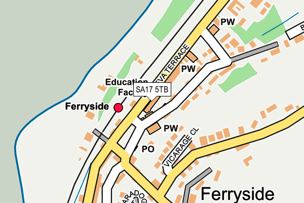
SA17 5TB is located in the Kidwelly and St Ishmael electoral ward, within the unitary authority of Carmarthenshire and the Welsh Parliamentary constituency of Carmarthen East and Dinefwr. The Local Health Board is Hywel Dda University and the police force is Dyfed-Powys. This postcode has been in use since January 1980.


GetTheData
Source: OS OpenMap – Local (Ordnance Survey)
Source: OS VectorMap District (Ordnance Survey)
Licence: Open Government Licence (requires attribution)
| Easting | 236684 |
| Northing | 210436 |
| Latitude | 51.768713 |
| Longitude | -4.368259 |
GetTheData
Source: Open Postcode Geo
Licence: Open Government Licence
| Country | Wales |
| Postcode District | SA17 |
➜ See where SA17 is on a map ➜ Where is Ferryside? | |
GetTheData
Source: Land Registry Price Paid Data
Licence: Open Government Licence
Elevation or altitude of SA17 5TB as distance above sea level:
| Metres | Feet | |
|---|---|---|
| Elevation | 10m | 33ft |
Elevation is measured from the approximate centre of the postcode, to the nearest point on an OS contour line from OS Terrain 50, which has contour spacing of ten vertical metres.
➜ How high above sea level am I? Find the elevation of your current position using your device's GPS.
GetTheData
Source: Open Postcode Elevation
Licence: Open Government Licence
| Ward | Kidwelly And St Ishmael |
| Constituency | Carmarthen East And Dinefwr |
GetTheData
Source: ONS Postcode Database
Licence: Open Government Licence
| Railway Station (Eva Terrace) | Ferryside | 100m |
| White Lion (Water Street) | Ferryside | 122m |
| Railway Station (Main Road) | Ferryside | 139m |
| Water Street (Carmarthen Road) | Ferryside | 178m |
| Water Street (Carmarthen Road) | Ferryside | 182m |
| Ferryside Station | 0.1km |
| Kidwelly Station | 5.2km |
GetTheData
Source: NaPTAN
Licence: Open Government Licence
GetTheData
Source: ONS Postcode Database
Licence: Open Government Licence


➜ Get more ratings from the Food Standards Agency
GetTheData
Source: Food Standards Agency
Licence: FSA terms & conditions
The below table lists the International Territorial Level (ITL) codes (formerly Nomenclature of Territorial Units for Statistics (NUTS) codes) and Local Administrative Units (LAU) codes for SA17 5TB:
| ITL 1 Code | Name |
|---|---|
| TLL | Wales |
| ITL 2 Code | Name |
| TLL1 | West Wales and The Valleys |
| ITL 3 Code | Name |
| TLL14 | South West Wales |
| LAU 1 Code | Name |
| W06000010 | Carmarthenshire |
GetTheData
Source: ONS Postcode Directory
Licence: Open Government Licence
The below table lists the Census Output Area (OA), Lower Layer Super Output Area (LSOA), and Middle Layer Super Output Area (MSOA) for SA17 5TB:
| Code | Name | |
|---|---|---|
| OA | W00003882 | |
| LSOA | W01000723 | Carmarthenshire 012E |
| MSOA | W02000153 | Carmarthenshire 012 |
GetTheData
Source: ONS Postcode Directory
Licence: Open Government Licence
| SA17 5TD | Eva Terrace | 37m |
| SA17 5RT | Water Street | 44m |
| SA17 5RU | Mount Pleasant | 70m |
| SA17 5SU | Vicarage Close | 98m |
| SA17 5RY | Horton View | 104m |
| SA17 5SA | 126m | |
| SA17 5SB | Marine Cottages | 133m |
| SA17 5SF | 143m | |
| SA17 5SG | 154m | |
| SA17 5RP | 155m |
GetTheData
Source: Open Postcode Geo; Land Registry Price Paid Data
Licence: Open Government Licence