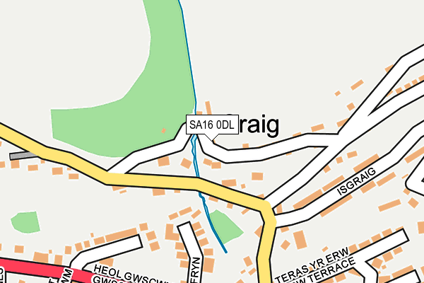
SA16 0DL is in Graig, Burry Port. SA16 0DL is located in the Pembrey electoral ward, within the unitary authority of Carmarthenshire and the Welsh Parliamentary constituency of Llanelli. The Local Health Board is Hywel Dda University and the police force is Dyfed-Powys. This postcode has been in use since January 1980.


GetTheData
Source: OS OpenMap – Local (Ordnance Survey)
Source: OS VectorMap District (Ordnance Survey)
Licence: Open Government Licence (requires attribution)
| Easting | 244572 |
| Northing | 201727 |
| Latitude | 51.692717 |
| Longitude | -4.250149 |
GetTheData
Source: Open Postcode Geo
Licence: Open Government Licence
| Locality | Graig |
| Town/City | Burry Port |
| Country | Wales |
| Postcode District | SA16 |
➜ See where SA16 is on a map ➜ Where is Burry Port? | |
GetTheData
Source: Land Registry Price Paid Data
Licence: Open Government Licence
Elevation or altitude of SA16 0DL as distance above sea level:
| Metres | Feet | |
|---|---|---|
| Elevation | 60m | 197ft |
Elevation is measured from the approximate centre of the postcode, to the nearest point on an OS contour line from OS Terrain 50, which has contour spacing of ten vertical metres.
➜ How high above sea level am I? Find the elevation of your current position using your device's GPS.
GetTheData
Source: Open Postcode Elevation
Licence: Open Government Licence
| Ward | Pembrey |
| Constituency | Llanelli |
GetTheData
Source: ONS Postcode Database
Licence: Open Government Licence
AEL Y DON, GRAIG, BURRY PORT, SA16 0DL 2018 21 AUG £190,000 |
GetTheData
Source: HM Land Registry Price Paid Data
Licence: Contains HM Land Registry data © Crown copyright and database right 2025. This data is licensed under the Open Government Licence v3.0.
| Capel Jerusalem (Gwscwm Road) | Achddu | 252m |
| Capel Jerusalem (Gwscwm Road) | Achddu | 263m |
| Bro Deri (Gwscwm Road) | Achddu | 278m |
| Achddu (Elkington Road) | Achddu | 308m |
| Post Office (Stepney Road) | Achddu | 319m |
| Pembrey & Burry Port Station | 1km |
| Kidwelly Station | 6.5km |
GetTheData
Source: NaPTAN
Licence: Open Government Licence
| Percentage of properties with Next Generation Access | 100.0% |
| Percentage of properties with Superfast Broadband | 100.0% |
| Percentage of properties with Ultrafast Broadband | 0.0% |
| Percentage of properties with Full Fibre Broadband | 0.0% |
Superfast Broadband is between 30Mbps and 300Mbps
Ultrafast Broadband is > 300Mbps
| Percentage of properties unable to receive 2Mbps | 0.0% |
| Percentage of properties unable to receive 5Mbps | 0.0% |
| Percentage of properties unable to receive 10Mbps | 0.0% |
| Percentage of properties unable to receive 30Mbps | 0.0% |
GetTheData
Source: Ofcom
Licence: Ofcom Terms of Use (requires attribution)
GetTheData
Source: ONS Postcode Database
Licence: Open Government Licence


➜ Get more ratings from the Food Standards Agency
GetTheData
Source: Food Standards Agency
Licence: FSA terms & conditions
| Last Collection | |||
|---|---|---|---|
| Location | Mon-Fri | Sat | Distance |
| Achddu Post Office | 17:00 | 11:30 | 218m |
| Pencoed Road | 17:15 | 11:30 | 715m |
| Five Roads Post Office | 15:45 | 11:30 | 5,759m |
GetTheData
Source: Dracos
Licence: Creative Commons Attribution-ShareAlike
The below table lists the International Territorial Level (ITL) codes (formerly Nomenclature of Territorial Units for Statistics (NUTS) codes) and Local Administrative Units (LAU) codes for SA16 0DL:
| ITL 1 Code | Name |
|---|---|
| TLL | Wales |
| ITL 2 Code | Name |
| TLL1 | West Wales and The Valleys |
| ITL 3 Code | Name |
| TLL14 | South West Wales |
| LAU 1 Code | Name |
| W06000010 | Carmarthenshire |
GetTheData
Source: ONS Postcode Directory
Licence: Open Government Licence
The below table lists the Census Output Area (OA), Lower Layer Super Output Area (LSOA), and Middle Layer Super Output Area (MSOA) for SA16 0DL:
| Code | Name | |
|---|---|---|
| OA | W00003821 | |
| LSOA | W01000710 | Carmarthenshire 021D |
| MSOA | W02000162 | Carmarthenshire 021 |
GetTheData
Source: ONS Postcode Directory
Licence: Open Government Licence
| SA16 0DW | 31m | |
| SA16 0DG | 63m | |
| SA16 0DN | Ocean View | 94m |
| SA16 0BY | Isfryn Close | 129m |
| SA16 0DF | 145m | |
| SA16 0DP | 147m | |
| SA16 0DE | Isgraig | 172m |
| SA16 0DB | 180m | |
| SA16 0DD | Isgraig | 235m |
| SA16 0DA | Erw Terrace | 238m |
GetTheData
Source: Open Postcode Geo; Land Registry Price Paid Data
Licence: Open Government Licence