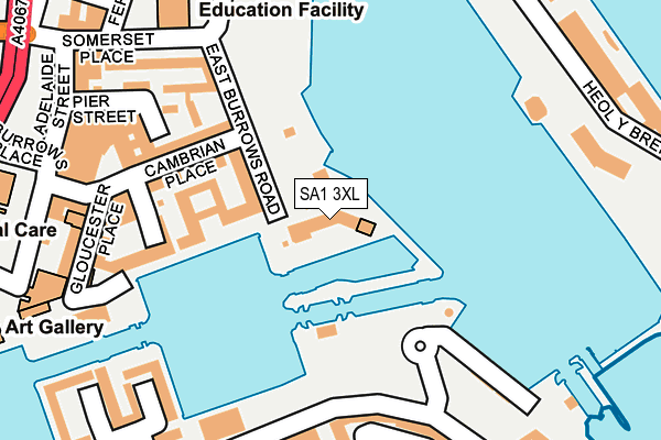
SA1 3XL lies on Pocketts Wharf in Maritime Quarter, Swansea. SA1 3XL is located in the Waterfront electoral ward, within the unitary authority of Swansea and the Welsh Parliamentary constituency of Swansea West. The Local Health Board is Swansea Bay University and the police force is South Wales. This postcode has been in use since January 1992.


GetTheData
Source: OS OpenMap – Local (Ordnance Survey)
Source: OS VectorMap District (Ordnance Survey)
Licence: Open Government Licence (requires attribution)
| Easting | 266223 |
| Northing | 192737 |
| Latitude | 51.617514 |
| Longitude | -3.933665 |
GetTheData
Source: Open Postcode Geo
Licence: Open Government Licence
| Street | Pocketts Wharf |
| Locality | Maritime Quarter |
| Town/City | Swansea |
| Country | Wales |
| Postcode District | SA1 |
➜ See where SA1 is on a map ➜ Where is Swansea? | |
GetTheData
Source: Land Registry Price Paid Data
Licence: Open Government Licence
Elevation or altitude of SA1 3XL as distance above sea level:
| Metres | Feet | |
|---|---|---|
| Elevation | 10m | 33ft |
Elevation is measured from the approximate centre of the postcode, to the nearest point on an OS contour line from OS Terrain 50, which has contour spacing of ten vertical metres.
➜ How high above sea level am I? Find the elevation of your current position using your device's GPS.
GetTheData
Source: Open Postcode Elevation
Licence: Open Government Licence
| Ward | Waterfront |
| Constituency | Swansea West |
GetTheData
Source: ONS Postcode Database
Licence: Open Government Licence
| Swansea Marina (Trawler Road) | Pentre Guinea | 167m |
| Environment Centre (Somerset Place) | Swansea | 225m |
| Ferrara Square (Trawler Road) | Swansea | 334m |
| Ferrara Square (Trawler Road) | Maritime Quarter And Marina | 375m |
| Sainsbury's (Quay Parade) | Swansea | 380m |
| Swansea Station | 1km |
| Llansamlet Station | 6km |
GetTheData
Source: NaPTAN
Licence: Open Government Licence
| Percentage of properties with Next Generation Access | 100.0% |
| Percentage of properties with Superfast Broadband | 100.0% |
| Percentage of properties with Ultrafast Broadband | 100.0% |
| Percentage of properties with Full Fibre Broadband | 0.0% |
Superfast Broadband is between 30Mbps and 300Mbps
Ultrafast Broadband is > 300Mbps
| Median download speed | 50.0Mbps |
| Average download speed | 69.3Mbps |
| Maximum download speed | 350.00Mbps |
| Median upload speed | 1.2Mbps |
| Average upload speed | 6.9Mbps |
| Maximum upload speed | 20.00Mbps |
| Percentage of properties unable to receive 2Mbps | 0.0% |
| Percentage of properties unable to receive 5Mbps | 0.0% |
| Percentage of properties unable to receive 10Mbps | 0.0% |
| Percentage of properties unable to receive 30Mbps | 0.0% |
GetTheData
Source: Ofcom
Licence: Ofcom Terms of Use (requires attribution)
Estimated total energy consumption in SA1 3XL by fuel type, 2015.
| Consumption (kWh) | 264,984 |
|---|---|
| Meter count | 40 |
| Mean (kWh/meter) | 6,625 |
| Median (kWh/meter) | 6,431 |
GetTheData
Source: Postcode level gas estimates: 2015 (experimental)
Source: Postcode level electricity estimates: 2015 (experimental)
Licence: Open Government Licence
GetTheData
Source: ONS Postcode Database
Licence: Open Government Licence


➜ Get more ratings from the Food Standards Agency
GetTheData
Source: Food Standards Agency
Licence: FSA terms & conditions
| Last Collection | |||
|---|---|---|---|
| Location | Mon-Fri | Sat | Distance |
| Cambrian Place | 18:15 | 10:30 | 223m |
| Ferrara Quay | 18:00 | 10:15 | 253m |
| St. Marys Sq | 17:30 | 10:30 | 735m |
GetTheData
Source: Dracos
Licence: Creative Commons Attribution-ShareAlike
The below table lists the International Territorial Level (ITL) codes (formerly Nomenclature of Territorial Units for Statistics (NUTS) codes) and Local Administrative Units (LAU) codes for SA1 3XL:
| ITL 1 Code | Name |
|---|---|
| TLL | Wales |
| ITL 2 Code | Name |
| TLL1 | West Wales and The Valleys |
| ITL 3 Code | Name |
| TLL18 | Swansea |
| LAU 1 Code | Name |
| W06000011 | Swansea |
GetTheData
Source: ONS Postcode Directory
Licence: Open Government Licence
The below table lists the Census Output Area (OA), Lower Layer Super Output Area (LSOA), and Middle Layer Super Output Area (MSOA) for SA1 3XL:
| Code | Name | |
|---|---|---|
| OA | W00010097 | |
| LSOA | W01001958 | Swansea 025H |
| MSOA | W02000192 | Swansea 025 |
GetTheData
Source: ONS Postcode Directory
Licence: Open Government Licence
| SA1 1RT | Mannheim Quay | 72m |
| SA1 1RU | Mannheim Quay | 128m |
| SA1 1WD | Mannheim Quay | 131m |
| SA1 1RG | Cambrian Place | 142m |
| SA1 1RE | East Burrows Road | 158m |
| SA1 1RQ | Cambrian Place | 166m |
| SA1 1RL | Cambrian Place | 183m |
| SA1 1RH | Cambrian Place | 198m |
| SA1 1RY | Pier Street | 203m |
| SA1 1SG | St Stephens Court | 209m |
GetTheData
Source: Open Postcode Geo; Land Registry Price Paid Data
Licence: Open Government Licence