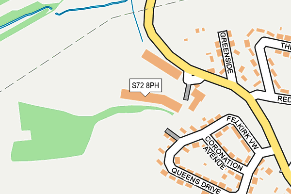
S72 8PH is located in the North East electoral ward, within the metropolitan district of Barnsley and the English Parliamentary constituency of Barnsley East. The Sub Integrated Care Board (ICB) Location is NHS South Yorkshire ICB - 02P and the police force is South Yorkshire. This postcode has been in use since May 1994.


GetTheData
Source: OS OpenMap – Local (Ordnance Survey)
Source: OS VectorMap District (Ordnance Survey)
Licence: Open Government Licence (requires attribution)
| Easting | 438692 |
| Northing | 411432 |
| Latitude | 53.598053 |
| Longitude | -1.416838 |
GetTheData
Source: Open Postcode Geo
Licence: Open Government Licence
| Country | England |
| Postcode District | S72 |
➜ See where S72 is on a map ➜ Where is Shafton? | |
GetTheData
Source: Land Registry Price Paid Data
Licence: Open Government Licence
Elevation or altitude of S72 8PH as distance above sea level:
| Metres | Feet | |
|---|---|---|
| Elevation | 70m | 230ft |
Elevation is measured from the approximate centre of the postcode, to the nearest point on an OS contour line from OS Terrain 50, which has contour spacing of ten vertical metres.
➜ How high above sea level am I? Find the elevation of your current position using your device's GPS.
GetTheData
Source: Open Postcode Elevation
Licence: Open Government Licence
| Ward | North East |
| Constituency | Barnsley East |
GetTheData
Source: ONS Postcode Database
Licence: Open Government Licence
| Greenside (Sandybridge Lane) | Shafton | 155m |
| Greenside (Sandybridge Lane) | Shafton | 158m |
| The Green (Dog Hill) | Shafton | 315m |
| Henry Close (Redthorne Way) | Shafton | 337m |
| Millside (Hawthorne Street) | Shafton | 503m |
| Fitzwilliam Station | 4.8km |
| Barnsley Station | 6.3km |
GetTheData
Source: NaPTAN
Licence: Open Government Licence
| Median download speed | 11.8Mbps |
| Average download speed | 14.6Mbps |
| Maximum download speed | 20.80Mbps |
| Median upload speed | 1.2Mbps |
| Average upload speed | 2.0Mbps |
| Maximum upload speed | 4.34Mbps |
GetTheData
Source: Ofcom
Licence: Ofcom Terms of Use (requires attribution)
GetTheData
Source: ONS Postcode Database
Licence: Open Government Licence


➜ Get more ratings from the Food Standards Agency
GetTheData
Source: Food Standards Agency
Licence: FSA terms & conditions
| Last Collection | |||
|---|---|---|---|
| Location | Mon-Fri | Sat | Distance |
| Sandybridge Lane | 16:00 | 09:00 | 149m |
| 108 High Street | 16:00 | 09:00 | 575m |
| 168 Weet Shaw Lane | 16:00 | 09:00 | 1,009m |
GetTheData
Source: Dracos
Licence: Creative Commons Attribution-ShareAlike
The below table lists the International Territorial Level (ITL) codes (formerly Nomenclature of Territorial Units for Statistics (NUTS) codes) and Local Administrative Units (LAU) codes for S72 8PH:
| ITL 1 Code | Name |
|---|---|
| TLE | Yorkshire and The Humber |
| ITL 2 Code | Name |
| TLE3 | South Yorkshire |
| ITL 3 Code | Name |
| TLE31 | Barnsley, Doncaster and Rotherham |
| LAU 1 Code | Name |
| E08000016 | Barnsley |
GetTheData
Source: ONS Postcode Directory
Licence: Open Government Licence
The below table lists the Census Output Area (OA), Lower Layer Super Output Area (LSOA), and Middle Layer Super Output Area (MSOA) for S72 8PH:
| Code | Name | |
|---|---|---|
| OA | E00037160 | |
| LSOA | E01007329 | Barnsley 003A |
| MSOA | E02001511 | Barnsley 003 |
GetTheData
Source: ONS Postcode Directory
Licence: Open Government Licence
| S72 8PQ | The Green | 96m |
| S72 8PD | Queens Drive | 133m |
| S72 8PJ | Whin Corner | 133m |
| S72 8PF | Coronation Avenue | 194m |
| S72 8PB | Queens Drive | 199m |
| S72 8PL | Greenside | 201m |
| S72 8PG | Felkirk View | 209m |
| S72 8PA | The Green | 288m |
| S72 8PW | The Green View | 352m |
| S72 8NR | Dog Hill | 373m |
GetTheData
Source: Open Postcode Geo; Land Registry Price Paid Data
Licence: Open Government Licence