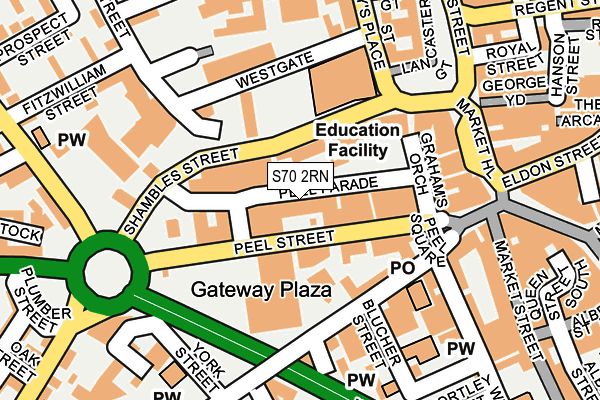
S70 2RN is located in the Central electoral ward, within the metropolitan district of Barnsley and the English Parliamentary constituency of Barnsley Central. The Sub Integrated Care Board (ICB) Location is NHS South Yorkshire ICB - 02P and the police force is South Yorkshire. This postcode has been in use since October 1984.


GetTheData
Source: OS OpenMap – Local (Ordnance Survey)
Source: OS VectorMap District (Ordnance Survey)
Licence: Open Government Licence (requires attribution)
| Easting | 434255 |
| Northing | 406350 |
| Latitude | 53.552686 |
| Longitude | -1.484431 |
GetTheData
Source: Open Postcode Geo
Licence: Open Government Licence
| Country | England |
| Postcode District | S70 |
➜ See where S70 is on a map ➜ Where is Barnsley? | |
GetTheData
Source: Land Registry Price Paid Data
Licence: Open Government Licence
Elevation or altitude of S70 2RN as distance above sea level:
| Metres | Feet | |
|---|---|---|
| Elevation | 110m | 361ft |
Elevation is measured from the approximate centre of the postcode, to the nearest point on an OS contour line from OS Terrain 50, which has contour spacing of ten vertical metres.
➜ How high above sea level am I? Find the elevation of your current position using your device's GPS.
GetTheData
Source: Open Postcode Elevation
Licence: Open Government Licence
| Ward | Central |
| Constituency | Barnsley Central |
GetTheData
Source: ONS Postcode Database
Licence: Open Government Licence
| - (Shambles Street) | Barnsley Town Centre | 60m |
| Dog Lane (Shambles Street) | Barnsley Town Centre | 93m |
| Sackville Street (Shambles Street) | Barnsley Town Centre | 110m |
| St Marys Gate (Shambles Street) | Barnsley Town Centre | 115m |
| Shambles Street (St Marys Place) | Barnsley Town Centre | 156m |
| Barnsley Station | 0.5km |
| Dodworth Station | 3.3km |
| Darton Station | 5.1km |
GetTheData
Source: NaPTAN
Licence: Open Government Licence
GetTheData
Source: ONS Postcode Database
Licence: Open Government Licence


➜ Get more ratings from the Food Standards Agency
GetTheData
Source: Food Standards Agency
Licence: FSA terms & conditions
| Last Collection | |||
|---|---|---|---|
| Location | Mon-Fri | Sat | Distance |
| Barnsley Delivery Office | 19:30 | 148m | |
| Barnsley Delivery Office | 19:30 | 12:45 | 158m |
| Church Street | 18:45 | 11:00 | 232m |
GetTheData
Source: Dracos
Licence: Creative Commons Attribution-ShareAlike
The below table lists the International Territorial Level (ITL) codes (formerly Nomenclature of Territorial Units for Statistics (NUTS) codes) and Local Administrative Units (LAU) codes for S70 2RN:
| ITL 1 Code | Name |
|---|---|
| TLE | Yorkshire and The Humber |
| ITL 2 Code | Name |
| TLE3 | South Yorkshire |
| ITL 3 Code | Name |
| TLE31 | Barnsley, Doncaster and Rotherham |
| LAU 1 Code | Name |
| E08000016 | Barnsley |
GetTheData
Source: ONS Postcode Directory
Licence: Open Government Licence
The below table lists the Census Output Area (OA), Lower Layer Super Output Area (LSOA), and Middle Layer Super Output Area (MSOA) for S70 2RN:
| Code | Name | |
|---|---|---|
| OA | E00037180 | |
| LSOA | E01007340 | Barnsley 013B |
| MSOA | E02001521 | Barnsley 013 |
GetTheData
Source: ONS Postcode Directory
Licence: Open Government Licence
| S70 2SH | Shambles Street | 59m |
| S70 1AL | Pitt Street | 117m |
| S70 2ST | Grahams Orchard | 127m |
| S70 2SW | Shambles Street | 128m |
| S70 2RQ | Sackville Street | 158m |
| S70 1AH | Nelson Street | 176m |
| S70 2PX | Market Hill | 178m |
| S70 1YA | Peel Square | 182m |
| S70 1AP | Blucher Street | 185m |
| S70 2RP | Sackville Street | 195m |
GetTheData
Source: Open Postcode Geo; Land Registry Price Paid Data
Licence: Open Government Licence